
Go-faster road inspections with a GoPro

BrainCreators has launched in the UK a cost-conscious “pro” edition of its road inspection system called INSPECH.
By David Arminas November 29, 2023 Read time: 2 mins
Road data can be uploaded to INSPECH Assessment, which swiftly generates an interactive digital twin on a dynamic map (image courtesy INSPECH/BrainCreators)

BrainCreators, a creator of digital inspection solutions, has introduced the “go pro for less” functionality for its digital road inspection system, INSPECH.

The functionality enables the use of a GoPro camera for data collection anytime and anywhere. This means that INSPECH can digitally conduct road inspections in the UK at a substantially reduced cost compared to traditional methods.

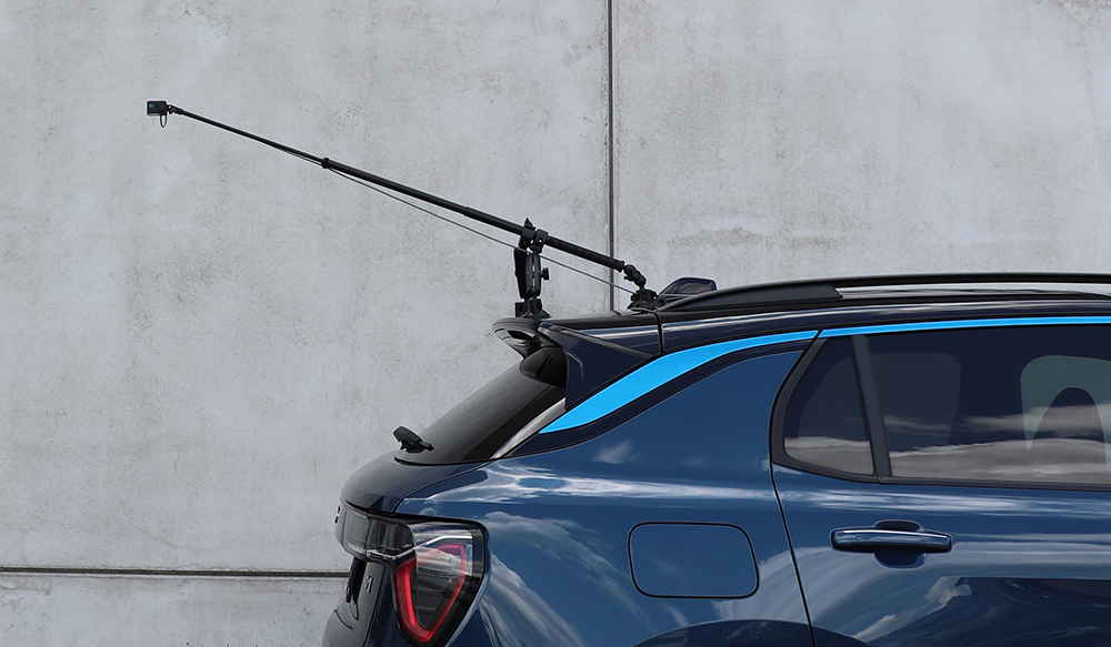
BrainCreators said that the use of a GoPro increases the flexibility of when and how a highways agency can collect data. For example, large vehicles are impractical and probably prohibited on sidewalks, whereas smaller vehicles - with a GoPro - might be allowed on sidewalks.

INSPECH can be used by local governments, road owners and operators, civil engineering firms, public-private partnerships and road management organisations. There are also two subscription options: IN-Assessment; and IN-Insights.

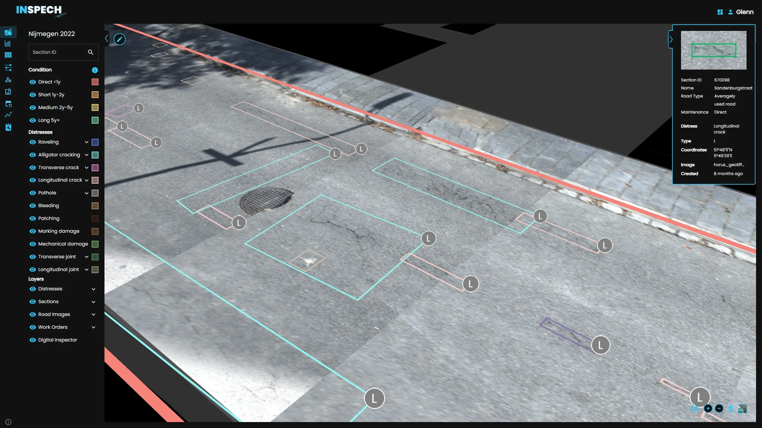
INSPECH Assessment is engineered to streamline the inspection process. It automates workflows, slashing the time it takes to transform inspector insights into tangible results. Road data, collected with professional camera equipment or a simple GoPro, is uploaded to INSPECH Assessment, which swiftly generates an interactive digital twin on a dynamic map. This advanced map is more than a visual representation; it's an editable canvas, enhancing and speeding up inspection capabilities.

INSPECH, using a GoPro camera attached at the rear of a vehicle, can digitally conduct road inspections at a substantially reduced cost compared to traditional methods (image courtesy INSPECH/BrainCreators)

Meanwhile, INSPECH Insights provides a comprehensive understanding of asset reliability and availability. It has the ability to self-collect data using GoPro cameras and create interactive digital twins. Road owners have tools, such as inspection comparisons and repair costings, at their fingertips.

Road data generated by both subscriptions can be collected by professional equipment or a simple GoPro camera. Customers who don’t have professional equipment to get more detailed road inspections, can work with various INSPECH partners who handle end-to-end road inspections, said Glenn Brouwer, co-founder at BrainCreators.

"This innovation represents a significant step towards cost-conscious road inspections, allowing users to harness the power of GoPro cameras for efficient data collection,” he said. “By reducing upfront costs and enhancing flexibility, INSPECH empowers users to conduct inspections more efficiently, maximising the return on infrastructure investments.”

INSPECH, as a company, was founded in Amsterdam by BrainCreators, experts in applied Artificial Intelligence, in collaboration with Unihorn, a civil engineering company focused on enhancing infrastructure and public spaces.

For more information on companies in this article

Related Content

  • GSSI launches affordable RoadScan 30 GPR road inspection system
    May 11, 2015
    Geophysical Survey Systems (GSSI), a manufacturer of ground penetrating radar (GPR) equipment, has launched a more affordable version of its non-destructive system, called RoadScan 30. The system is designed for measuring pavement thickness, conducting base and sub-base evaluations and measuring available asphalt prior to milling operations. Hundreds of miles of pavement layer thickness data can be collected in a day. RoadScan 30 can collect data densities not obtainable using coring or other labour-i
  • Visualisation technology from Bentley Systems
    May 15, 2019
    Bentley Systems has introduced its SYNCHRO XR, its app for immersively visualising 4D construction digital twins with the new Microsoft HoloLens 2. The SYNCHRO XR for HoloLens 2 system allows users to interact collaboratively with digital construction models using intuitive gestures to plan, visualise, and experience construction sequencing. Project digital twin data is visualised with the HoloLens 2 through Bentley’s connected data environment, powered by Microsoft Azure. With the mixed reality solutio
  • Construction software boosts operating efficiency
    March 5, 2012
    Intelligent data handling and management technologies are helping boost operating efficiency - Mike Woof reports The construction software sector and GIS market are seeing a rapid development of new products and technologies that will help boost efficiency, with factors such as data management and platform integration being key focus areas.
  • Using radar to deliver a fine runway finish
    April 4, 2014
    Radar Portal Systems (RPS) has spent a lot of time developing its sophisticated pavement top-surface photometric imaging system so it can cater specifically for the aviation market. This has now been specially developed for use on aircraft runways and taxiways The system was recently used at Brisbane Airport to survey runway and runway shoulders, collecting photometric top-surface data at a 4m width at speeds of up to 100km/h. This dataset allows the firm to display meshing data of the runway surface showin