Esri and Heliguy to cooperate

Esri UK has signed a partnership with drone developer Heliguy as part of its strategy to offer all elements of a drone service.
February 15, 2021 Read time: 2 mins
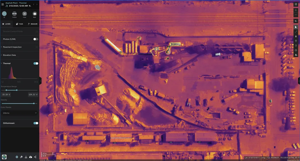
Thermal imaging using Esri UK Site Scan

The partnership will provide customers with drone hardware, pilot training and flying services from Heliguy, adding to Esri’s existing drone flight planning, data capture, data processing and GIS software.

Current Esri drone software customers include Skanska Norway, Arcadis and PCL Construction in North America. Meanwhile, Heliguy, an unmanned aerial vehicle specialist, manages some of Europe’s largest drone programmes, working with construction firms such as Balfour Beatty and Atkins.

Esri UK and Heliguy will work on joint projects to introduce new and more efficient workflows by bringing together customers’ GIS and Survey teams who have traditionally worked separately on drone-related projects. The goal is to streamline processes, from drone management and data capture, through to data analysis and better sharing of outputs across a business, including integration with BIM and CAD workflows.

“By providing a single source of hardware and software, the partnership will help customers maximise their investment in drones and GIS,” said Craig Evenden, head of construction and BIM at Esri UK. “As drone usage grows, accelerated by the COVID-19 pandemic, the [construction] community is demanding more integrated programmes that can easily grow across their business. Heliguy’s vast experience and training capabilities, coupled with Esri’s cloud-based drone and GIS software are a perfect match for the AEC industry’s new enterprise requirements.”

Esri UK customers include Arcadis, Mott MacDonald, Costain, Crossrail, the Skanska, Costain and STRABAG Joint Venture and Highways England. Formed in 2006, Heliguy is based in the UK with an office in Dallas in the US state of Texas.

For more information on companies in this article

Related Content

  • Smart constructioon with GIS, GPS design technology
    May 2, 2012
    A UK highway project has benefited from the latest software, GIS and GPS technology, Mike Woof reports. Sophisticated software, GIS and GPS technology has played an important role in a large highway upgrade project in the UK and helping to increase efficiency and drive down construction costs.
  • Airport expansion for the Maldives assisted by Trimble
    September 6, 2019
    An airport redevelopment and expansion project in the Maldives has been assisted by the use of technology from Trimble. In 2016 the Chinese firm Beijing Urban Construction Group (BUCG) was awarded the contract for the expansion of the Ibrahim Nasir International Airport on Hulhule island in the Maldives, which is part of the Indian Ocean island group. The massive US$440 million expansion and land reclamation work is intended to boost capacity at the Maldives Airport. BUCG has utilised Trimble field solu
  • Software collaboration between Autodesk and Leica Geosystems
    October 8, 2019
    Leica Geosystems has announced further cooperation with Autodesk to streamline construction documentation.
  • Ma-estro turns quarry operators into skilled Q-PILOTS
    July 3, 2023
    As the adoption of artificial intelligence-based technology sweeps across various industrial sectors, concerns have surfaced about the potential displacement of human labour and professional expertise. In response, Ma-estro is championing AI-driven innovation as a means of bucking the trend, placing people back at the core of the quarrying sector with tools designed to enhance and improve human labour rather than supplant it.