Colas’s Yellow Project warns highway teams of collision risk

Colas’s Yellow Project has been developed with Aximum Electronic Products - a Colas Group Company - and software experts Foxstream. The system uses thermal imaging and video analytics to detect and classify approaching vehicles into “threat categories”. It identifies those that pose the greatest collision risk with a highway works vehicle or nearby workers. The thermal camera is mounted at height on the rear of a works or emergency vehicle and performs in both dark conditions and full sunlight. It does not
November 7, 2017 Read time: 2 mins
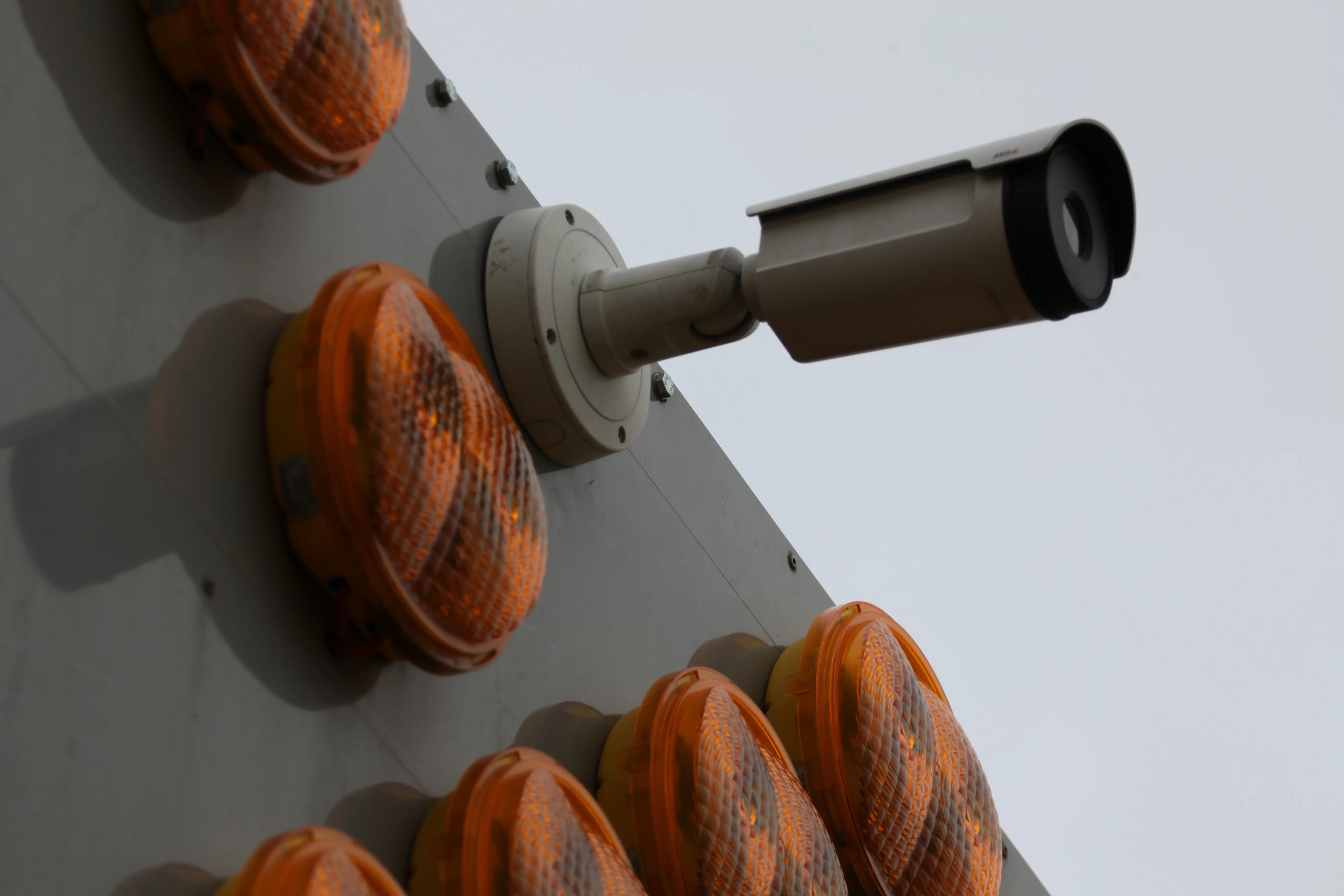
Project Yellow uses a rear-mounted thermal imaging camera

184 Colas’s Yellow Project has been developed with 164 Aximum Electronic Products - a Colas Group Company - and software experts Foxstream. The system uses thermal imaging and video analytics to detect and classify approaching vehicles into “threat categories”. It identifies those that pose the greatest collision risk with a highway works vehicle or nearby workers.

The thermal camera is mounted at height on the rear of a works or emergency vehicle and performs in both dark conditions and full sunlight. It does not suffer from false alarms caused by pixel shifting, as can occur with an optical camera analytic system, particularly at night. When a vehicle that poses a collision risk is detected by the analytics system, an audible and visual warning is sounded and additional or amended vehicle lighting can be initiated.

In addition, a wireless alarm is provided for workers undertaking works on foot away from their vehicle to ensure they are immediately aware of a high-collision risk scenario.

The system is equipped with a GPS and Internet of Things connectivity solution for real-time monitoring of the vehicle’s position and for directly uploading data to the Datex II traffic data interface. This allows satellite navigation manufacturers to use this information to warn road users of the location of the workforce. Highways workers can select a “detection area” to mirror the road geometry and lane width when they arrive on site. This ensures that the system is used on an infinite range of curves and elevation changes while preventing false alarms.

For more information on companies in this article

Related Content

  • River level monitoring to reduce scour risk
    July 11, 2022
    An OTT ecoLog 1000 water level logger with cellular data connection to Hydromet Cloud was trialled upon the Vales Burn Bridge in Scotland
  • SICK launches 3D TIC502 LiDAR sensor system for traffic management
    May 18, 2018
    Sick says that its latest TIC502 twin LiDAR sensor system has high all-weather capability between -40OC and +60OC. The TIC502 incorporates vehicle speed detection with 3D profiling and counting of fast-lane, free flowing and static traffic to facilitate toll charge assessment. It can also be integrated with additional 2D LiDAR sensors to count axles for complete traffic profiling and assessment in a single system, according to the company that was set up in 1946 by optical engineer Erwin Sick in Waldkir
  • Ammann: crowded jobsites made safer
    March 17, 2025
    The first advances from Ammann’s participation in the Autonomous Operation Cluster (AOC) project are now available on some Ammann heavy compactors.
  • Focusing on workzone safety systems
    March 16, 2012
    The US has seen a major reduction in deaths following accidents in its highway construction work zones, while Europe and other parts of the world are looking at new safety technology and systems to trigger a similar trend. Guy Woodford reports. Work in the US to reduce the likelihood of potentially fatal accidents at highway work zones is paying dividend.