Campbell Scientific launches smarter weather station, Weatherbrain

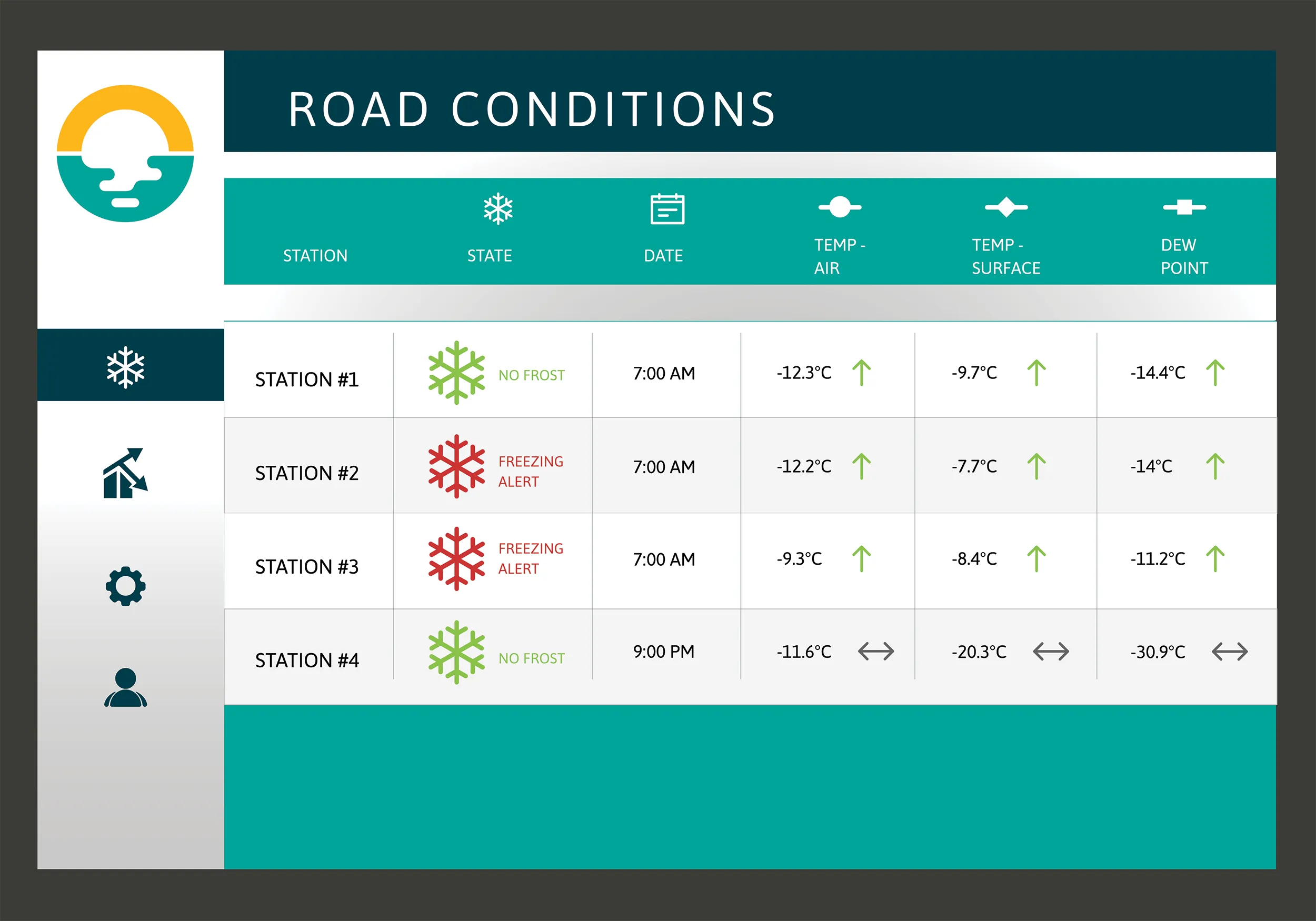
Campbell Scientific Canada has launched its WeatherBrain meteorological system for highways after a year of testing in the city of Magog, Canada. WeatherBrain is a software package that produces readable meteorological data for predicting road and weather conditions, allowing more efficient use of road crews.
February 9, 2018 Read time: 2 mins
Weatherbrain predictions can be more accurate than those from traditional weather stations, according to Campbell Scientific Canada
Campbell Scientific Canada has launched its WeatherBrain meteorological system for highways after a year of testing in the city of Magog, Canada


WeatherBrain is a software package that produces readable meteorological data for predicting road and weather conditions, allowing more efficient use of road crews.

Campbell Scientific said that WeatherBrain’s forecasting, analysis and decision support capabilities can save users time, money and effort on their winter road maintenance programmes.

For the year-long test in Magog, in the province of Quebec, Campbell Scientific covered the city’s 550km of roads with a myriad of weather stations. Individually, these stations act as traditional road weather information systems – RWIS – to monitor snow thickness both on and off roadways. They also collect data on air temperature and dew point.

The problem with traditional RWIS stations is that they collect meteorological data about current conditions via road surface and atmospheric sensors and a datalogger. The datalogger compiles information gathered from the sensors, then delivers the often-cryptic piles of data to the end-user for their analysis and interpretation.

WeatherBrain stations are different, according to Campbell Scientific, because they collate, analyse and present the data in much more detail and in a more easily understood format than traditional stations. Collectively, WeatherBrain’s stations make up a densified network of data points.

An inability to accurately interpret meteorological data remains can result in the over-use and misuse of road salts to prevent accidents.

Similar to traditional RWIS, WeatherBrain consists of a series of RWIS stations equipped with sensors to monitor snow thickness, air temperature, dew point and other facts. However, WeatherBrain has the capacity to pull in geo-relevant third party data, providing a more robust data set to allow for increased relevancy and accuracy.

Extensive algorithms take this geo-relevant data set and create nowcasts and forecasts for the next 12 hours. Based on these nowcasts and forecasts, the software produces actionable indicators that show the user when they’ll need to take action, effectively putting them ahead of impending weather events.

For example, based on the systems forecast, Campbell Scientific said that WeatherBrain can predict a black ice event will occur in 4 hours, so road maintenance operators can schedule their road crews to take proactive maintenance, eliminating the risk altogether.

Related Content

  • Biral showcases meteorological equipment at UK highways show
    January 6, 2017
    Meteorological specialist Biral recently exhibited its range of advanced weather and visibility sensors at the Highways Management Show in Coventry, UK Biral, set up in 1975, works with companies and organisations across all industries, including road and transportation, to deliver solutions to monitor visibility and local weather conditions as part of smart road systems and intelligent transport networks. Biral said that its VPF and SWS Visibility and Present Weather Sensors ranges are particularly benefic
  • Biral showcases meteorological equipment at UK highways show
    January 24, 2017
    Meteorological specialist Biral recently exhibited its range of advanced weather and visibility sensors at the Highways Management Show in Coventry, UK Biral, set up in 1975, works with companies and organisations across all industries, including road and transportation, to deliver solutions to monitor visibility and local weather conditions as part of smart road systems and intelligent transport networks. Biral said that its VPF and SWS Visibility and Present Weather Sensors ranges are particularly bene
  • IBI’s Routemapper charts new territory with Highways England
    September 14, 2016
    Mapping the asset High-speed data collection just got faster for England’s newly created strategic roads operator Highways England’s establishment as a publicly held company in 2015 created a need for a highly accurate asset inventory. This was potentially very costly and had serious safety implications. As well as its relationships with numerous managing agents and contractors, assets include 35,300km of highway, 12,100km of earthworks, 23,200km of safety fences, 150,000 technology assets and sig
  • Traffic management drives sustainability
    June 18, 2012
    New initiatives could boost transport sustainability – David Crawford writes. New roles are opening up for urban traffic management systems in helping city authorities to meet increasingly stringent governmental and supra-governmental air quality standards. European local authorities are typically tasked with both traffic management and pollution monitoring within their areas, making them well placed to draw on the latter to mitigate the impacts of the former.