Campbell Scientific launches smarter weather station, Weatherbrain

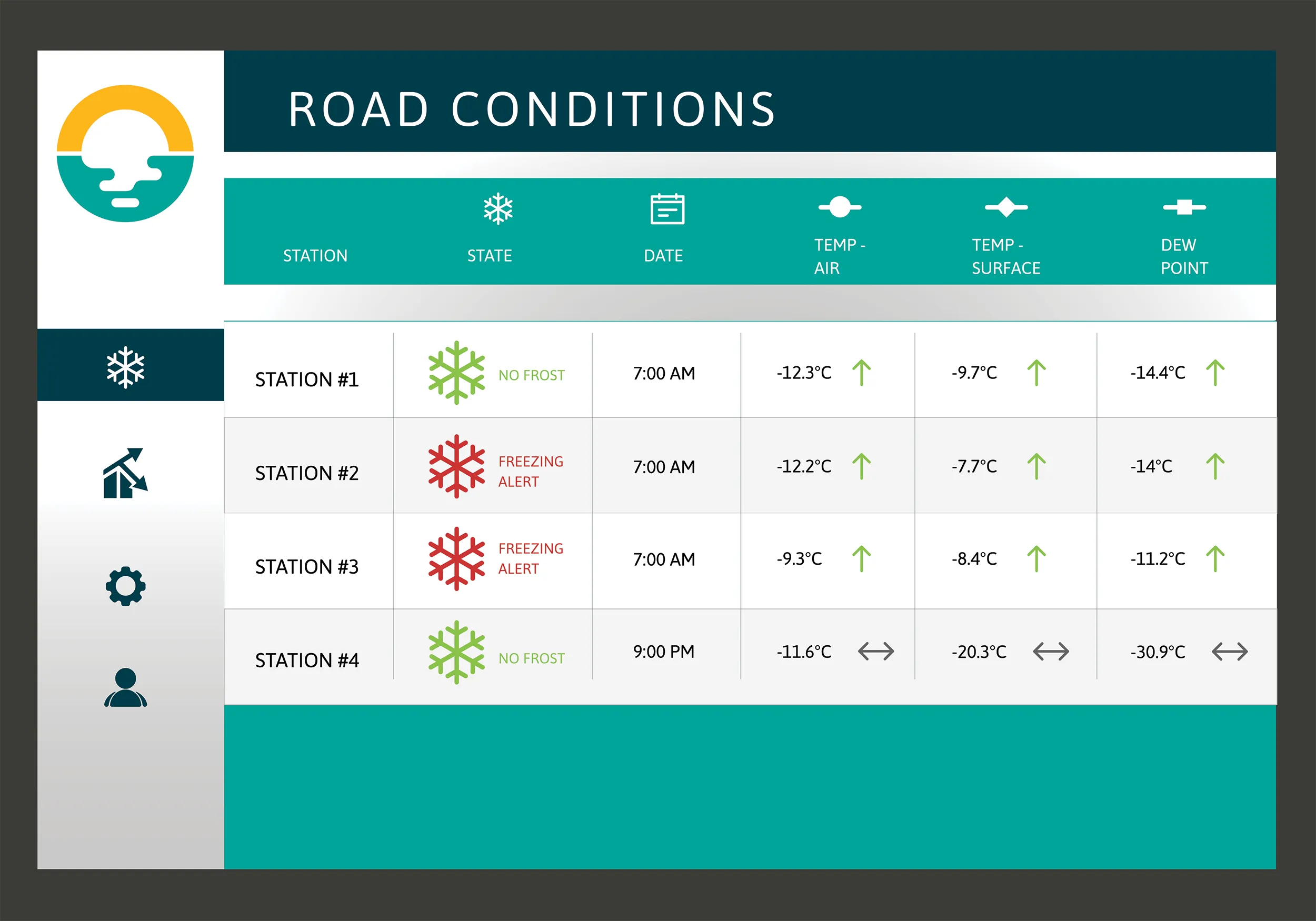
Campbell Scientific Canada has launched its WeatherBrain meteorological system for highways after a year of testing in the city of Magog, Canada. WeatherBrain is a software package that produces readable meteorological data for predicting road and weather conditions, allowing more efficient use of road crews.
February 9, 2018 Read time: 2 mins
Weatherbrain predictions can be more accurate than those from traditional weather stations, according to Campbell Scientific Canada
Campbell Scientific Canada has launched its WeatherBrain meteorological system for highways after a year of testing in the city of Magog, Canada


WeatherBrain is a software package that produces readable meteorological data for predicting road and weather conditions, allowing more efficient use of road crews.

Campbell Scientific said that WeatherBrain’s forecasting, analysis and decision support capabilities can save users time, money and effort on their winter road maintenance programmes.

For the year-long test in Magog, in the province of Quebec, Campbell Scientific covered the city’s 550km of roads with a myriad of weather stations. Individually, these stations act as traditional road weather information systems – RWIS – to monitor snow thickness both on and off roadways. They also collect data on air temperature and dew point.

The problem with traditional RWIS stations is that they collect meteorological data about current conditions via road surface and atmospheric sensors and a datalogger. The datalogger compiles information gathered from the sensors, then delivers the often-cryptic piles of data to the end-user for their analysis and interpretation.

WeatherBrain stations are different, according to Campbell Scientific, because they collate, analyse and present the data in much more detail and in a more easily understood format than traditional stations. Collectively, WeatherBrain’s stations make up a densified network of data points.

An inability to accurately interpret meteorological data remains can result in the over-use and misuse of road salts to prevent accidents.

Similar to traditional RWIS, WeatherBrain consists of a series of RWIS stations equipped with sensors to monitor snow thickness, air temperature, dew point and other facts. However, WeatherBrain has the capacity to pull in geo-relevant third party data, providing a more robust data set to allow for increased relevancy and accuracy.

Extensive algorithms take this geo-relevant data set and create nowcasts and forecasts for the next 12 hours. Based on these nowcasts and forecasts, the software produces actionable indicators that show the user when they’ll need to take action, effectively putting them ahead of impending weather events.

For example, based on the systems forecast, Campbell Scientific said that WeatherBrain can predict a black ice event will occur in 4 hours, so road maintenance operators can schedule their road crews to take proactive maintenance, eliminating the risk altogether.

Related Content

  • Wirtgen Group launches WITOS intelligent telematics system
    April 16, 2013
    The Wirtgen Group is presenting a glimpse of the future of road construction at this year's bauma. Wirtgen Group telematics and on-site solutions (WITOS) combines a telematics fleet management solution with a high-performance software system for process optimisation. WITOS is a modular software system that supports fleet and service management but also enables new approaches to process optimisation. This makes it possible to apply the just-in-time principle to organising construction processes and to optimi
  • Concrete runway paving in the US
    December 15, 2017
    A new Wirtgen SP 94i slipform paver has helped deliver the successful reconstruction of a runway in the US state of Missouri. With more than 30,000 take-offs and landings a year, Jefferson City Memorial Airport (JEF) is one of the most heavily frequented airports in Missouri. Thousands of visitors travel through it every day on their way to the government and congress offices in the state capital on the Missouri River. At the end of April 2016, work commenced on the reconstruction of a runway approximately
  • Texas certification of RetroTek-MU operator a first
    July 27, 2018
    Striping Service and Supply is the first US contractor certified by the Texas Department of Transportation to operate the RetroTek-MU road striping Retroreflectometer. The Texas A&M Transportation Institute stringent certification programme provides a quantitative basis for evaluating the ability of a contractor to operate the RetroTek-MU retroreflectometer. The vehicle-mounted RetroTek-MU - manufactured by Reflective Measurement Systems, based in Dublin, Ireland - measures the retroreflectivity of lo
  • Premiere in the Black Forest
    October 5, 2023
    One of the steepest sections of the B 500, an important road in the southern Black Forest, had to be renewed in the summer of 2023 – more precisely: the first kilometres behind the Triberg town sign, past the famous waterfalls. Asphalt paving specialists from Gebrüder Bantle GmbH & Co. KG were commissioned to resurface the carriageway.