Campbell Scientific launches smarter weather station, Weatherbrain

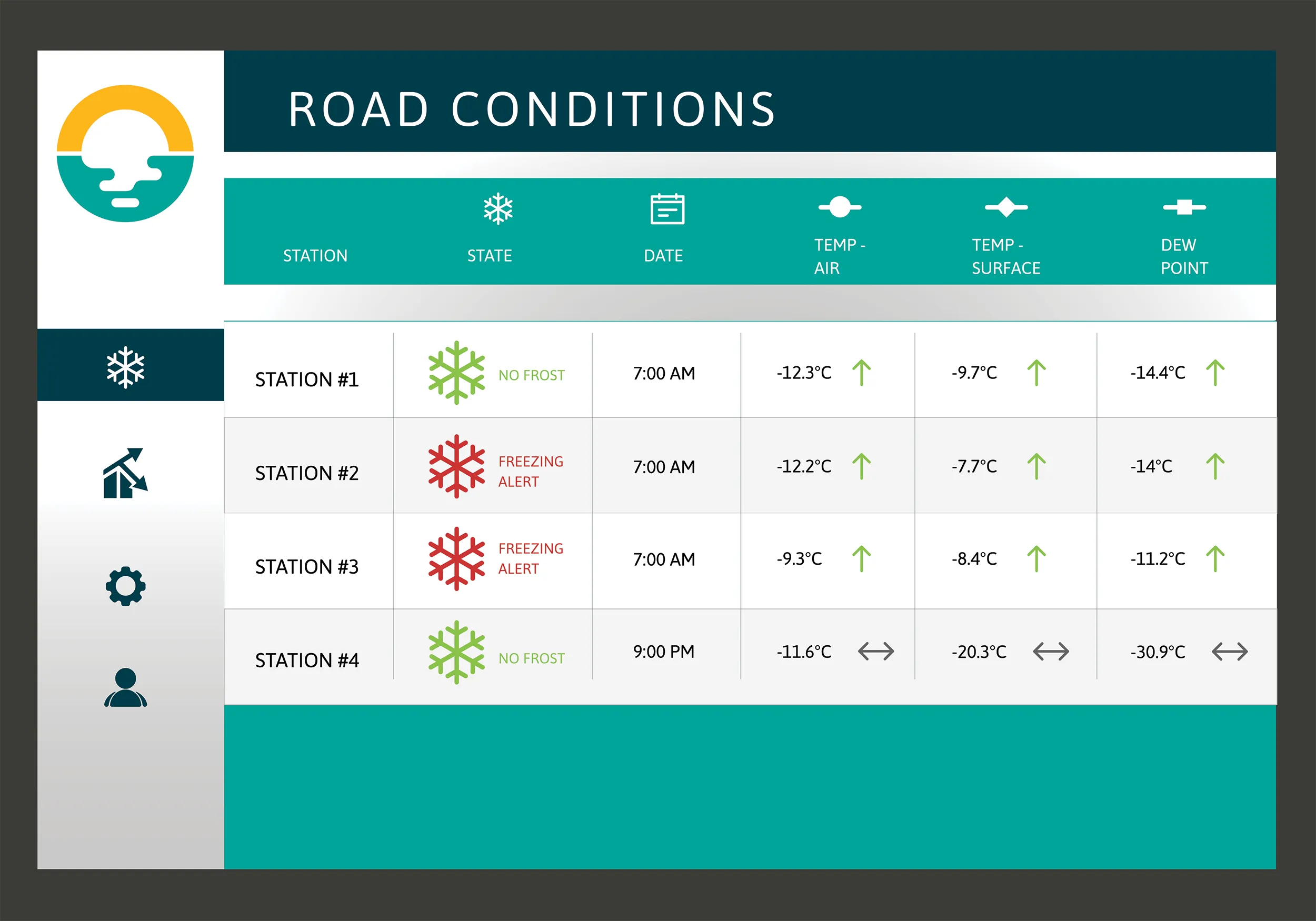
Campbell Scientific Canada has launched its WeatherBrain meteorological system for highways after a year of testing in the city of Magog, Canada. WeatherBrain is a software package that produces readable meteorological data for predicting road and weather conditions, allowing more efficient use of road crews.
February 9, 2018 Read time: 2 mins
Weatherbrain predictions can be more accurate than those from traditional weather stations, according to Campbell Scientific Canada
Campbell Scientific Canada has launched its WeatherBrain meteorological system for highways after a year of testing in the city of Magog, Canada


WeatherBrain is a software package that produces readable meteorological data for predicting road and weather conditions, allowing more efficient use of road crews.

Campbell Scientific said that WeatherBrain’s forecasting, analysis and decision support capabilities can save users time, money and effort on their winter road maintenance programmes.

For the year-long test in Magog, in the province of Quebec, Campbell Scientific covered the city’s 550km of roads with a myriad of weather stations. Individually, these stations act as traditional road weather information systems – RWIS – to monitor snow thickness both on and off roadways. They also collect data on air temperature and dew point.

The problem with traditional RWIS stations is that they collect meteorological data about current conditions via road surface and atmospheric sensors and a datalogger. The datalogger compiles information gathered from the sensors, then delivers the often-cryptic piles of data to the end-user for their analysis and interpretation.

WeatherBrain stations are different, according to Campbell Scientific, because they collate, analyse and present the data in much more detail and in a more easily understood format than traditional stations. Collectively, WeatherBrain’s stations make up a densified network of data points.

An inability to accurately interpret meteorological data remains can result in the over-use and misuse of road salts to prevent accidents.

Similar to traditional RWIS, WeatherBrain consists of a series of RWIS stations equipped with sensors to monitor snow thickness, air temperature, dew point and other facts. However, WeatherBrain has the capacity to pull in geo-relevant third party data, providing a more robust data set to allow for increased relevancy and accuracy.

Extensive algorithms take this geo-relevant data set and create nowcasts and forecasts for the next 12 hours. Based on these nowcasts and forecasts, the software produces actionable indicators that show the user when they’ll need to take action, effectively putting them ahead of impending weather events.

For example, based on the systems forecast, Campbell Scientific said that WeatherBrain can predict a black ice event will occur in 4 hours, so road maintenance operators can schedule their road crews to take proactive maintenance, eliminating the risk altogether.

Related Content

  • Bentley expanding capabilities with new deals
    April 30, 2018
    Bentley Systems is acquiring Plaxis, a Netherlands-based provider of geotechnical software. In addition, Bentley also has an agreement to acquire soil engineering software provider SoilVision, based in Saskatchewan, Canada. The acquisitions develop Bentley’s capabilities in the geotechnical sector. These deals allow BIM advancements to be extended to subsurface engineering for infrastructure projects. Projects commence with geotechnical surveys and sampling, captured with Bentley’s gINT for versatile
  • The Lessons of the Genoa bridge collapse
    April 23, 2019
    The partial collapse of the Polcevera viaduct, better known as the Morandi Bridge, has prompted debate regarding the technical and administrative aspects of maintaining road infrastructures. We discussed it with the engineer Gabriele Camomilla, former Director of Research and Maintenance of the Società Autostrade, who coordinated the only major structural intervention performed on the bridge, carried out in the early 1990s
  • TRL announces tool to predict incident response consequences
    May 1, 2012
    TRL has formally launched its latest software product to help keep the UK's roads moving when an incident or planned event threatens to create significant congestion. TEST - Tool for Evaluating Strategies for Traffic - has been developed for operators of traffic control centres to predict the consequences of actions they undertake on their network, in response to an incident.Incidents, events and road works all have the potential to impact traffic patterns and flows and can often cause significant congestio
  • ARRB Systems' network-level continuous friction testing
    November 20, 2024
    Pavement safety assessments have traditionally focused on discrete low-density friction assessments using proven technology. But more detailed investigations and analysis are now feasible through improved technologies, explains Simon Tetley of ARRB Systems*.