Campbell Scientific launches smarter weather station, Weatherbrain

Campbell Scientific Canada has launched its WeatherBrain meteorological system for highways after a year of testing in the city of Magog, Canada. WeatherBrain is a software package that produces readable meteorological data for predicting road and weather conditions, allowing more efficient use of road crews.
February 9, 2018 Read time: 2 mins
Weatherbrain predictions can be more accurate than those from traditional weather stations, according to Campbell Scientific Canada
Campbell Scientific Canada has launched its WeatherBrain meteorological system for highways after a year of testing in the city of Magog, Canada


WeatherBrain is a software package that produces readable meteorological data for predicting road and weather conditions, allowing more efficient use of road crews.

Campbell Scientific said that WeatherBrain’s forecasting, analysis and decision support capabilities can save users time, money and effort on their winter road maintenance programmes.

For the year-long test in Magog, in the province of Quebec, Campbell Scientific covered the city’s 550km of roads with a myriad of weather stations. Individually, these stations act as traditional road weather information systems – RWIS – to monitor snow thickness both on and off roadways. They also collect data on air temperature and dew point.

The problem with traditional RWIS stations is that they collect meteorological data about current conditions via road surface and atmospheric sensors and a datalogger. The datalogger compiles information gathered from the sensors, then delivers the often-cryptic piles of data to the end-user for their analysis and interpretation.

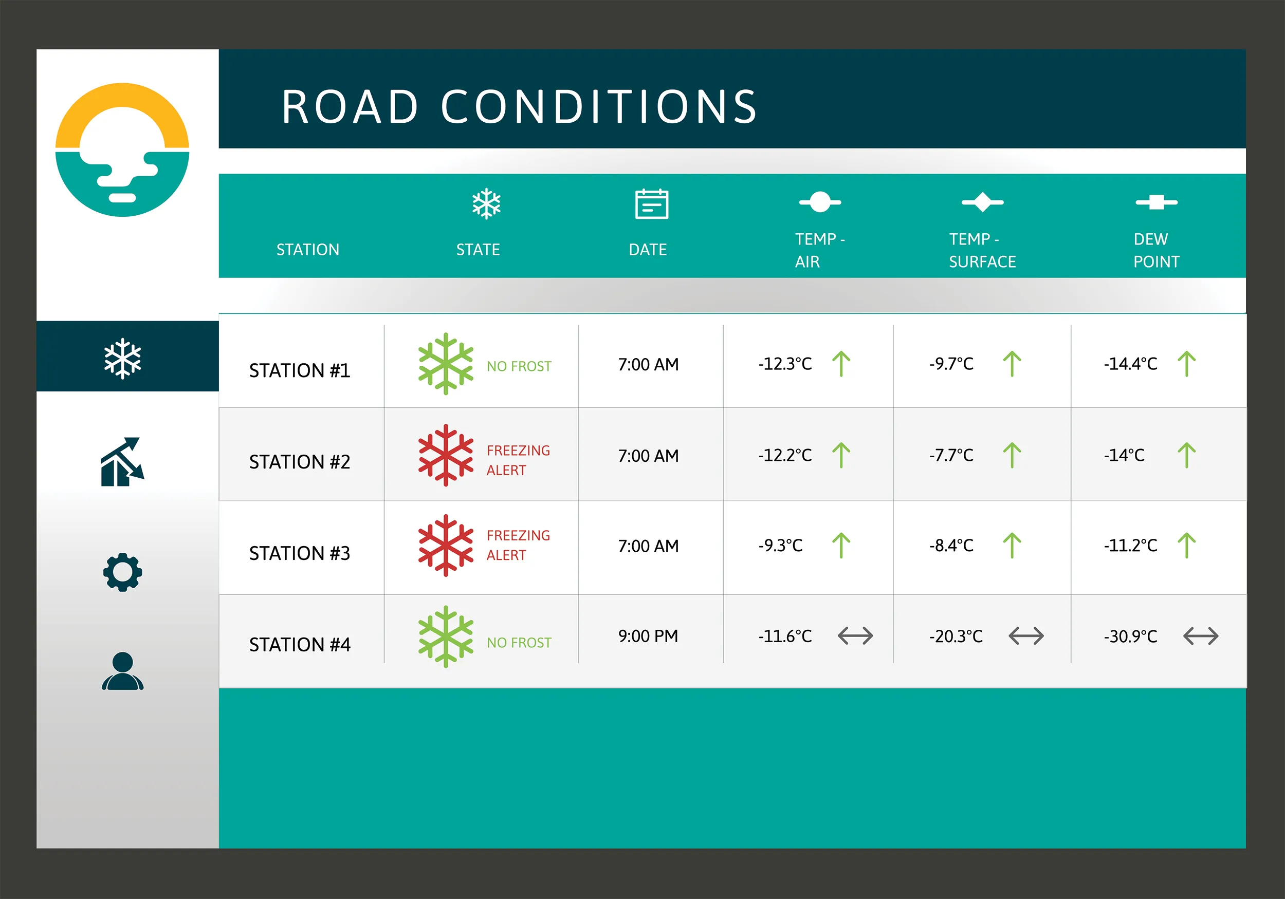
WeatherBrain stations are different, according to Campbell Scientific, because they collate, analyse and present the data in much more detail and in a more easily understood format than traditional stations. Collectively, WeatherBrain’s stations make up a densified network of data points.

An inability to accurately interpret meteorological data remains can result in the over-use and misuse of road salts to prevent accidents.

Similar to traditional RWIS, WeatherBrain consists of a series of RWIS stations equipped with sensors to monitor snow thickness, air temperature, dew point and other facts. However, WeatherBrain has the capacity to pull in geo-relevant third party data, providing a more robust data set to allow for increased relevancy and accuracy.

Extensive algorithms take this geo-relevant data set and create nowcasts and forecasts for the next 12 hours. Based on these nowcasts and forecasts, the software produces actionable indicators that show the user when they’ll need to take action, effectively putting them ahead of impending weather events.

For example, based on the systems forecast, Campbell Scientific said that WeatherBrain can predict a black ice event will occur in 4 hours, so road maintenance operators can schedule their road crews to take proactive maintenance, eliminating the risk altogether.

Related Content

  • Winner Profile: iCITE Data Aggregator by Eberle Design Inc for traffic management
    May 21, 2019
    There is a global need for more intelligent traffic management and enhanced road safety, fuelled by data collection and the useful interpretation of that data into real-time information that provides for effective action by traffic engineers. The prevailing transportation paradigm, one-person-one-vehicle, is forcing the multimodal traffic infrastructure to its limits. With continuous congestion, longer commute times, and increased accidents, agencies are tasked with finding solutions without escalating thei
  • New study into the impact of weather on Europe’s transport
    November 5, 2012
    A new study into the impact of extreme weather conditions on Europe’s transport network has been carried out by Finland’s VTT Technical Research Centre. This broad-based study covered all 27 EU states and highlighted that some countries face significantly higher risks of transport disruption than others. This is the first study worldwide to evaluate risks to transport from weather phenomena on a country-specific and mode-specific basis. The study revealed that Poland faces particular problems, while other h
  • Laser mapping speeds up survey measurement
    February 21, 2012
    British scanning company 3D Laser Mapping is hoping to benefit from a £3 million ($5 million) fund announced recently by the UK government for police forces to purchase laser scanning technology for accident recording and investigation.
  • Aggregate Industries launches Automated Inspection and Testing
    May 15, 2018
    With safety the priority in road paving, Aggregate Industries says it has launched an automated data gathering system to replace hazardous inspections by crew members. AI says that the new system, known as Automated Inspection and Testing, will see all pavers, rollers and survey vehicles fitted with the latest technology including GPS, infra-red sensors and a data recording unit. All will automatically log high-quality data before, during and after the surfacing process.