Campbell Scientific launches smarter weather station, Weatherbrain

Campbell Scientific Canada has launched its WeatherBrain meteorological system for highways after a year of testing in the city of Magog, Canada. WeatherBrain is a software package that produces readable meteorological data for predicting road and weather conditions, allowing more efficient use of road crews.
February 9, 2018 Read time: 2 mins
Weatherbrain predictions can be more accurate than those from traditional weather stations, according to Campbell Scientific Canada
Campbell Scientific Canada has launched its WeatherBrain meteorological system for highways after a year of testing in the city of Magog, Canada


WeatherBrain is a software package that produces readable meteorological data for predicting road and weather conditions, allowing more efficient use of road crews.

Campbell Scientific said that WeatherBrain’s forecasting, analysis and decision support capabilities can save users time, money and effort on their winter road maintenance programmes.

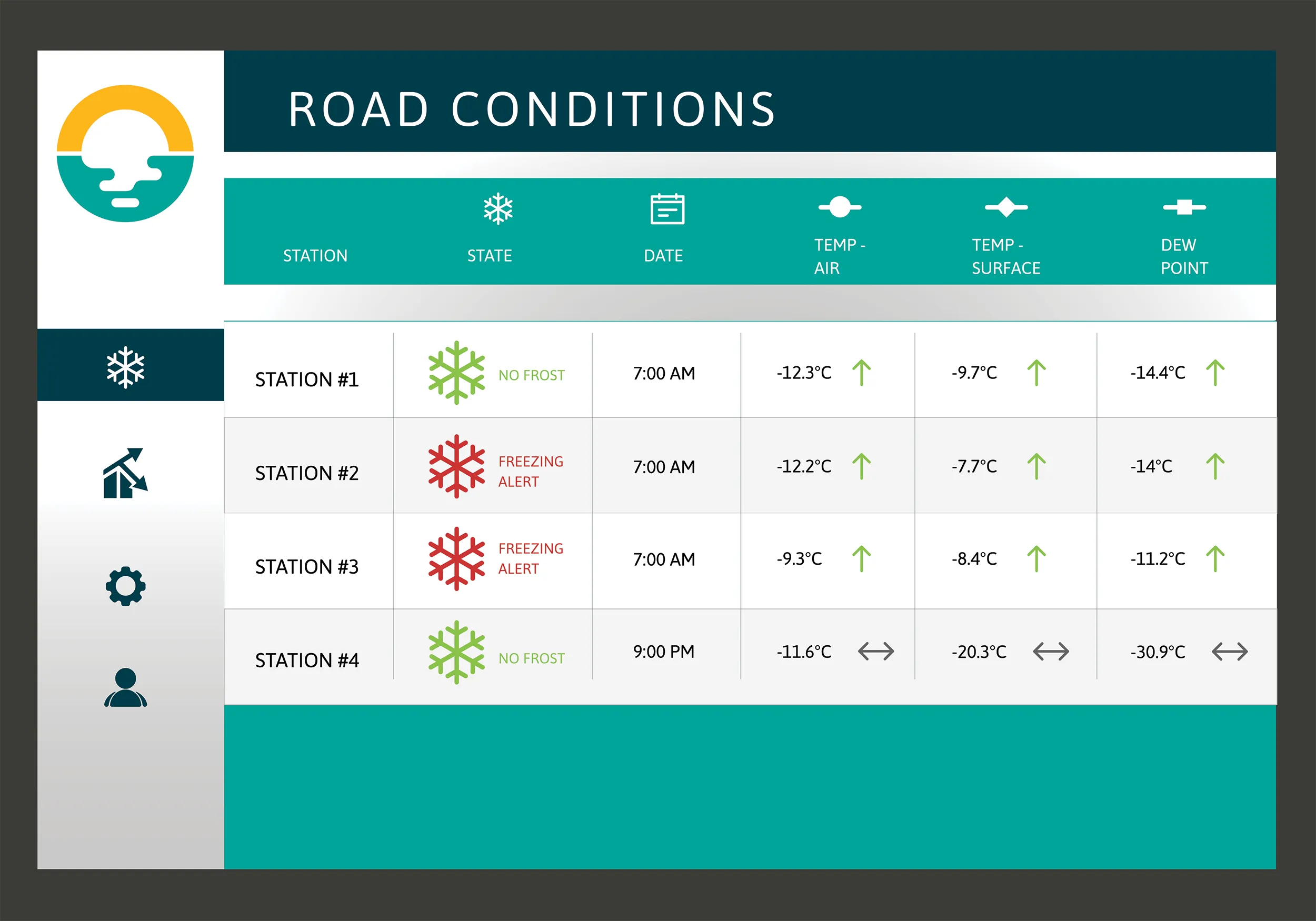
For the year-long test in Magog, in the province of Quebec, Campbell Scientific covered the city’s 550km of roads with a myriad of weather stations. Individually, these stations act as traditional road weather information systems – RWIS – to monitor snow thickness both on and off roadways. They also collect data on air temperature and dew point.

The problem with traditional RWIS stations is that they collect meteorological data about current conditions via road surface and atmospheric sensors and a datalogger. The datalogger compiles information gathered from the sensors, then delivers the often-cryptic piles of data to the end-user for their analysis and interpretation.

WeatherBrain stations are different, according to Campbell Scientific, because they collate, analyse and present the data in much more detail and in a more easily understood format than traditional stations. Collectively, WeatherBrain’s stations make up a densified network of data points.

An inability to accurately interpret meteorological data remains can result in the over-use and misuse of road salts to prevent accidents.

Similar to traditional RWIS, WeatherBrain consists of a series of RWIS stations equipped with sensors to monitor snow thickness, air temperature, dew point and other facts. However, WeatherBrain has the capacity to pull in geo-relevant third party data, providing a more robust data set to allow for increased relevancy and accuracy.

Extensive algorithms take this geo-relevant data set and create nowcasts and forecasts for the next 12 hours. Based on these nowcasts and forecasts, the software produces actionable indicators that show the user when they’ll need to take action, effectively putting them ahead of impending weather events.

For example, based on the systems forecast, Campbell Scientific said that WeatherBrain can predict a black ice event will occur in 4 hours, so road maintenance operators can schedule their road crews to take proactive maintenance, eliminating the risk altogether.

Related Content

  • Additive helps roads de-ice themselves
    March 4, 2022
    Italian additive specialist Iterchimica has created an additive for asphalt mixes which allows pavement surfaces to de-ice themselves.
  • Bridge inspection: destructive versus non-destructive methods
    January 6, 2015
    Tens of thousands of bridges in the United States are in desperate need of repair. But where to begin analysing their deteriorating state? Roger Roberts* investigates tips and techniques for ensuring bridge safety The average age of America’s more than 600,000 crumbling bridges is 42 years – many are 60 to 80 years old. The situation is dire, with many described as functionally obsolete, according to the American Society of Civil Engineers’ latest edition of its Report Card for America’s Infrastructure.
  • Laser scanning focuses on asset management
    January 9, 2015
    Laser scanners and improved data collection and analysis software are making light of asset management surveying. David Arminas reports The age of the laser scanner is upon us, taking over from traditional manual methods of surveying, data collection and processing. These new technical developments are making it much easier to process and use the data captured and are providing highways engineers with powerful tools to record, map and visualise their assets. This is good news for highways authorities
  • Trimble’s technology advances for machine fleets
    January 26, 2018
    Trimble is gearing up to boost construction efficiency with a new level of machine technology – Mike Woof writes The introduction of the latest version of Trimble’s VisionLink package will help allow contractors to reduce operating costs while boosting working efficiency, according to the firm. Trimble’s VisionLink system was developed in partnership with Caterpillar and includes tools for production monitoring. This now offers customers greater capabilities, due in many respects to its increased versat