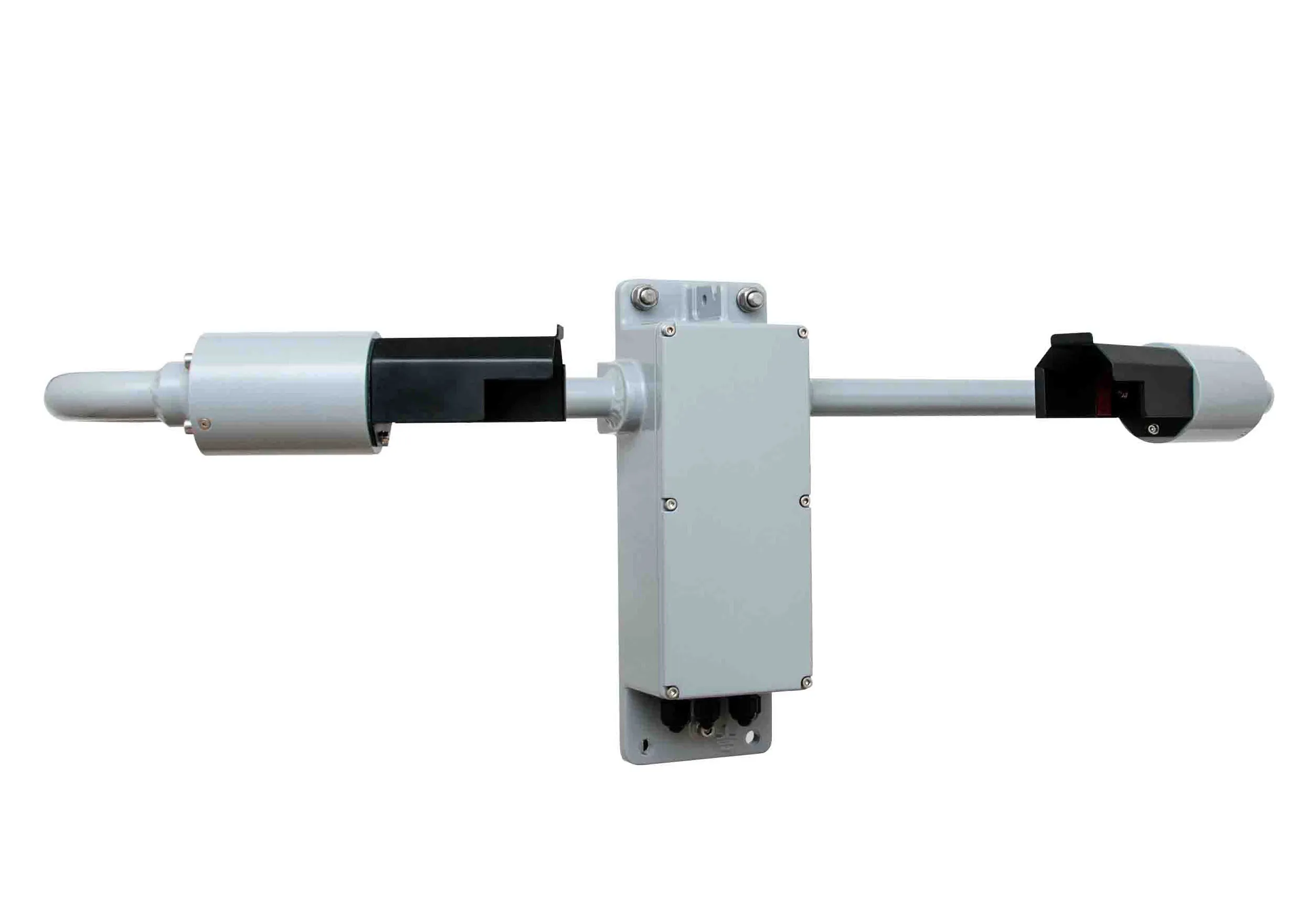
British meteorological instrument manufacturer Biral has launched what it says is “a very competitively priced” transportation road weather sensor (RWS-20). The sensor monitors visibility and obstruction to vision for road transport applications. It has been manufactured to allow easy integration with any road weather information system but it has been developed specifically for the harsh roadside environment. The RWS-20 is based upon Biral’s SWS range of visibility sensors, sharing many of its advanced tec
British meteorological instrument manufacturer 8558 Biral has launched what it says is “a very competitively priced” transportation road weather sensor (RWS-20)
The sensor monitors visibility and obstruction to vision for road transport applications.
It has been manufactured to allow easy integration with any road weather information system but it has been developed specifically for the harsh roadside environment. The RWS-20 is based upon Biral’s SWS range of visibility sensors, sharing many of its advanced technical features. It uses the compact forward scatter measurement principle and remains accurate in all weather conditions, ensuring local light sources, headlights or flashing signs do not impact its operation or reliability.
The RWS-20 has a measurement range of to 7.5km for use in road applications where fog, rain, spray and snow can create dangerous driving conditions. The optical windows and sensor hoods contain heating for use in harsh weather conditions throughout the year. Both optical windows have systems for lens contamination monitoring, ensuring the visibility output is constantly compensated to maintain accuracy whilst reducing routine maintenance duties.
The unit also has self-test capabilities, along with automatic alerts for cleaning the optical windows. The product has a serial data output of RS232, RS422 or RS485, while providing analogue voltage visibility outputs (0- 10V) or the extinction coefficient (EXCO).
The RWS-20 features optional relays which directly connect to road-side signage and other control systems, allowing intelligent communication and operation of local warning signs.
Biral is based in Bristol, UK. Its products range from sensors - measuring wind, temperature, precipitation, visibility, solar radiation and other standard parameters – to complete weather stations. Biral is also a specialist in the design, manufacture and supply of particle analysis and climate research instruments for science, industry and the environment.