Advanced vehicle monitoring technology

PIPS Technology has commissioned two Journey Time Measurement Systems (JTMS) in Gravesend and Tunbridge Wells for Kent Highway Services (KHS) in the UK. The JTMS locations consist of 34 Automatic Number Plate Recognition (ANPR) cameras and JTMS software all provided by PIPS Technology.
March 2, 2012 Read time: 2 mins
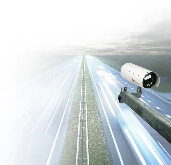
Roads in the english county of Kent now feature vehicle monitoring systems from PIPS technology
202 Pips Technology has commissioned two Journey Time Measurement Systems (JTMS) in Gravesend and Tunbridge Wells for Kent Highway Services (KHS) in the UK. The JTMS locations consist of 34 Automatic Number Plate Recognition (ANPR) cameras and JTMS software all provided by PIPS Technology.

The PIPS JTMS solutions installed in Kent both feature a network of award-winning P372 integrated Spike ANPR cameras, linked by wireless communications to the JTMS software. The Spike cameras are able to read the number plate of every vehicle that passes and sends time stamped and encrypted data back to the JTMS server.

The JTMS server calculates journey times from the data collected and forwards them to a common database which calculates journey times from systems all over Kent. To calculate the journey time the JTMS database uses the data transmitted from PIPS cameras and calculates how long it takes each vehicle to travel from one part of the network to another. From this an average time is calculated so that users know how well the traffic is flowing. Journey time data is useful as it can be transmitted to the roadside to communicate travel times to drivers by variable message signs (VMS) and allows planners to see areas of the road network which are not flowing as they should.

The system in Kent is being used to monitor journey times and alert operators in the KHS Traffic Management Centre of possible congestion and delays on the network. In total there are 21 different camera sites featuring PIPS Spike cameras spread across the two individual project locations, all of which are on single lane carriageways.

For more information on companies in this article

Related Content

  • Innovative GIS advances from Bluesky
    July 18, 2012
    Aerial survey specialist Bluesky is funding research into the development and use of a new system to map the UK’s cities and towns at night. Bluesky has teamed up with the University of Leicester to look at solutions using new high sensitivity camera sensor technology. Mounted on survey aircraft, the new system can record the location of street lights, illuminated road signs and other night-time sources of light. This can deliver an accurate resource for asset inventories, light pollution assessment and ene
  • Smart constructioon with GIS, GPS design technology
    May 2, 2012
    A UK highway project has benefited from the latest software, GIS and GPS technology, Mike Woof reports. Sophisticated software, GIS and GPS technology has played an important role in a large highway upgrade project in the UK and helping to increase efficiency and drive down construction costs.
  • Advanced driving simulator developed by TRL
    July 4, 2018
    In the UK, TRL is introducing a sophisticated driving simulator that will help with developing transport infrastructure as well as research into driving. This advanced system is intended to assist in driving future transport policy, customer safety and road network performance. The new simulator can be used for behavioural research into driving and can be used as a validation tool. The complete simulator package features three main systems as it consists of the new full size DigiCar, a portable version (Mi
  • Road trains project saves space as well as fuel
    February 23, 2012
    A high-tech European project involving cars could reduce fuel consumption by up to one-fifth as Patrick Smith reports. A new EU project, Sartre, is aimed at developing and testing technology for vehicles that can drive themselves in long road trains on motorways.