
SICK’s Free Flow Profiler scans vehicles on the move

SICK has launched the Free Flow Profiler vehicle measurement system that enables highly accurate 3D profiling of vehicles across multiple lanes in free-flow traffic The company says that the Free Flow Profiler is a “versatile and adaptable” all-weather system. It is “ideal for vehicle tolling and classification uses, especially useful in operations such as optimal weight loading of ferries or trains and for verifying vehicle dimensions to maximise revenue recovery”. During multilane, free road movem
August 27, 2019 Read time: 3 mins
SICK’s Free Flow Profiler scans vehicles on the move
SICK has launched the Free Flow Profiler vehicle measurement system that enables highly accurate 3D profiling of vehicles across multiple lanes in free-flow traffic


The company says that the Free Flow Profiler is a “versatile and adaptable” all-weather system. It is “ideal for vehicle tolling and classification uses, especially useful in operations such as optimal weight loading of ferries or trains and for verifying vehicle dimensions to maximise revenue recovery”.  

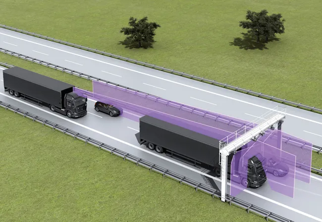
During multilane, free road movement, SICK 2D LiDAR sensors are set up to scan traffic at a high frequency and measure vehicle length, width and height automatically. Typically, three SICK sensors will be gantry-mounted. However, the system can be enlarged to encompass multiple lanes or adapted with varying sensor layouts to obtain information for monitoring purposes. The system operates up to 40m to profile all vehicle types, from heavy road transport to passenger cars, towed vehicles and motorcycles.

Vehicle measurements are processed in the SICK Traffic Controller to produce a highly-accurate 3D model of each vehicle. The system captures vehicle dimensions, vehicle type, driving direction and lane assignment. Options to integrate vehicle classification, axle counting or detection of overheated vehicle parts can be added to meet local operator conditions and requirements.

The SICK Free Flow Profiler system can be incorporated into new facilities, retrofitted and even easily relocated. Capable of accurately profiling vehicles at speeds from 0-120kph, it can be integrated with other traffic management monitoring systems such as optical character recognition, CCTV and security.

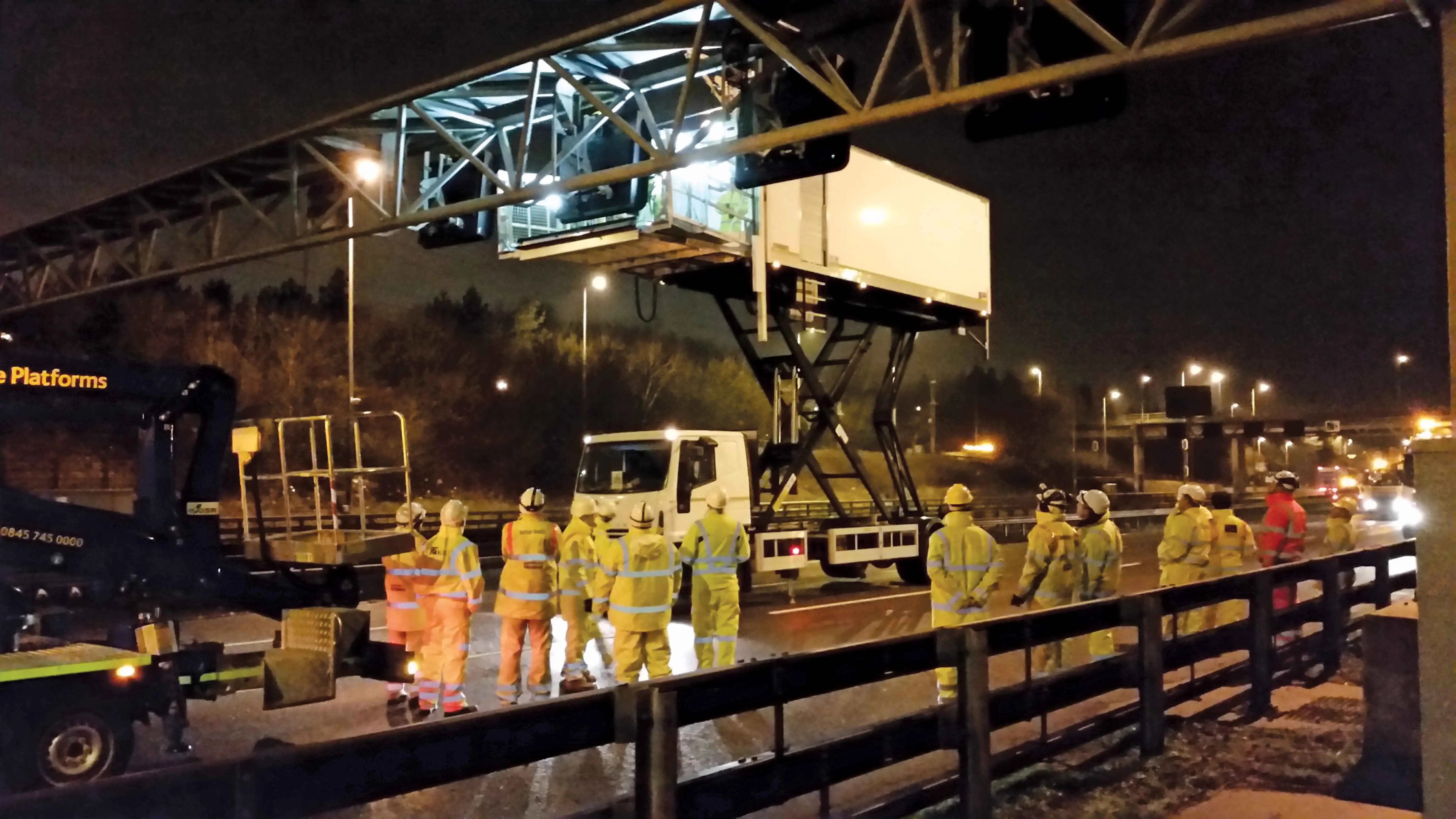
Gantry-mounted, or direct-mounted on existing structures over traffic lanes, installation is non-disruptive without disturbance of the road surface. The IP67 protected SICK LMS511 Class 1 (eye-safe) LiDAR sensors have an operating temperature range of -30°C to +60°C.

The Free Flow Profiler software provides operators with easy access to the collected and processed data. Easy to commission with an installation wizard and simple to operate, data can be accessed via a standard web browser and downloaded via the TCP/IP interface to the customer traffic management control. History of the last 50 vehicles is displayed automatically.

“It offers a versatile solution whenever accurate 3D vehicle profile is an advantage,” says Neil Sandhu, SICK’s UK product manager for imaging, measurement and ranging. “For example, warnings of over height or over-sized vehicles, approaching bridges or tunnels or loading ferries so that the distribution of vehicles and weights is optimised. Up to 30 different automated vehicle classifications enable precise charging of toll fees.”

Related Content

  • Innovative GIS advances from Bluesky
    July 18, 2012
    Aerial survey specialist Bluesky is funding research into the development and use of a new system to map the UK’s cities and towns at night. Bluesky has teamed up with the University of Leicester to look at solutions using new high sensitivity camera sensor technology. Mounted on survey aircraft, the new system can record the location of street lights, illuminated road signs and other night-time sources of light. This can deliver an accurate resource for asset inventories, light pollution assessment and ene
  • Cultivate better on-site safety awareness by leveraging technology with Leica Geosystems
    August 10, 2023
    When a vital fiber-optic cable was cut during construction work in Germany, the impact was huge. There were telecom disruptions affecting the greater Frankfurt area, all departures and landings at Frankfurt Airport were suspended, and Lufthansa’s global IT system crashed. Leica Geosystems says it is vital to put in place “strategies to protect people, equipment, and assets… and to emphasise the crucial role digital solutions play in ensuring safety.”
  • Innovative control system for concrete pavers
    February 14, 2012
    Wirtgen has developed a novel control system for use on its concrete paving equipment. Matthias Fritz is the product engineer at Wirtgen tasked with developing the system. The new AutoControlpackage uses GPS technology to provide guidance for the machine's steering functions. Fritz added, "It has an augmentation centre for vertical control because it requires millimetre accuracy for height." This 3D control system is for use with the firm's SP15 and SP25 slipform pavers and is said to be a user-friendly, co
  • Highways England launches Maintenance Assistance Vehicle - MAV
    July 7, 2016
    Highways England has developed a vehicle to help replace overhead highway signs that it says will reduce the need to close lanes and roads during work The vehicle uses a hydraulic scissor lift similar to that seen on catering vehicles that load food into the hold of airplanes at airports. Traditionally, signs are taken down and installed using a flatbed truck, crane and cherry picker, taking up to 40 minutes. However, the Maintenance Assistance Vehicle (MAV) can do this in around 20 to 25 minutes by usin