Morgan State University in the US has installed a FORUM8 cycling simulator at its Safety and Behavioral Analysis Center to research vehicle and cyclist behaviours.
The simulator is from Japanese 3D simulation software manufacturer FORUM8. It will help investigate and collect data on interactions between drivers and cyclists under varied road and traffic conditions, said the Safety and Behavioral Analysis Center (SABA), located in Baltimore, northeastern US .
In 2018, 857 cyclists were killed in the US as a result of a road traffic accident, according to the latest data from the US National Highway Traffic Safety Administration. NHTSA is a Washington-based federal government agency that regulates road safety standards in general and motor vehicle safety standards in particular to “save lives, prevent injuries, reduce vehicle-related crashes”, according to its website.
The SABA research project aims to find out what can be done to help prevent bicycle injuries and deaths, many of which can be avoided if motorists and cyclists follow the rules of the road and watch out for each other, notes the university, specifically doctoral research institution.
The team, within the university’s Dept of Transportation and Urban Infrastructure Studies, has been conducting research into a range of specific driver behaviours. These include texting while driving, reactions to variable message signs and driving when using GPS in variable traffic and weather conditions.
The new research using the FORUM8 cycle simulator will simulate a road network. Data captured during the trials, such as speed, steering-control and braking, will be available in a detailed report at the end of the project to help. The goal is to improve road safety training for drivers and bikers as well for highway engineers responsible for improving road layouts and signage.
The bicycle simulator, installed in the SABA laboratory, is linked to the university’s two FORUM8 full-scale, high fidelity driving simulators and an eye-tracking system. The driving simulators comprise a cockpit designed to replicate a real production driving seat. It features all the usual controls necessary for the operation of a vehicle - steering wheel, hand brake, throttle, signal-light controllers, emergency blinkers, brake pedals and an automatic gear shift lever.
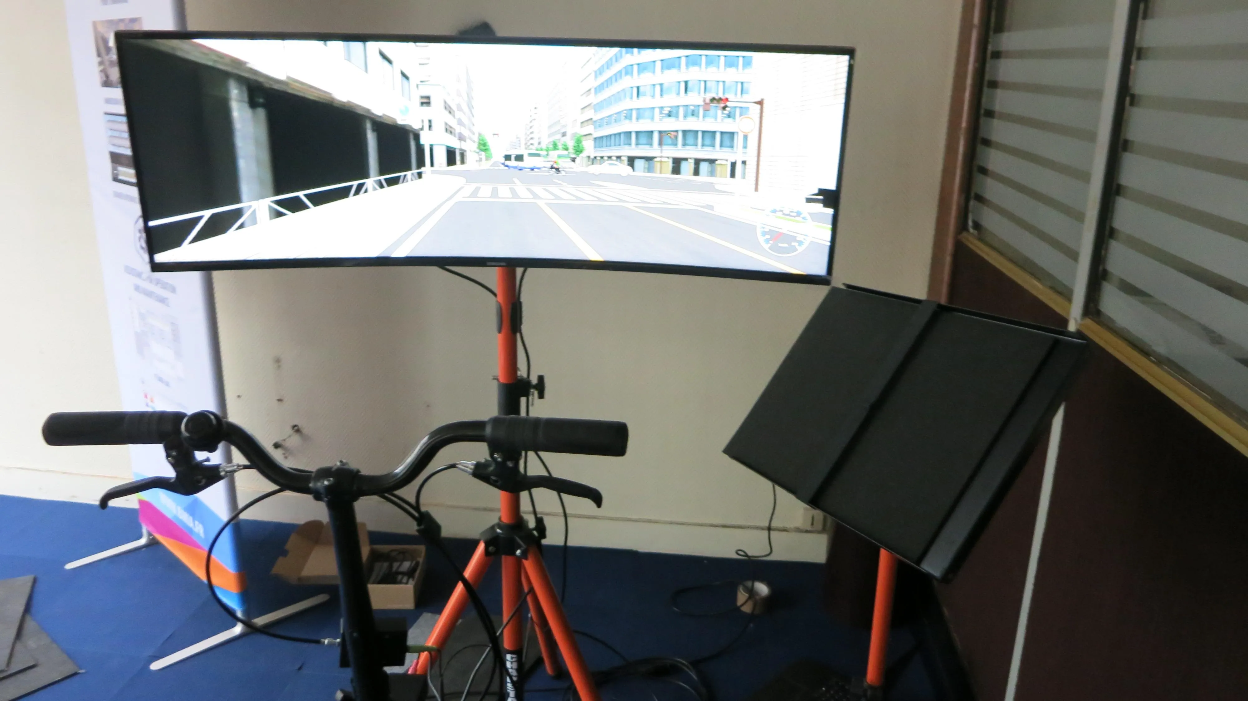
The cockpit is surrounded by three monitors that project front and peripheral views of the 3D simulated road network and wider cityscape generated by FORUM8’s interactive software called VR Design Studio, but also known as UC-win/Road software.
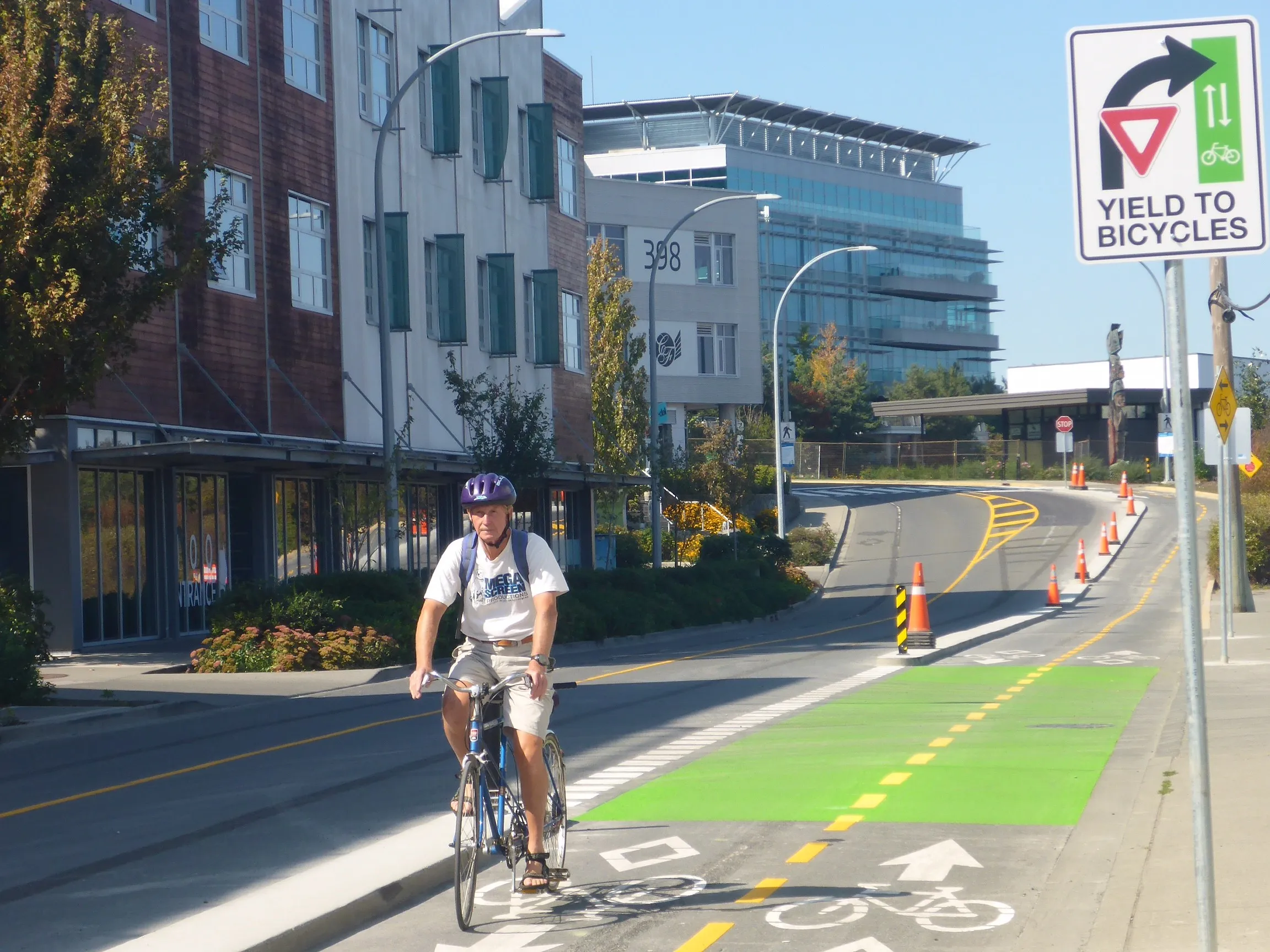
The bicycle simulator comprises a standard, fixed road bike with a single monitor that displays the same simulated road network as projected onto the drive simulator screens. It provides the rider with a view of a realistic 3D environment including roads, bridges, signage, buildings, pedestrians, and landscape details.
Networked together the simulators are centrally managed from the researchers control desk and both the driver and the biker are able to choose their own routes from the origin to the destination, interacting with each other in real-time from their individual perspectives. The aim is to replicate an experience as close to reality as possible.
The VR Design Studio software enables researchers to create and edit the entire road network elements. These include road alignments, intersection design, traffic signals, cross sections, roadside signs, terrain setup, day or night-time, weather, road-surfaces and traffic volumes.
SABA is recruiting at least 30 people from the Baltimore area who will act as the drivers and riders for the duration of the project, explained Dr Mansoueh Jeihani who is leading the project.
“We installed the first FORUM8 drive simulators in 2011 and found the technology easy to use and capable of producing detailed and realistic visualisations,” he said. “Key features for us in choosing the cycle simulator include the ability to link the different simulators in a shared network as well as the range of third-party software plug-ins that is supported by VR Design Studio.
“When we needed to enhance the range of traffic flow options, we were able to seamlessly integrate it with the traffic micro-simulation software S-Paramics as well as the latest eye-tracking software to add further important dimensions to our research,” said Jeihani.