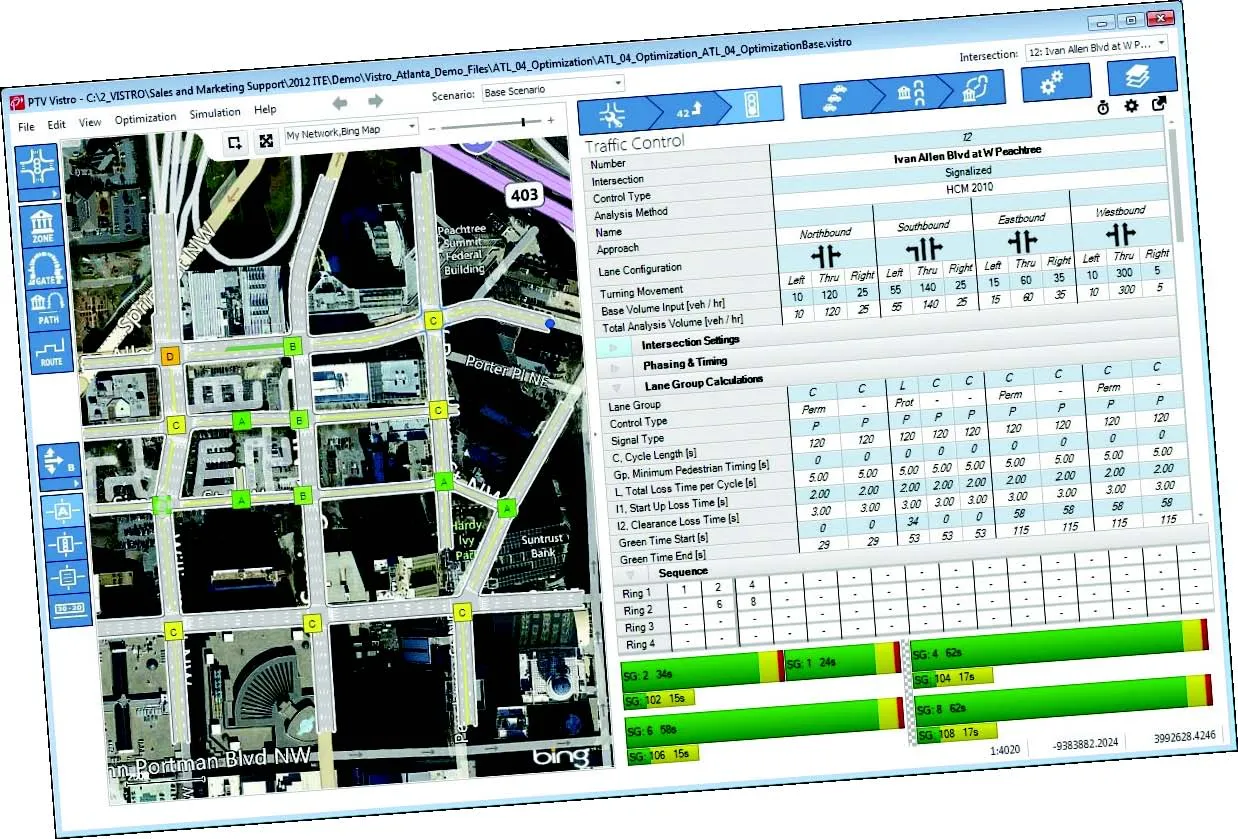
PTV has beaten 70 competitors to win the prize for the best solution in the category Mobility and Logistics, in the Bitkom (the German Association of Towns and Municipalities) Urban Solutions Pitch. a competition which is part of CeBIT 2012 which is being held from 6-12 March. PTV won the award for RIO (Road Intersection Optimisation), an innovative method for traffic signal control optimisation.
"So far traffic signal control systems have only been analysed for individual intersections or a sequence of intersections. These results have been used as the basis for signal control optimisation," explains PTV Board member Thomas Haupt. "However, this restricted analysis does not provide a consistent view of the entire traffic flow."
The RIO method now enables planners to take a much larger area into consideration, even entire cities, including competing traffic flows, Haupt claims. It uses a demand-based transportation model. PTV says this means that it is scalable in terms of time and space or for different traffic management scenarios. If conditions change, for example due to road construction or busy shopping days, the traffic signal control system can be quickly adjusted to the new situation.
"Users in Brazil and the Dominican Republic have already applied the RIO method ," says Haupt. "We also use the transportation planning software Visum which is part of our PTV Vision software suite for the application."
The software is based on an integrated approach and can be used for both navigation networks and autonavigation. Data generated by means of the RIO methods can be used for all levels of transportation planning and traffic engineering. As a result, PTV claims its RIO innovation is the ideal solution for dealing with individual challenges and addressing complex urban issues, such as permanent traffic jams.