
Canada: doubts persist about proposed Howse Pass highway through Rocky Mountains

Alberta group attempts to revive the idea of a Howse Pass highway.
By David Arminas March 11, 2020 Read time: 2 mins
A Howse Pass road: beautiful but too costly (© Keeperofthezoo | Dreamstime.com)

The Provincial British Columbia government in western Canada has thrown cold water on the revived idea of building another major highway over the Rocky Mountains.

British Columbia – whose eastern territory is comprised mostly of the Rocky Mountain range – says the proposed Howse Pass shortcut from the neighbouring province of Alberta would be too costly. Also, the government is in the midst of major mountain road widening programme costing billions, according to reports by the Canadian Broadcasting Corporation.

The BC government was responding to comments by John Vandermeer, chairman of the Central Alberta Economic Partnership. He recently told media in Alberta that the huis organisation would like to undertake an economic development study for the region, which would include a reassessment of the viability of the Howse Pass route. It would run from central Alberta to the city of Kamloops in south-central British Columbia.

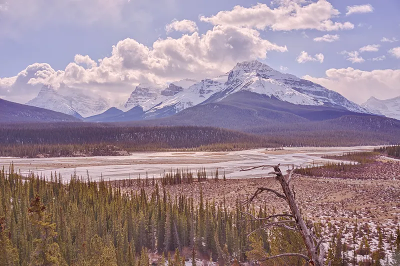
The 760km-drive from the central Alberta city of Red Deer to Kamloops starts by heading south to Calgary and then into BC. A Howse Pass route, touching 1,540m above sea level, would take drivers directly west from Red Deer into the Rockies and Banff National Park before crossing into BC. There are not towns or cites along this route which would be built through mostly wilderness areas in BC.

Howse Pass would, however, shave 94km off the southern Calgary route and join the Trans-Canada Highway near the BC town of Golden. The importance of all major roads across the mountains is access to the Pacific ports, mainly Vancouver, on the BC coast.

Vandermeer said a number of central Alberta municipal leaders are interested in the potential economic boost to central Alberta should a new mountain route be available.

But environmental groups are likely fight a Howse Pass route. It would also be tricky getting federal government permission because 34km of the route would pass through the federally-run world-renowned Banff National Park, a mostly wilderness area covering nearly 6,650km² and bordering BC.

Related Content

  • Indeco hammers carry out key excavation work in Italian tunnel project
    December 2, 2014
    Indeco breakers have been instrumental in excavating the Serra Rotonda Tunnel along the new Salerno-Reggio Calabria highway in southern Italy - Lucio Garofalo reports The A3 Salerno-Reggio-Calabria highway runs for some 443km, linking the A1 Milano-Napoli with the southernmost part of the country. A tunnel is a major link on this highway and was originally built between 1966 and 1974 in an area where road construction can be a challenge due to orography, geology and seismicity. Since 2001, the A3 has bee
  • Mombasa-Tanga link faces delays over design changes
    April 10, 2018
    Kenya has blamed design changes for delaying the start of work on a road linking the port of Mombasa to the Tansanian port of Tanga. The change to the key road’s design is from a single to dual carriageway along a section of the 445km transnational highway. However, the African Development Bank (AfDB), the principal financier of the project, said the Kenyan government itself was slow in completing preliminary studies, such as road designs, in order to start construction.
  • Romania retenders Lugoj-Deva section of A1
    April 20, 2022
    The Lugoj-Deva segment has been troublesome, with landslides halting work at least twice.
  • Parsons wins 407 Transitway contract around the Toronto area in Canada
    August 21, 2015
    Parsons has been selected by the Canadian province of Ontario to provide environmental assessment planning and preliminary design for the next section of the 407 Transitway. Work will include 23km of bus rapid transit lanes, from west of Hurontario Street to east of Highway 400, as well as 11 transit stations, all around the provincial capital Toronto area. The project is part of the 150km cross-regional rapid transit corridor planned to parallel Highway 407 Express Toll Route freeway, a 107km control