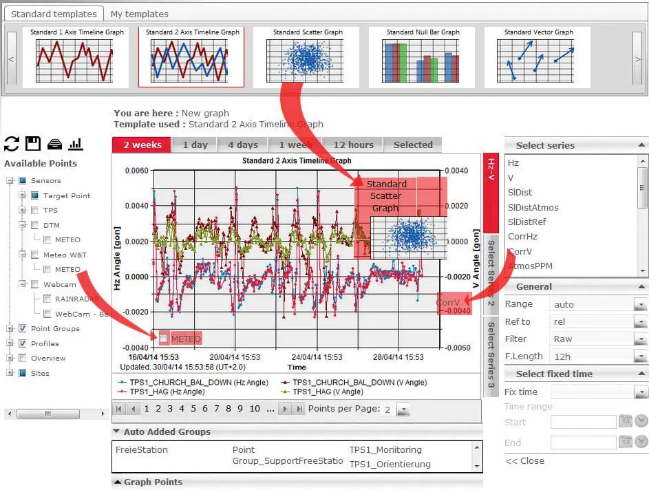
A joint development project between Delcan Corporation and Intelligent Devices Incorporated (IDI) has resulted in the sophisticated Intelligent NETworks product. This is an integrated product that combines the IDI Intelligent Control NTCIP system with the Delcan advanced transportation applications of NETworks. The system can be linked to dynamic message signs (DMS), CCTV and vehicle detector stations (VDS), traffic intersections, as well as environment road weather sensor stations.
A joint development project between Delcan Corporation and Intelligent Devices Incorporated (IDI) has resulted in the sophisticated Intelligent NETworks product.
This is an integrated product that combines the IDI Intelligent Control NTCIP system with theModular platform in design, Intelligent Networks features a range of individual modules that end users can select as required. These include: CCTV, DMS, VDS, highway advisory radio, travel times, data archiving and reporting), urban traffic signals, ramp metering, and automatic vehicle location (AVL).
The firm's proven ParkMap product is designed for traffic order making and management and the latest version offers a greater range of CAD-like drawing tools, enabling restrictions to be plotted following features on the map. ParkMap version 4.5 also has more options for labelling maps and more functionality specifically for experimental and temporary traffic orders.
The AccsMap is used for recording, checking and analysing road collisions and the improved 4.3 version offers improved querying and accident labelling for greater flexibility.
Both ParkMap and AccsMap now have the ability to rotate a map through any angle when printing it, to enable the best use to be made of the size of paper available, and they allow the area of map that will be included to be selected on screen.
Specialist firm
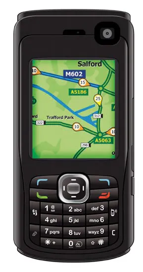
Meanwhile GPS support has been improved in response to the rising number of GPS-enabled phones incorporating TrafficTV. Travellers can now use cell phones to plan their journeys and the advanced graphic options mean a clearer view and sharper colours on the handset.