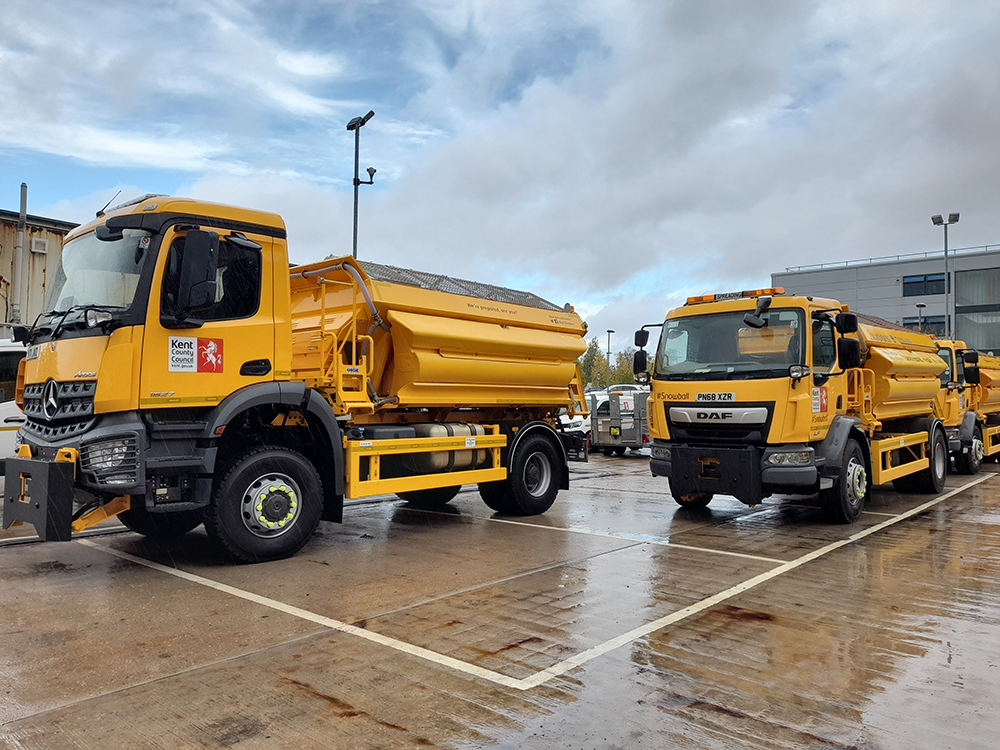
In 2019/20 the UK county of Kent, south of London, laid down around 12,500 tonnes of grit. It is critical for the county to deploy gritting resources in the most cost-efficient manner while ensuring the safety of road users.
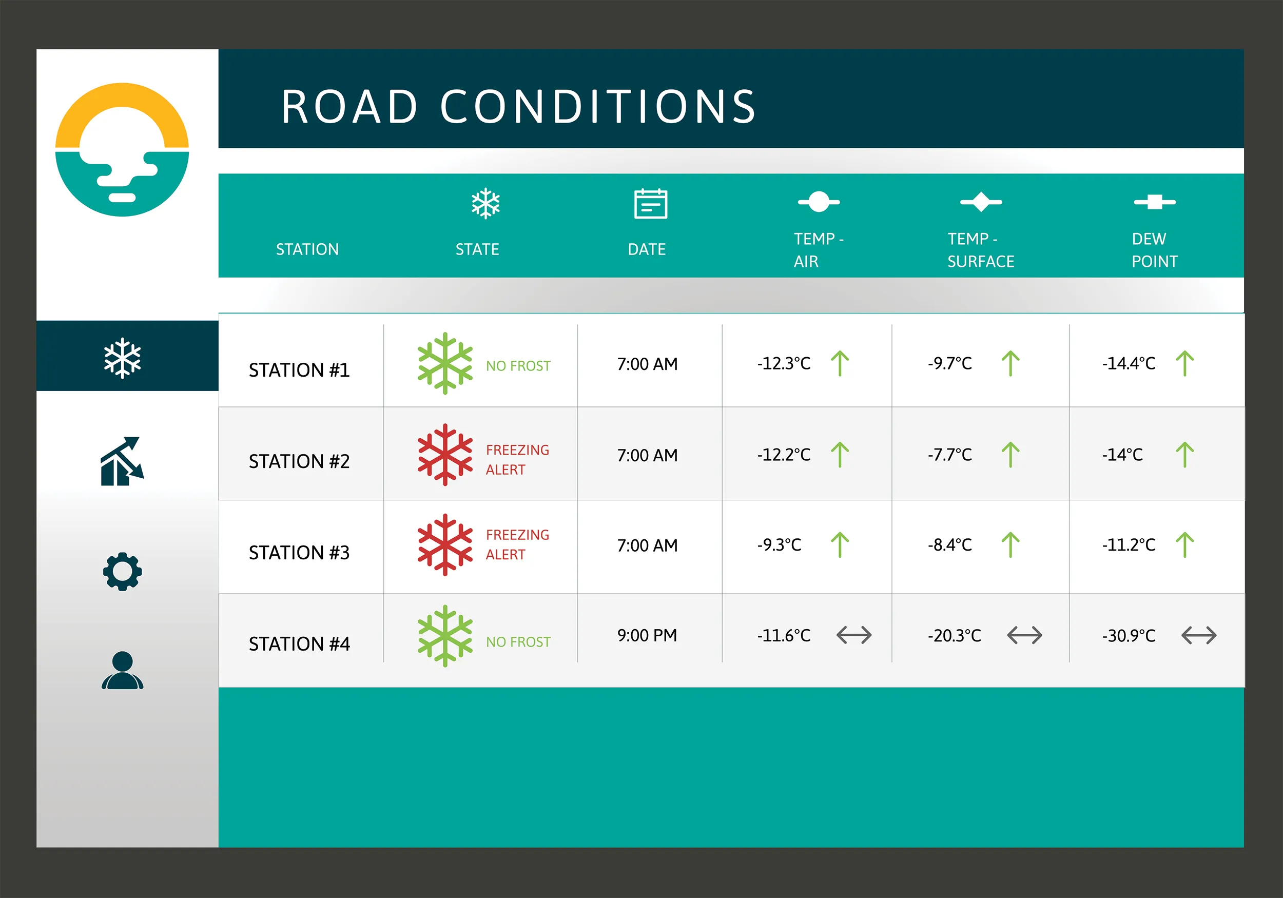
Road maintenance contractor Amey has been working with Kent to achieve both goals. The focus of the collaborative work has been Amey’s pioneering Smart Winter modelling, developed by Amey’s consulting division. Smart Winter uses artificial intelligence models to predict road conditions 24 hours ahead of time in order to analyse geographical data along with road surface temperature data from a network of sensors. The accuracy rate is 90 percent to within 1°C.
This data analysis has allowed for a wholesale redesign of Kent’s gritting domains to maximise their effectiveness and efficiency through targeting resources to stretches of road that need them most. The unnecessary - surplus - gritting of roads that do not freeze is reduced and routes more susceptible to icing are treated more quickly.
Smart Winter modelling collaboration with Kent County Council was first trialled in 2018 but fully launched in winter 2019/20. More recent initiatives, including the re- programming of gritter paths to optimally traverse each domain, have further enhanced the programme.
Additionally, through its new Live Labs collaboration, Amey Consulting has implemented a digital highways platform (HADMS) to manage Kent’s estate and assets, which includes monitoring performance and compliance of Kent’s gritting vehicles. HADMS is now used operationally by Kent to actively monitor performance of its winter fleet operations.
The council had the vision to recognise the emerging potential presented by using new active in-field sensor hardware to bring intelligence to maintenance operations. Amey suggested using these sensors alongside micro-weather forecasting and geospatial data to train an AI model that would predict road surface conditions.
There were two immediate objectives. One was to provide more accurate and granular forecasts that account for localised factors. The other was to enable these to be produced across the entire road network rather than being limited to only those locations with active physical sensors.
Amey created a digital model of Kent’s gritting network which has been used to simulate and optimise the locations and movements of its gritting fleet. This has been adapted so that the council’s winter services team can test alternative scenarios such as varying the salt spread rate or excluding specific routes to suit forecast weather conditions. Updated routes can then be uploaded to the gritting fleets’ navigation systems.
The HADMS compliance monitoring platform is integral to applying the findings of the data analysis such as new gritting routes or domains. This, alongside changes to Kent’s fleet navigation service provided by Exactrack, a UK-based specialist in vehicle tracking for local authorities, means that coverage and performance can be continuously monitored. Any issues or areas for improvement are identified immediately.
Over 100 sensors are located across the Kent route geography capturing road surface condition data. These were installed by Winter Sense, a spin-off company from the UK’s University of Birmingham and Campbell Scientific, a global environmental measurement solutions provider which secured the global licensing rights for the Winter Sense technology and are responsible for further developing, commercialising and deploying the technology globally. Exactrack provided the vehicle tracking and navigation system.
The data gathered by sensors sits alongside micro-weather data as well as geospatial and terrain data that is used to train the AI model and predict route surface conditions. This micro-weather data was provided by the Dark Sky service using weather station and other data to generate granular weather statistics.
The AI model applies machine learning to adapt to the data provided by these sensor readings and other sources (weather, terrain etc.). The model uses a very high volume of samples – in this case gathered over the course of winter 2019/20 – to learn the physical response behaviour of these sensorised locations on the network. Once trained in this way, the model can then be readily applied to other non-sensorised locations by leveraging the same source data, allowing Kent to forecast route conditions across the full extent of its road network.
These systems are ground-breaking in the winter maintenance space. Gritting domains have been changed and gritting routes revised to maximise effectiveness and efficiency. The Amey team is now in the process of digitising new gritter paths to more accurately fit each domain. It is working with Kent County Council and its weather forecast provider DTN Meteogroup, to help them move towards route-based rather than domain-based gritting decisions across the road network. DTN Meteogroup, based in the US state of Minnesota, specialises in subscription-based services for the analysis and delivery of real-time weather, agricultural, energy and commodity market information.
This means that rather than gritting entire sections (domains) of the network, Kent can potentially pinpoint and treat only those routes and sections of road that need treating. This can be supported by adaptive routing and navigation, opening up the possibility for the county’s gritting fleet to be programmed to tackle different permutations of route forecasts, improving flexibility and allowing for real-time reaction to changing conditions.
These changes place data at the centre of decision making and together they represent a step-change in winter management of Kent’s roads.