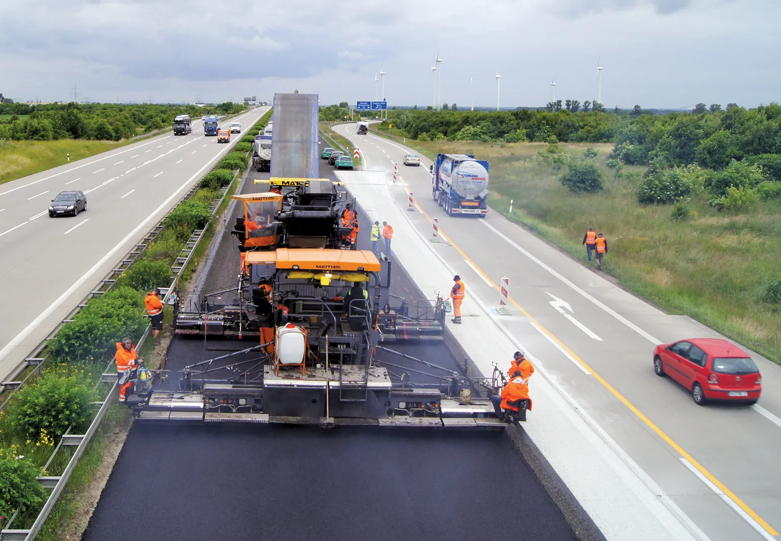
New trials pave the way for smart road pricing using Global Navigation Satellite Systems (GNSS). In recent years, the concept of road charging has been gaining acceptability among Europe's policymakers.
RSS
At European level, in addition to the well known Eurovignette Directive, the latest proposals of the2465 European Commission (EC) make clear reference to road charging, which is often termed 'smart pricing', with emphasis on the need for prices to reflect real costs.
The EC proposals are complemented by various existing and proposed schemes at national level. For example, Germany has been operating such a scheme for trucks above 12tonnes since 2005 and, in 2010, Slovakia introduced a GNSS charging scheme for Heavy Goods Vehicles over 3.5tonnes in selected corridors. By the far the most ambitious scheme to date, however, has been recently unveiled by the Dutch authorities, whose objective is to charge all vehicles per kilometre throughout the entire national network.
While the technology to implement such pricing schemes exists, doubts about the technical and economic feasibility of large-scale application have persisted; especially with respect to the accuracy, integrity, availability and continuity requirements that are critical to avoiding driver overcharging on the one hand, or loss of revenue for the road operator on the other. Moreover, the lack of tangible evidence about the impact of GNSS Road User Charging (RUC) schemes on congestion and pollution has acted as a further impediment, reinforcing a notion among the general public that pay-per-kilometre will simply end up tantamount to an added tax.
Against this backdrop, the March 2010 launch of the first-ever large-scale nationwide demonstrator in the Netherlands will be watched closely by policymakers and end-users alike.
The demonstrator trials will be conducted over an overall period of six months within the context of the GINA (GNSS for INnovative road Applications) project, co-funded by the EC and the European GNSS Supervisory Authority (GSA).
Their objective is to establish to what extent, and to what levels of performance, GNSS technology based on European GNSS infrastructure can support the implementation of a RUC scheme and justify its added value as compared with GPS-only. The trials are divided into two parts, exhaustive and end-to-end. The exhaustive trials campaign was conducted over a period of four weeks during March, 2010.
Two vehicles equipped with GMV I-20 on-board units (OBUs) and high performance reference equipment followed pre-determined routes identified by the project. Three such routes were defined in a manner aimed at challenging GNSS performance, while remaining representative of real conditions likely to be faced by drivers in the Netherlands.
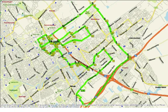
The routes covered the cities and surroundings of Amsterdam, Rotterdam and The Hague. Each route was repeated a minimum of 20 times in order to enable the compilation of sufficient data to achieve statistically significant results.
The objective of the exhaustive trials was to test the performance of EGNOS (the European Geostationary Navigation Overlay Service) in terms of accuracy and integrity compared to a GPS system. Aspects such as distance measurement accuracy, performance in the identification of geo-objects and the overall charging accuracy of the system were also analysed.
The end-to-end trials will extend over six months, during which time 100 vehicles fitted with GMV I-20 OBUs will drive around the Netherlands freely, without being restricted to pre-determined routes. The objective of the endto- end trials is two-fold.
One is to perform an overall assessment of the capabilities of the system from different perspectives (including ability to generate invoices, evaluation of drivers reactions and feedback, provision of added-value services, and effects of interferences in system performance).
The other is to carry out exhaustive performance analyses for those variables that do not require a reference system (including estimation of overcharging performance, capability of producing repeatable results for same conditions etc.).
The end-to-end trials will not rely on an independent reference system, consequently enabling a shorter analysis procedure. For the purpose of these trials, all the OBUs will use the SISNeT (Signal in Space through the Internet) for EGNOS enhancement, and the data recorded will be downloaded automatically for analysis using GMV's Palview platform. Using this system, geoobjects are programmed into the OBUs by reference to the geographical areas where the drivers usually use their cars and other factors.
Data recording and analysis are limited by the constraints of the privacy laws prevailing in the Netherlands, which prevent access to data for linking with the identities of the drivers.
The first preliminary results from the exhaustive trials are expected to be available by May 2010, while the data analysis from the endto- end trials should be available shortly after the trials are concluded in October/November.
In addition to the trials being carried out in the Netherlands, the GINA project is due to undertake a complementary trial in Portugal during the summer months. Performed by2769 Ascendi, a Portuguese highway operator, the objective of these trials will be to demonstrate how GINA and GNSS technology could be used for event-based charging, such as on motorway toll roads; to make a comparison of the performance of GINA with existing dedicated short-range communications (DSRC) based road tolling solutions, and to test the use of GNSS for other Value Added Services that could be of interest for highway operators and drivers.
The final results of the trials will be presented at a stakeholders' conference in Brussels scheduled for the beginning of 2011. It is hoped that the success of the GINA trials will act as a major enabler, paving the way for the more widespread deployment of GNSS-based applications throughout Europe's road and urban networks.RSS
New trials pave the way for smart road pricing using Global Navigation Satellite Systems (GNSS)
In recent years, the concept of road charging has been gaining acceptability among Europe's policymakers. Given that current trends project a continuing rise in passenger and freight transport, the idea of pay-as-you-drive seems to be invoked more and more by policymakers at national and European levels as a means of managing traffic, reducing congestion and financing the road network.At European level, in addition to the well known Eurovignette Directive, the latest proposals of the
The EC proposals are complemented by various existing and proposed schemes at national level. For example, Germany has been operating such a scheme for trucks above 12tonnes since 2005 and, in 2010, Slovakia introduced a GNSS charging scheme for Heavy Goods Vehicles over 3.5tonnes in selected corridors. By the far the most ambitious scheme to date, however, has been recently unveiled by the Dutch authorities, whose objective is to charge all vehicles per kilometre throughout the entire national network.
While the technology to implement such pricing schemes exists, doubts about the technical and economic feasibility of large-scale application have persisted; especially with respect to the accuracy, integrity, availability and continuity requirements that are critical to avoiding driver overcharging on the one hand, or loss of revenue for the road operator on the other. Moreover, the lack of tangible evidence about the impact of GNSS Road User Charging (RUC) schemes on congestion and pollution has acted as a further impediment, reinforcing a notion among the general public that pay-per-kilometre will simply end up tantamount to an added tax.
Against this backdrop, the March 2010 launch of the first-ever large-scale nationwide demonstrator in the Netherlands will be watched closely by policymakers and end-users alike.
The demonstrator trials will be conducted over an overall period of six months within the context of the GINA (GNSS for INnovative road Applications) project, co-funded by the EC and the European GNSS Supervisory Authority (GSA).
Their objective is to establish to what extent, and to what levels of performance, GNSS technology based on European GNSS infrastructure can support the implementation of a RUC scheme and justify its added value as compared with GPS-only. The trials are divided into two parts, exhaustive and end-to-end. The exhaustive trials campaign was conducted over a period of four weeks during March, 2010.
Two vehicles equipped with GMV I-20 on-board units (OBUs) and high performance reference equipment followed pre-determined routes identified by the project. Three such routes were defined in a manner aimed at challenging GNSS performance, while remaining representative of real conditions likely to be faced by drivers in the Netherlands.
The routes covered the cities and surroundings of Amsterdam, Rotterdam and The Hague. Each route was repeated a minimum of 20 times in order to enable the compilation of sufficient data to achieve statistically significant results.
The objective of the exhaustive trials was to test the performance of EGNOS (the European Geostationary Navigation Overlay Service) in terms of accuracy and integrity compared to a GPS system. Aspects such as distance measurement accuracy, performance in the identification of geo-objects and the overall charging accuracy of the system were also analysed.
The end-to-end trials will extend over six months, during which time 100 vehicles fitted with GMV I-20 OBUs will drive around the Netherlands freely, without being restricted to pre-determined routes. The objective of the endto- end trials is two-fold.
One is to perform an overall assessment of the capabilities of the system from different perspectives (including ability to generate invoices, evaluation of drivers reactions and feedback, provision of added-value services, and effects of interferences in system performance).
The other is to carry out exhaustive performance analyses for those variables that do not require a reference system (including estimation of overcharging performance, capability of producing repeatable results for same conditions etc.).
The end-to-end trials will not rely on an independent reference system, consequently enabling a shorter analysis procedure. For the purpose of these trials, all the OBUs will use the SISNeT (Signal in Space through the Internet) for EGNOS enhancement, and the data recorded will be downloaded automatically for analysis using GMV's Palview platform. Using this system, geoobjects are programmed into the OBUs by reference to the geographical areas where the drivers usually use their cars and other factors.
Data recording and analysis are limited by the constraints of the privacy laws prevailing in the Netherlands, which prevent access to data for linking with the identities of the drivers.
The first preliminary results from the exhaustive trials are expected to be available by May 2010, while the data analysis from the endto- end trials should be available shortly after the trials are concluded in October/November.
In addition to the trials being carried out in the Netherlands, the GINA project is due to undertake a complementary trial in Portugal during the summer months. Performed by
The final results of the trials will be presented at a stakeholders' conference in Brussels scheduled for the beginning of 2011. It is hoped that the success of the GINA trials will act as a major enabler, paving the way for the more widespread deployment of GNSS-based applications throughout Europe's road and urban networks.RSS