Faster and safer utilities works are the benefit of innovative data sharing moves – Mike Woof writes. Utilities works in urban areas can cause major problems with regard to traffic congestion, as well as posing key safety issues for road users and site workers. Better planning of utilities operations can help tackle congestion and prevent jams, while also ensuring that on-site personnel have a safer working environment. To ensure that site workers know the exact location of buried utilities, comprehensive m

Faster and safer utilities works are the benefit of innovative data sharing moves – Mike Woof writes
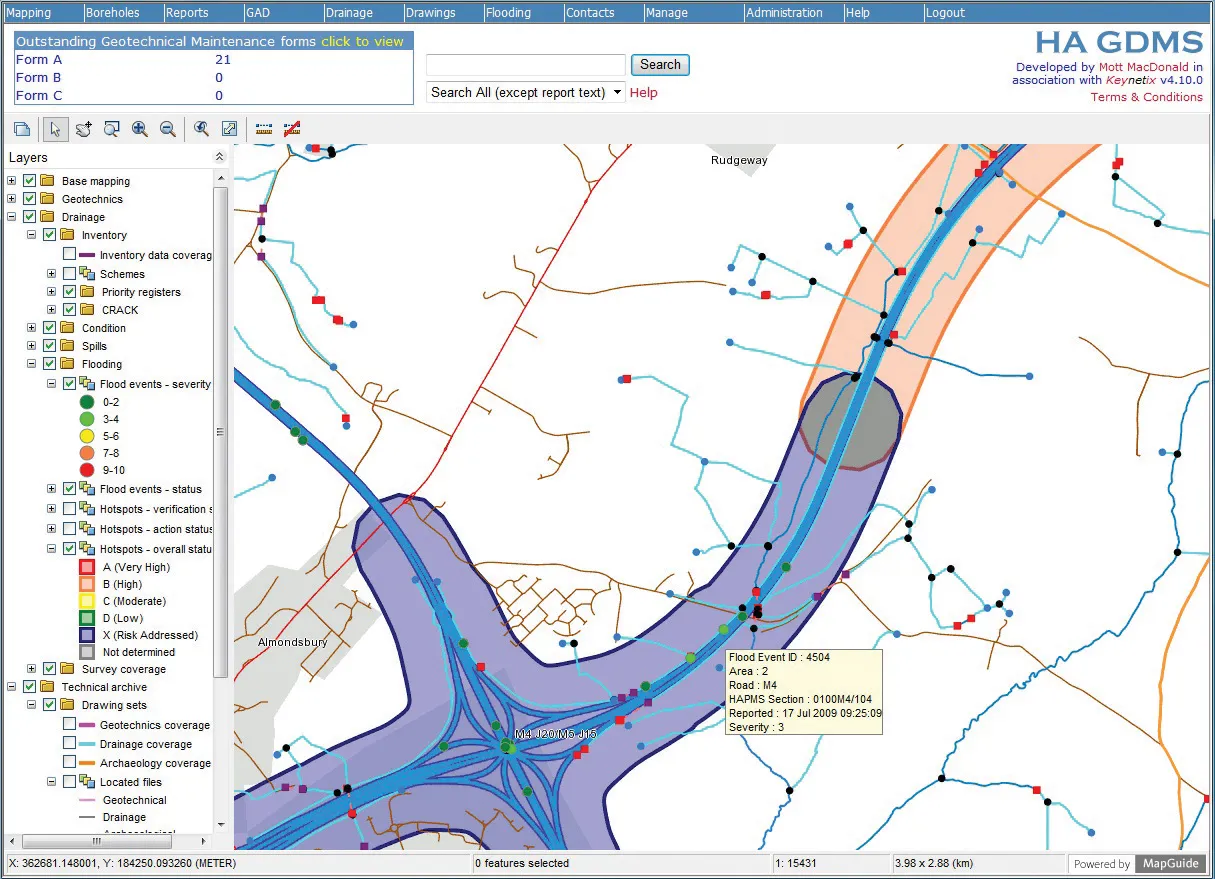
Utilities works in urban areas can cause major problems with regard to traffic congestion, as well as posing key safety issues for road users and site workers. Better planning of utilities operations can help tackle congestion and prevent jams, while also ensuring that on-site personnel have a safer working environment.To ensure that site workers know the exact location of buried utilities, comprehensive mapping operations that provide access to accurate data are vital. These speed working and cut traffic delays, while reducing the risk of accidental electricity cable-strikes or damage to gas pipes, which can be extremely dangerous for site workers. In addition, the risk of flooding from striking water mains or causing Internet and communications blackouts from damage to fibre optic links can be avoided.
In the US, contractors can call up a central information centre to find out details of buried utilities. However in the UK this has now gone one step further with the availability of information to all interested parties on buried utilities being placed on-line.
This innovative approach to the management of utilities works is the result of a partnership that has produced the Intelligent Trench. The novel underground mapping solution is also being combined with
And the data is available through a one-stop operation. The service provides asset data quickly and efficiently, saving time and money for all stakeholders, helps improve the on-site safety of workers, and protects underground assets from accidental damage. Steve Voller, industry solutions director for
Intelligent Trench combines advanced radio frequency identification (RFID) asset marking from