Advanced vehicle monitoring technology

PIPS Technology has commissioned two Journey Time Measurement Systems (JTMS) in Gravesend and Tunbridge Wells for Kent Highway Services (KHS) in the UK. The JTMS locations consist of 34 Automatic Number Plate Recognition (ANPR) cameras and JTMS software all provided by PIPS Technology.
February 15, 2012 Read time: 2 mins

Roads in the english county of Kent now feature vehicle monitoring systems from PIPS technology

202 Pips Technology has commissioned two Journey Time Measurement Systems (JTMS) in Gravesend and Tunbridge Wells for Kent Highway Services (KHS) in the UK. The JTMS locations consist of 34 Automatic Number Plate Recognition (ANPR) cameras and JTMS software all provided by PIPS Technology.

The PIPS JTMS solutions installed in Kent both feature a network of award-winning P372 integrated Spike ANPR cameras, linked by wireless communications to the JTMS software. The Spike cameras are able to read the number plate of every vehicle that passes and sends time stamped and encrypted data back to the JTMS server.

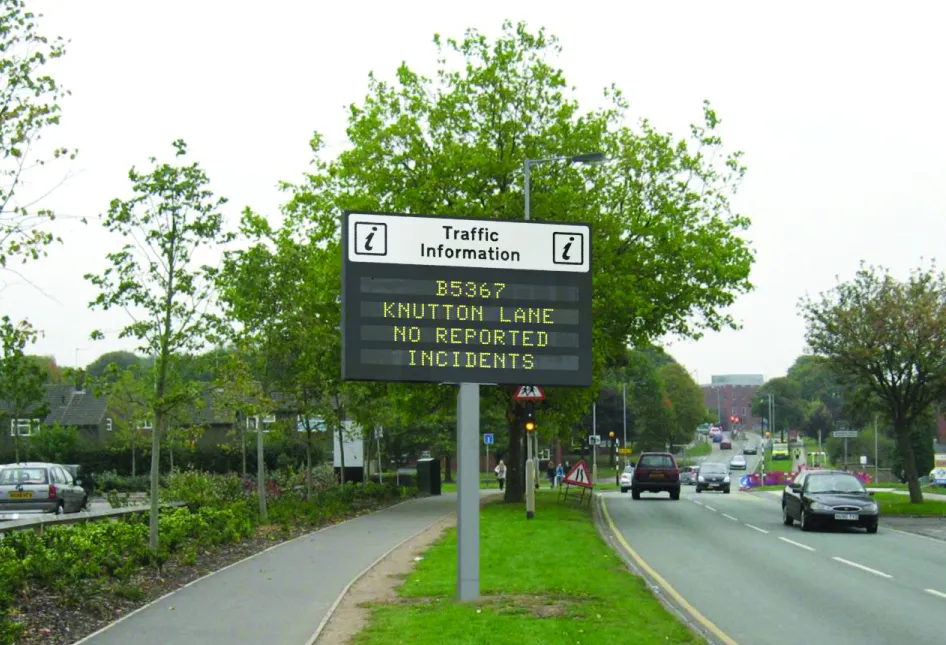
The JTMS server calculates journey times from the data collected and forwards them to a common database which calculates journey times from systems all over Kent. To calculate the journey time the JTMS database uses the data transmitted from PIPS cameras and calculates how long it takes each vehicle to travel from one part of the network to another. From this an average time is calculated so that users know how well the traffic is flowing. Journey time data is useful as it can be transmitted to the roadside to communicate travel times to drivers by variable message signs (VMS) and allows planners to see areas of the road network which are not flowing as they should.

The system in Kent is being used to monitor journey times and alert operators in the KHS Traffic Management Centre of possible congestion and delays on the network. In total there are 21 different camera sites featuring PIPS Spike cameras spread across the two individual project locations, all of which are on single lane carriageways.

For more information on companies in this article

Related Content

  • Green Light for signs
    June 18, 2012
    The project to install Variable Message Signs (VMS), recently approved by Staffordshire County Council, will provide motorists with important travel and road safety information, and up-to-date warnings of incidents and accidents to help them avoid trouble spots and possible congestion. Michael Smith, the county council’s senior highways project engineer, said: “‘In addition to representing good value for money, the company has a sound track record in this area having already successfully supplied and instal
  • Green Light for signs
    June 26, 2012
    The project to install Variable Message Signs (VMS), recently approved by Staffordshire County Council, will provide motorists with important travel and road safety information, and up-to-date warnings of incidents and accidents to help them avoid trouble spots and possible congestion. Michael Smith, the county council’s senior highways project engineer, said: “‘In addition to representing good value for money, the company has a sound track record in this area having already successfully supplied and instal
  • Machine control advances boosting quality
    June 12, 2017
    The latest developments in machine control technology will deliver major gains in quality and productivity. Machine control technology plays an increasingly important role in construction. The pace of development has been fast, with new systems offering major gains in both productivity and quality across a range of applications. At the recent CONEXPO-CON/AGG 2017 exhibition in Las Vegas, key advances were unveiled in machine control technologies suited to markets such as earthmoving, concrete paving and pil
  • Laser scanning focuses on asset management
    January 9, 2015
    Laser scanners and improved data collection and analysis software are making light of asset management surveying. David Arminas reports The age of the laser scanner is upon us, taking over from traditional manual methods of surveying, data collection and processing. These new technical developments are making it much easier to process and use the data captured and are providing highways engineers with powerful tools to record, map and visualise their assets. This is good news for highways authorities