The department of transportation in the US state of Arizona has automated its data processes, says Duncan Guthrie. In Arizona, the Department of Transportation (ADOT) is improving the way it responds to the demand for information from the Federal Highways Administration (FHWA). ADOT is implementing an automated, repeatable process to simplify and smooth the creation and maintenance of their state-wide dataset. This will meet reporting requirements for ARNOLD - All Road Network Of Linear Referenced Data - an
The department of transportation in the US state of Arizona has automated its data processes, says Duncan Guthrie*
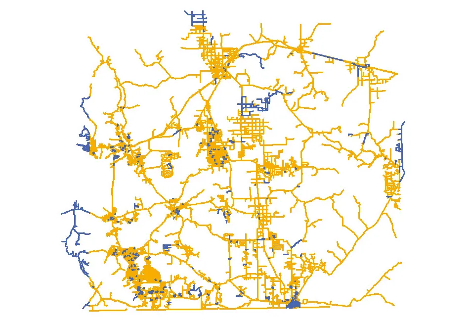
In Arizona, the Department of Transportation (ADOT) is improving the way it responds to the demand for information from the Federal Highways Administration (FHWA). ADOT is implementing an automated, repeatable process to simplify and smooth the creation and maintenance of their state-wide dataset. This will meet reporting requirements for ARNOLD - All Road Network Of Linear Referenced Data - and HPMS, the Highway Performance Monitoring System.
The ADOT serves one of the fastest-growing areas of the country. It’s vital, therefore, that the state has accurate and reliable information about its road network for their own internal purposes and for meeting the external FHWA requirements.
Traditionally the FHWA has been interested only in high-level information - the large interstate network. Local counties and state governments have been left to record and manage other roads.
The ARNOLD initiative means that ADOT needs to supply an accurate and state-wide dataset of all public roads to the Federal Highways Administration on an annual basis. This not only enables Federal Highways to more effectively manage the country’s transport infrastructure, but allows the agency to designate funding on a state-by-state basis.
To meet these demands in 2012, ADOT embarked on its Centerline Unification project. Working with Works Consulting, ADOT implemented a solution to integrate its own state highways with local centerline data, provided by over 30 local government agencies, called locals, once a year. The project resulted in a state-wide road centerline dataset. An extension to the project then provided a semi-automated, bespoke solution to maintain the network with new submissions from the locals.
To streamline the data maintenance process, ADOT wanted to move to a commercial off-the-shelf (COTS) solution and increase the level of automation, while providing valuable feedback to the locals on their data. To do so, ADOT and Works Consulting engaged with8588 1Spatial to make use of their 1Integrate technology, used by US Census for the automated conflation and maintenance of their TIGER database.
The solution has created a set of predefined, automated business rules within the 1Integrate technology. These are applied to the data every time a submission is received from the locals. These business rules check that the data conforms and meets the ADOT’s required data quality standard. The features within the dataset that don’t conform are returned to the locals to be rectified.
Once the data submission meets ADOT’s quality criteria, 1Integrate automatically matches the new submission with the existing state-wide dataset and identifies any changes in real time. These changes are then integrated into the state-wide dataset, ensuring it is an accurate and up-to-date representation of the real world.
Clearly, this kind of automated process saves a significant amount of time and money compared to a manual or bespoke process. It also means that the locals can send in data at any time, so that instead of a dataset which is accurate once a year, the data can be updated continuously.
Having this accurate and current dataset is critical for ADOT. It will provide further intelligence around the transportation network by integrating with other transportation data sources and also enable external consumers of the data, such as other state government departments and the public, to use and rely on the information.
Ultimately, automating the maintenance of the state-wide road network will save ADOT money and resources and make the department more efficient. Importantly, the data can support innovative new ideas within the state.
Moving forward, the automated process will sit behind ADOTs clearing house, AZGEO. This will provide a web-based application for locals to submit their data and receive their data reports. This makes even easier the entire process of keeping the state-wide dataset accurate and up-to-date.
Many other states have already completed one full update of their road network. But the FHWA requires that network information is continually maintained. To do so requires technology to replace this huge and traditionally manual task.
*Duncan Guthrie is director of North America sales for 1Spatial
In Arizona, the Department of Transportation (ADOT) is improving the way it responds to the demand for information from the Federal Highways Administration (FHWA). ADOT is implementing an automated, repeatable process to simplify and smooth the creation and maintenance of their state-wide dataset. This will meet reporting requirements for ARNOLD - All Road Network Of Linear Referenced Data - and HPMS, the Highway Performance Monitoring System.
The ADOT serves one of the fastest-growing areas of the country. It’s vital, therefore, that the state has accurate and reliable information about its road network for their own internal purposes and for meeting the external FHWA requirements.
Traditionally the FHWA has been interested only in high-level information - the large interstate network. Local counties and state governments have been left to record and manage other roads.
The ARNOLD initiative means that ADOT needs to supply an accurate and state-wide dataset of all public roads to the Federal Highways Administration on an annual basis. This not only enables Federal Highways to more effectively manage the country’s transport infrastructure, but allows the agency to designate funding on a state-by-state basis.
To meet these demands in 2012, ADOT embarked on its Centerline Unification project. Working with Works Consulting, ADOT implemented a solution to integrate its own state highways with local centerline data, provided by over 30 local government agencies, called locals, once a year. The project resulted in a state-wide road centerline dataset. An extension to the project then provided a semi-automated, bespoke solution to maintain the network with new submissions from the locals.
To streamline the data maintenance process, ADOT wanted to move to a commercial off-the-shelf (COTS) solution and increase the level of automation, while providing valuable feedback to the locals on their data. To do so, ADOT and Works Consulting engaged with
The solution has created a set of predefined, automated business rules within the 1Integrate technology. These are applied to the data every time a submission is received from the locals. These business rules check that the data conforms and meets the ADOT’s required data quality standard. The features within the dataset that don’t conform are returned to the locals to be rectified.
Once the data submission meets ADOT’s quality criteria, 1Integrate automatically matches the new submission with the existing state-wide dataset and identifies any changes in real time. These changes are then integrated into the state-wide dataset, ensuring it is an accurate and up-to-date representation of the real world.
Clearly, this kind of automated process saves a significant amount of time and money compared to a manual or bespoke process. It also means that the locals can send in data at any time, so that instead of a dataset which is accurate once a year, the data can be updated continuously.
Having this accurate and current dataset is critical for ADOT. It will provide further intelligence around the transportation network by integrating with other transportation data sources and also enable external consumers of the data, such as other state government departments and the public, to use and rely on the information.
Ultimately, automating the maintenance of the state-wide road network will save ADOT money and resources and make the department more efficient. Importantly, the data can support innovative new ideas within the state.
Moving forward, the automated process will sit behind ADOTs clearing house, AZGEO. This will provide a web-based application for locals to submit their data and receive their data reports. This makes even easier the entire process of keeping the state-wide dataset accurate and up-to-date.
Many other states have already completed one full update of their road network. But the FHWA requires that network information is continually maintained. To do so requires technology to replace this huge and traditionally manual task.
*Duncan Guthrie is director of North America sales for 1Spatial