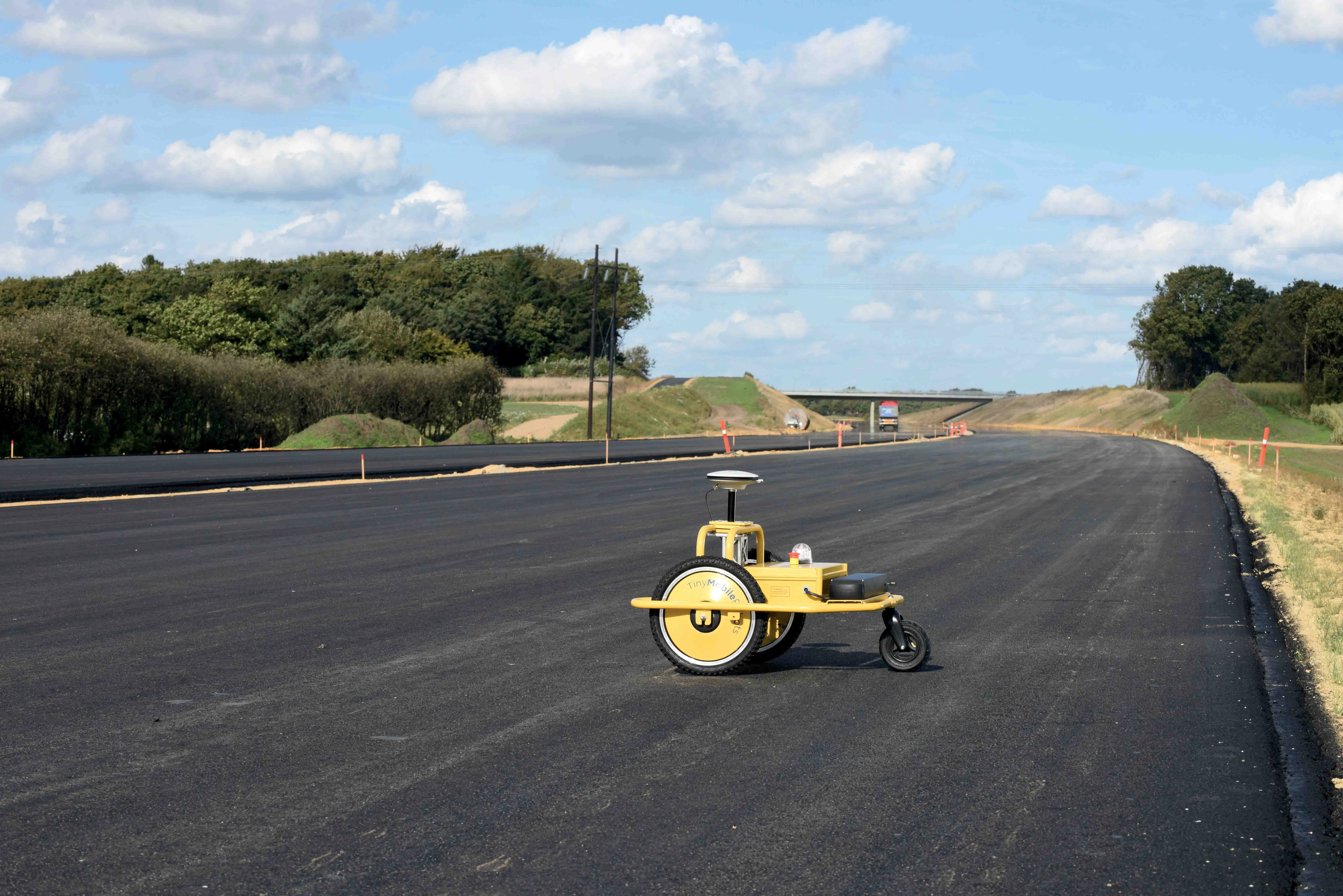
After nearly four years of development, including two years on-site testing, Danish robotics firm TinyMobileRobots has launched its mobile linemarker robot, TinySurveyor.
While three people are traditionally required for road marking layout, the robot can do it faster and more reliably, said chief executive Jens Peder Kristensen. The robot requires supervision by only one person and can work through all weather conditions.
If the road system layout is digitalised, road coordinates in the specific form
After nearly four years of development, including two years on-site testing, Danish robotics firm TinyMobileRobots has launched its mobile linemarker robot, TinySurveyor.
While three people are traditionally required for road marking layout, the robot can do it faster and more reliably, said chief executive Jens Peder Kristensen. The robot requires supervision by only one person and can work through all weather conditions.
If the road system layout is digitalised, road coordinates in the specific format can be uploaded to TinySurveyor. Data in LandXML and CSV format can be transferred to a USB stick and then simply inserted into the robot.
If no digital data is available, the robot can be used to collect the data from a few key points and automatically generate the full layout. In both cases, the robot will greatly reduce layout work, and take around one-third of the time required for manual layout.