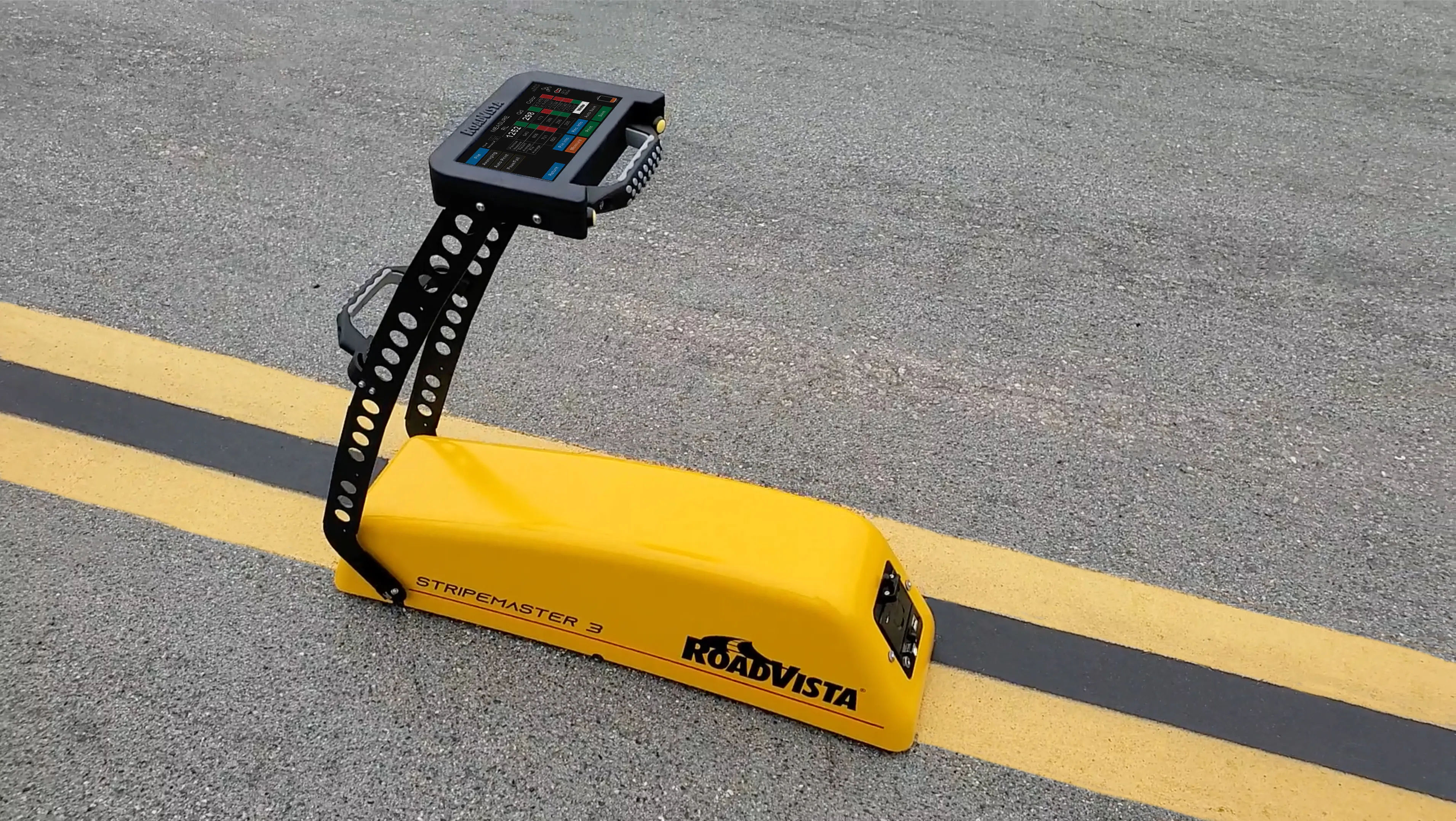
RoadVista has launched StripeMaster 3, the company’s next generation retroreflectometer for testing and measuring pavement markings.
StripeMaster 3 quantifies roadway and airfield pavement marking characteristics including retroreflectivity, daytime visibility and night-time retroreflected colour.
RoadVista says StripeMaster 3 provides safety for drivers, pilots, automated vehicle functions and helps agencies comply with the new MUTCD minimum retroreflectivity requirements for pavement markings.
MUTCD is the national standard for traffic control devices used on all streets, highways, bikeways and private roads open to public travel. It currently requires that pavement markings be visible at night and that all markings on interstate highways be retroreflective but does not require a minimum level.
StripeMaster 3, a full asset management tool, is completely designed and manufactured in the US. The user can test and quantify pavement markings on roadways, highways and airfields with measurable data with standard and custom attributes, locations, comments and other important data.
It can also document the condition of pavement markings through an automated ‘pass/fail’ feature. Its large nearly 18cm touch screen display is easy to read, even in direct sunlight and the instrument’s handle makes it light enough to carry and maneuver along a continuous road marking when testing on busy roadways.
A dedicated software package provides data that can be viewed and printed onsite or can be downloaded after testing for comprehensive report generation, analysis and GIS integration, explained Eric Nelson, director for RoadVista. It has the capability for immediate onsite records or easy data export via USB or Bluetooth for comprehensive data management.
Testing can be performed day or night and will perform dry, wet or rain testing per ASTM standards. This comprehensive system empowers municipalities with full insight into their markings for both human and machine vision creating safer roads for all vehicles.
RoadVista, a Gamma Scientific company, manufactures instruments and provides laboratory testing services for retroreflection, roadway lighting and connected roads. Retroreflectometers and light measurement instruments from RoadVista are available for testing traffic signs, pavement markings, pavement markers, delineators, sign sheeting, high visibility clothing, headlamps, automotive sensors and roadway lighting.