RoadVista launches StripeMaster 3

StripeMaster 3 quantifies roadway and airfield pavement marking characteristics including retroreflectivity, daytime visibility and night-time retroreflected colour.
By David Arminas March 1, 2023 Read time: 2 mins
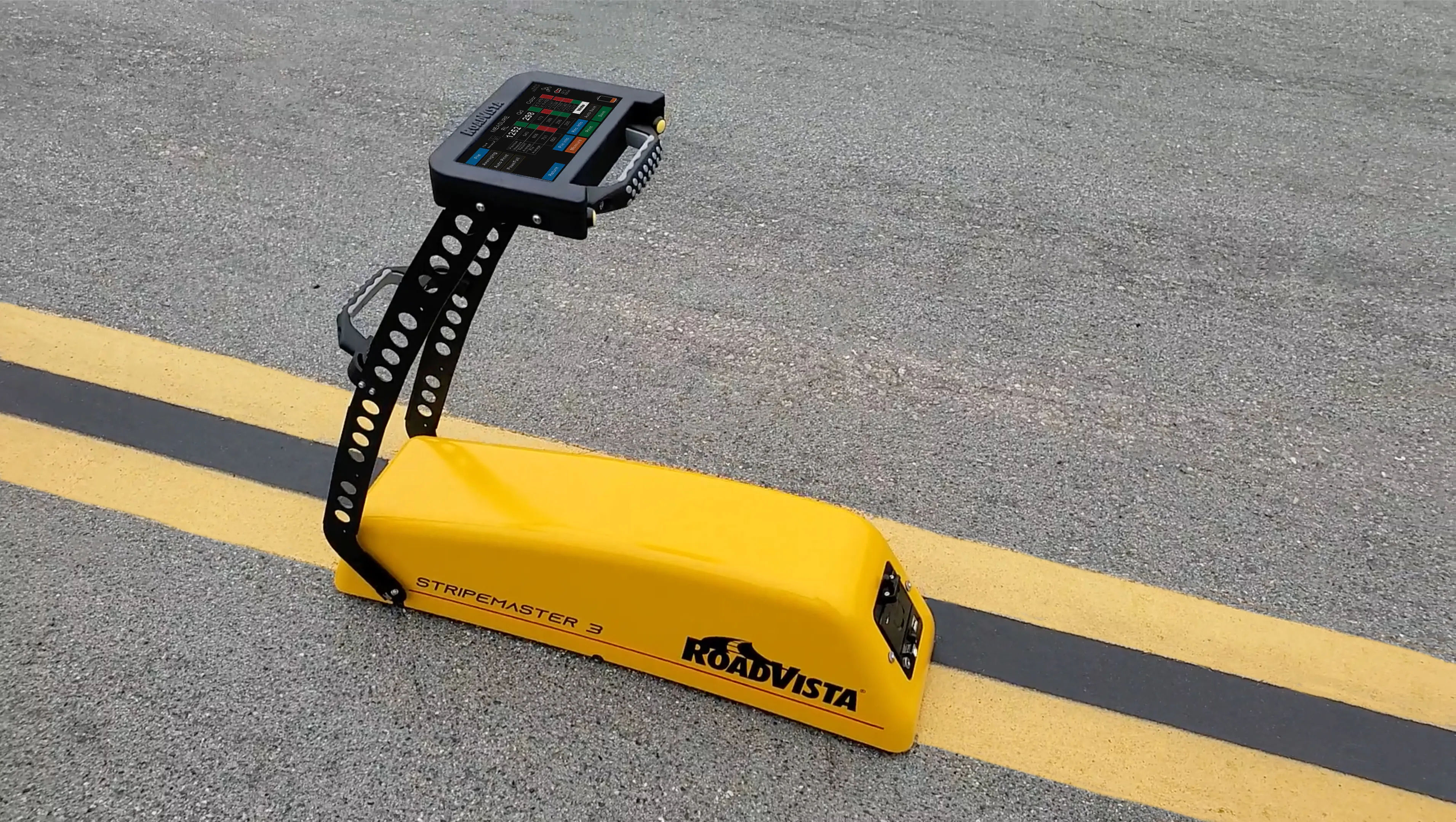
StripeMaster 3’s large nearly 18cm touch screen display is easy to read, even in direct sunlight

RoadVista has launched StripeMaster 3, the company’s next generation retroreflectometer for testing and measuring pavement markings.

StripeMaster 3 quantifies roadway and airfield pavement marking characteristics including retroreflectivity, daytime visibility and night-time retroreflected colour.

RoadVista says StripeMaster 3 provides safety for drivers, pilots, automated vehicle functions and helps agencies comply with the new MUTCD minimum retroreflectivity requirements for pavement markings.

MUTCD is the national standard for traffic control devices used on all streets, highways, bikeways and private roads open to public travel. It currently requires that pavement markings be visible at night and that all markings on interstate highways be retroreflective but does not require a minimum level.

StripeMaster 3, a full asset management tool, is completely designed and manufactured in the US. The user can test and quantify pavement markings on roadways, highways and airfields with measurable data with standard and custom attributes, locations, comments and other important data.

It can also document the condition of pavement markings through an automated ‘pass/fail’ feature. Its large nearly 18cm touch screen display is easy to read, even in direct sunlight and the instrument’s handle makes it light enough to carry and maneuver along a continuous road marking when testing on busy roadways.

A dedicated software package provides data that can be viewed and printed onsite or can be downloaded after testing for comprehensive report generation, analysis and GIS integration, explained Eric Nelson, director for RoadVista. It has the capability for immediate onsite records or easy data export via USB or Bluetooth for comprehensive data management.

Testing can be performed day or night and will perform dry, wet or rain testing per ASTM standards. This comprehensive system empowers municipalities with full insight into their markings for both human and machine vision creating safer roads for all vehicles.

RoadVista, a Gamma Scientific company, manufactures instruments and provides laboratory testing services for retroreflection, roadway lighting and connected roads. Retroreflectometers and light measurement instruments from RoadVista are available for testing traffic signs, pavement markings, pavement markers, delineators, sign sheeting, high visibility clothing, headlamps, automotive sensors and roadway lighting.

For more information on companies in this article

Related Content

  • Data collection key to software developments
    February 13, 2012
    The collection and handling of data are key technology drivers in the software sector. New methods of data collection and manipulation are driving significant developments in software at present. The latest technology allows designers and engineers to collect, store and manipulate ever larger amounts of data. Growing use of mobile field equipment for both data collection and field management is driving interactive systems. And in an interview this month Autodesk senior vice-president for the construction an
  • SICK launches 3D TIC502 LiDAR sensor system for traffic management
    May 18, 2018
    Sick says that its latest TIC502 twin LiDAR sensor system has high all-weather capability between -40OC and +60OC. The TIC502 incorporates vehicle speed detection with 3D profiling and counting of fast-lane, free flowing and static traffic to facilitate toll charge assessment. It can also be integrated with additional 2D LiDAR sensors to count axles for complete traffic profiling and assessment in a single system, according to the company that was set up in 1946 by optical engineer Erwin Sick in Waldkir
  • Iteris launches iPerform to measure and manage transportation networks
    April 26, 2012
    Iteris has introduced the iPerform information management solution that utilises all available data resources to provide effective performance analysis and prediction. The software can fuse information from a full spectrum of sources including roadway sensors as well as weather and other traffic related data. Moreover, Iteris says it provides this valuable information for not only freeways, but for arterials and multi-modal forms of transportation as well. "With the increased emphasis on accountability in t
  • Laser scanning focuses on asset management
    January 9, 2015
    Laser scanners and improved data collection and analysis software are making light of asset management surveying. David Arminas reports The age of the laser scanner is upon us, taking over from traditional manual methods of surveying, data collection and processing. These new technical developments are making it much easier to process and use the data captured and are providing highways engineers with powerful tools to record, map and visualise their assets. This is good news for highways authorities