
Portable retroreflector accurately measures road markings

DELTA, which has introduced its brand new handheld RetroSign GR3 retroreflectometer for measuring the retroreflection of traffic signs, also offers a number of instruments for road markings. The Danish company points out that as the median age of the average driver grows the importance of night-time visibility of pavement markings for traffic safety becomes even greater. "Night-time visibility is determined by the retroflectivity of the pavement markings and therefore retroreflectivity is an important p
April 5, 2012 Read time: 2 mins
DELTA's portable LTL-X Retrometer for measuring the retroreflection of road markings
199 Delta, which has introduced its brand new handheld RetroSign GR3 retroreflectometer for measuring the retroreflection of traffic signs, also offers a number of instruments for road markings.
The Danish company points out that as the median age of the average driver grows the importance of night-time visibility of pavement markings for traffic safety becomes even greater.

"Night-time visibility is determined by the retroflectivity of the pavement markings and therefore retroreflectivity is an important performance feature built into the roadways and is essential for efficient traffic flow and highway safety," says DELTA.

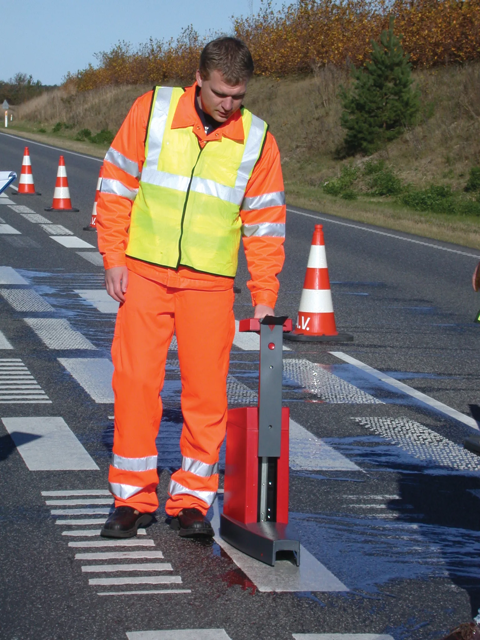
Its portable LTL-X Retrometer, for example, measures the retroreflection of road markings at a simulated distance of 30m according to CEN (European Committee for Standardisation) and ASTM (3930 American Society for Testing and Materials) standards.

The LTL-X has advanced new technology and an ergonomic design, and is the fourth generation retrometer based on the proven knowledge from the worldwide use of LTL2000 and its predecessors.

The retractable handle has an integrated display, and measurements and settings of road and user ID, line type, measurement averages, instrument status and languages are done at the touch of a button. Optional GPS values are shown, and the LTL-X is fitted with printer and wheels for easier operation.

For more information on companies in this article

Related Content

  • Inrix Analytics announced
    May 4, 2012
    Inrix has introduced what it claims is the industry's first cloud-based data analytics services designed to improve how transportation agencies monitor, manage and measure the performance of their road networks. "Now more than ever, government agencies worldwide are being required to stretch and justify every dollar invested in transportation - being asked to do more with less," said Rick Schuman, Inrix VP of public sector.
  • Drone system from HCSS
    October 22, 2021
    HCSS says it is offering powerful new features for its HCSS Aerial package, a drone-based data analytics platform. This includes improvements with calculations and measurements, annotation and designs, and navigation. New features are said to optimise tablet performance and improve user experience with the mobile device.
  • The DURABROADS project targets safer mobility
    April 2, 2014
    The innovative DURABROADS project will help deliver a sustained reduction of fatalities in the long term, writes the ERF’s José Diez In 2012, Europe recorded the lowest number of fatalities since the first data were collected. All in all, fatalities were down by 9% in 2012, which means that 3,000 lives were saved that year. Should the current pace continue, we can be confident that the ambitious objective of reducing fatalities by 50% by 2020, compared to 2010, will be reached. To achieve the goals of
  • Smart constructioon with GIS, GPS design technology
    May 2, 2012
    A UK highway project has benefited from the latest software, GIS and GPS technology, Mike Woof reports. Sophisticated software, GIS and GPS technology has played an important role in a large highway upgrade project in the UK and helping to increase efficiency and drive down construction costs.