3D Repo develop virtual reality safety app for Balfour Beatty

3D Repo is working with contractors Balfour Beatty and Vinci and the UK roads agency Highways England to deploy a virtual reality simulation program for safety training. 3D Repo, a spin-off from University College London, develops open-source software for building information modelling in the cloud. More than 40 different 3D file formats are decomposed and federated in the company’s big data repository.
April 18, 2017 Read time: 2 mins
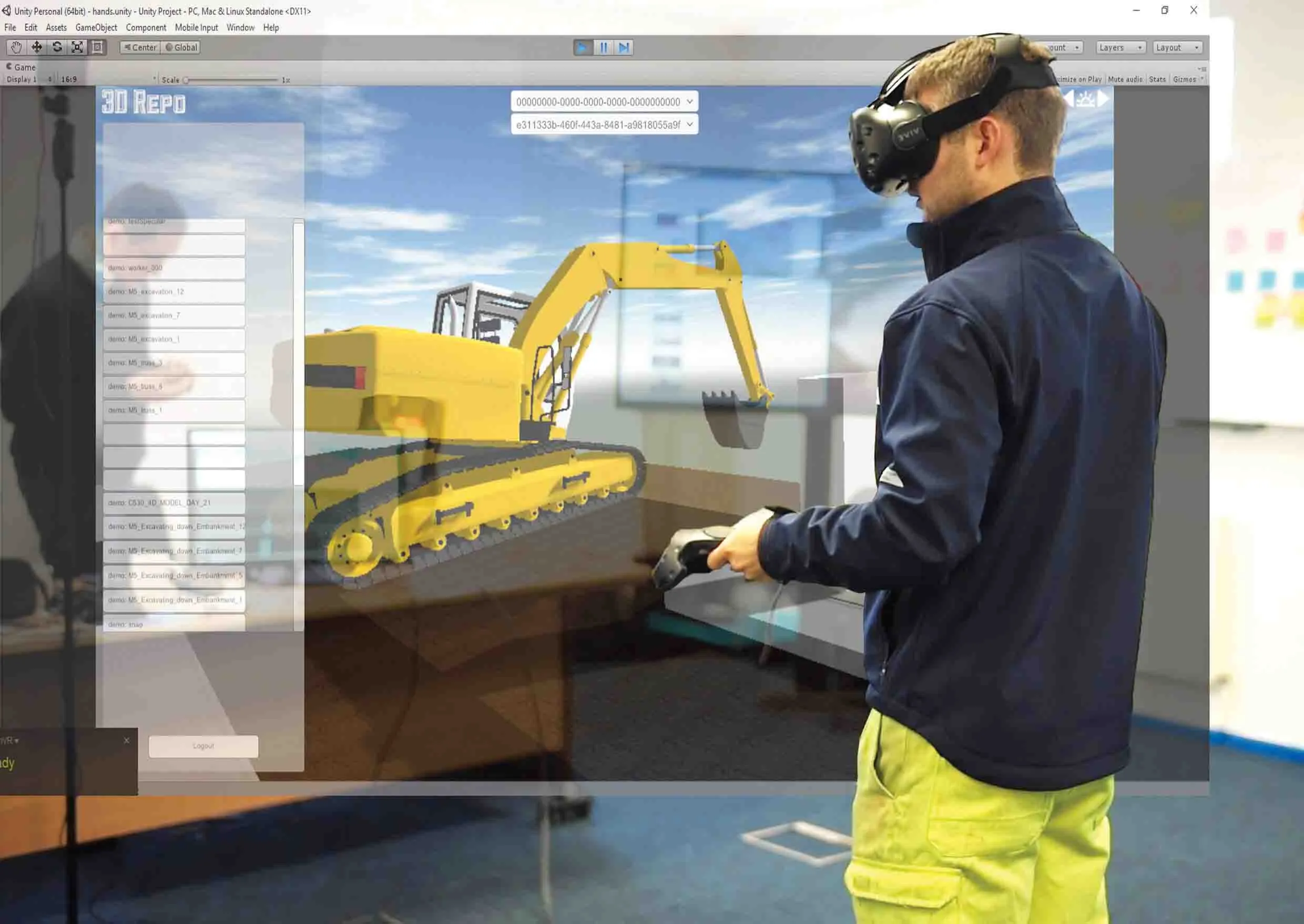
Seeing is believing, and staying healthy: 3D Repo’s construction site simulation
3D Repo is working with contractors Balfour Beatty and 5177 Vinci and the UK roads agency 8100 Highways England to deploy a virtual reality simulation program for safety training


3D Repo, a spin-off from University College London, develops open-source software for building information modelling in the cloud. More than 40 different 3D file formats are decomposed and federated in the company’s big data repository.

The simulated program - part of the UK’s Smart Motorway programme – is a fully immersive simulation to prevent on-site accidents by making highways construction and maintenance projects safer through improved training. It features real world scenarios while the virtual experience gives users different perspectives of the same potentially dangerous situation in order to develop an understanding of safe working zones.  

“In order to demonstrate our understanding of our customers’ needs and facilitate the collaboration between our customers and their clients, we wanted to digitally transform our approach,” commented

Neil Thompson, head of digital research at 1146 Balfour Beatty, said that using a standard visual reality headset, the 3D Repo simulation provides multiple views of different scenarios. The user is immersed in a position relative to an activity, for example bank excavation, so they can examine both the worker’s as well as the plant driver’s visibility. The user can then position themselves where they think they are safe and switch to the plant operator’s position to understand what they would see.

All this is done within the safety of an office or training room and without the need for lengthy manuals, training sessions or specialist personnel. As the scenarios are hosted online, the system can be set up easily from any location and can be deployed across numerous sites at the same time.

“Upon login, users can access all their projects remotely on the fly and without the need to create custom executables each time,” said Jozef Dobos, chief executive of 3D Repo. “We also utilise existing site-specific 3D models and building information modelling (BIM) data so that custom scenarios can be created and uploaded as and when needed.”

For more information on companies in this article

Related Content

  • The era of workzone data
    July 4, 2018
    Portable work zone messaging is now integral - not an add-on - when it comes to safety on large-scale highway projects. Andrew Williams* reports. Portable work zone ITS solutions have emerged in recent years as important flexible tools for managing major roadwork projects, from new-build to upgrades. They effectively ensure traffic disruption is kept to a minimum and lives can be saved. As such, the technology forms a central component of a major €1.7 billion project in the southern English county of Cambr
  • Topcon and Bentley join forces to model reality
    March 8, 2017
    Topcon Positioning and Bentley Systems are introducing the product of their joint development project at CONEXPO-CON/AGG 2017, a reality modelling software solution.
  • Free flight planner app for HCSS Aerial
    April 9, 2021
    The HCSS Aerial: Drone Mission app works with most drones to capture high-resolution images.
  • IBI’s Routemapper charts new territory with Highways England
    September 14, 2016
    Mapping the asset High-speed data collection just got faster for England’s newly created strategic roads operator Highways England’s establishment as a publicly held company in 2015 created a need for a highly accurate asset inventory. This was potentially very costly and had serious safety implications. As well as its relationships with numerous managing agents and contractors, assets include 35,300km of highway, 12,100km of earthworks, 23,200km of safety fences, 150,000 technology assets and sig