
3D Repo develop virtual reality safety app for Balfour Beatty

3D Repo is working with contractors Balfour Beatty and Vinci and the UK roads agency Highways England to deploy a virtual reality simulation program for safety training. 3D Repo, a spin-off from University College London, develops open-source software for building information modelling in the cloud. More than 40 different 3D file formats are decomposed and federated in the company’s big data repository.
April 18, 2017 Read time: 2 mins
Seeing is believing, and staying healthy: 3D Repo’s construction site simulation
3D Repo is working with contractors Balfour Beatty and 5177 Vinci and the UK roads agency 8100 Highways England to deploy a virtual reality simulation program for safety training


3D Repo, a spin-off from University College London, develops open-source software for building information modelling in the cloud. More than 40 different 3D file formats are decomposed and federated in the company’s big data repository.

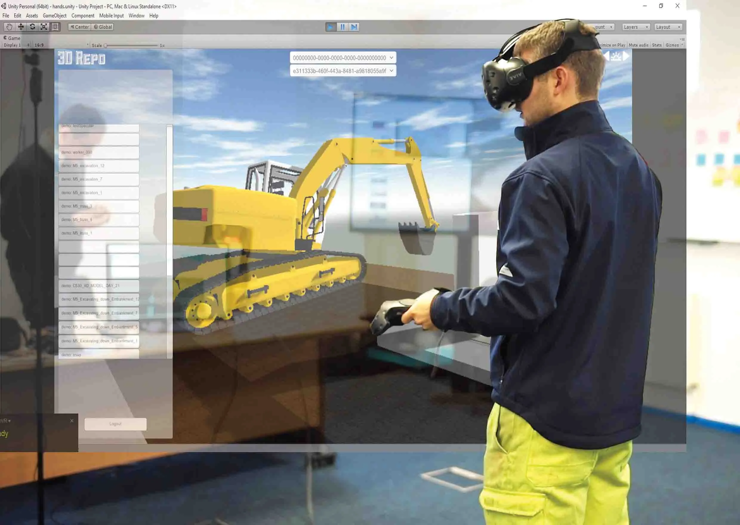
The simulated program - part of the UK’s Smart Motorway programme – is a fully immersive simulation to prevent on-site accidents by making highways construction and maintenance projects safer through improved training. It features real world scenarios while the virtual experience gives users different perspectives of the same potentially dangerous situation in order to develop an understanding of safe working zones.  

“In order to demonstrate our understanding of our customers’ needs and facilitate the collaboration between our customers and their clients, we wanted to digitally transform our approach,” commented

Neil Thompson, head of digital research at 1146 Balfour Beatty, said that using a standard visual reality headset, the 3D Repo simulation provides multiple views of different scenarios. The user is immersed in a position relative to an activity, for example bank excavation, so they can examine both the worker’s as well as the plant driver’s visibility. The user can then position themselves where they think they are safe and switch to the plant operator’s position to understand what they would see.

All this is done within the safety of an office or training room and without the need for lengthy manuals, training sessions or specialist personnel. As the scenarios are hosted online, the system can be set up easily from any location and can be deployed across numerous sites at the same time.

“Upon login, users can access all their projects remotely on the fly and without the need to create custom executables each time,” said Jozef Dobos, chief executive of 3D Repo. “We also utilise existing site-specific 3D models and building information modelling (BIM) data so that custom scenarios can be created and uploaded as and when needed.”

For more information on companies in this article

Related Content

  • Efficient asset management delivers
    April 25, 2013
    Maximising the economic benefit of infrastructure assets can be achieved through delivering better quality maintenance. Increasing utilisation of infrastructure follows on from those assets being in better condition. Clearly by tracking infrastructure condition closely, huge gains can be made in addressing technical issues before they become more serious and more costly, as well as minimising disruption. In UK city Birmingham, high resolution aerial photography from Bluesky is helping the city council under
  • Data collection key to software developments
    February 13, 2012
    The collection and handling of data are key technology drivers in the software sector. New methods of data collection and manipulation are driving significant developments in software at present. The latest technology allows designers and engineers to collect, store and manipulate ever larger amounts of data. Growing use of mobile field equipment for both data collection and field management is driving interactive systems. And in an interview this month Autodesk senior vice-president for the construction an
  • New project software developed by Bentley
    February 8, 2018
    Bentley Systems claims that its OpenRoads ConceptStation modelling package allows highway engineering professionals to quickly build conceptual road and bridge models. The software allows rapid conceptual and preliminary design, using information obtained through point clouds, reality meshes, GIS, and other sources. OpenRoads ConceptStation combines engineering drawing tools and project costs to improve decision-making in the design phase. Benefits include increasing design productivity, identifying
  • Positioning tools continue to improve
    July 16, 2012
    Topcon says that its new IP-S2 package combines GNNS positioning capabilities with inertial sensors, while the firm also has a solution for customers wanting to mix and match receiver components. The IP-S2 is a vehicle-mounted, mobile 3D tool that offers precision mapping and surveying capabilities. The package collects data using 3D laser scanners, LIDAR, and/or cameras, and this is then integrated, time-stamped and geo-referenced. The customer can use this assembled data to combine LIDAR point cloud and d