Revolutionary cable locator

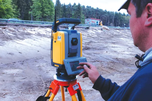
Leica Geosystems says its new Leica Digicat 600i and 650i series, with Logicat software, is set to revolutionise underground cable location. The 600i and 650i, fitted with what Leica says is an innovative data capture and on-board memory function, is said to aid operations management moves to increase onsite safety by detecting cables and identifying operator training needs. Locating underground cables and pipes is said to be a simple and efficient task with the 600i and 650i series, boosting the operator’s
June 19, 2012 Read time: 2 mins
Leica Geosystems says its new Leica Digicat 600i and 650i series is set to ‘revolutionise’ underground cable location
265 Leica Geosystems says its new Leica Digicat 600i and 650i series, with Logicat software, is set to revolutionise underground cable location.

The 600i and 650i, fitted with what Leica says is an innovative data capture and on-board memory function, is said to aid operations management moves to increase onsite safety by detecting cables and identifying operator training needs. Locating underground cables and pipes is said to be a simple and efficient task with the 600i and 650i series, boosting the operator’s productivity and profitability.

The 650i is said to offer the user the same features and functionally of the 600i, with the extra benefit of service depth indication.

When using the Digicat in conjunction with the Digitex 100t or Sonde in 8 or 33 kHz modes, operators can determine the depth of the buried utility which, according to Leica, provides a clear advantage when conducting ground surveys.

The 600i and 650i locators have Bluetooth wireless connectivity, allowing the Digicat to integrate with mobile mapping technology to log survey data, in addition to enabling wireless Bluetooth data transfer. With Logicat software, calculation records can be retrieved and collated, helping to improve onsite safety and identify training needs.

For more information on companies in this article

Related Content

  • A competitive market
    August 2, 2012
    Competition is increasing in the earthmoving sectors, and for some companies market share is improving The wheeled loader market is becoming more competitive, with a number of firms now challenging the leading players, Caterpillar, Komatsu and Volvo. In other earthmoving product sectors such as excavators, companies such as Case, Doosan, Hyundai, JCB, Liebherr and Volvo are becoming more aggressive in terms of sales and are capturing market share. Case is gearing up its operations in Western Europe, Eastern
  • Asphalt milling optimised by 3D controls
    February 20, 2012
    3D machine controls can optimise milling efficiency, Mike Woof reports. More efficient milling and recycling operations can be carried out by using the latest 3D control systems on the market. At the last Trimble Dimensions event in Las Vegas, the advantages of 3D controls for milling operations proved a key topic. The use of 3D control systems can offer huge advantages in milling operations. This technology helps increase productivity as the milling machine will only remove what is required, which also hel
  • Aggregates production innovations delivering efficiency
    August 1, 2017
    EvoQuip, the newest division of Terex Corporation, is launching a Cobra 230 impact crusher later this year, to sit alongside the Cobra 260. The 24tonne machine will offer a production capacity of 140-150tonnes/hour in asphalt and construction recycling. The Cobra 230 is 11.3m long and 2.46m wide, or 5.15m wide with a side conveyor. It features a quick set-up time and the machine can be moved onsite without having to stop the crusher. Keestrack says that its novel H4 tracked cone crusher is light and compact
  • More accurate mapping
    July 31, 2024

    Trimble and Radiodetection have established a collaboration to improve the technology used in the utility measurement and mapping process. Through the integration of the Trimble Catalyst DA2 GNSS system and Radiodetection’s RD MapTM+ application and precision locator products, the software and hardware integration streamlines utility-locating workflows. This can provide high-accuracy measurement capabilities for the generation of underground utilities maps in a single field operation.