GSSI offers bridge monitoring tool

GSSI is introducing the sophistictaed BridgeScan condition assessment system. This package is used for concrete inspection and utility mapping of bridges. Said to be both affordable and versatile, this ground penetrating radar (GPR) equipment can be used to assess concrete condition on bridge decks, as well as parking structures. Using this unit offers accurate assessments of concrete condition, which improves repair cost estimation and saves time and money. With BridgeScan, identification of rebar
May 19, 2015 Read time: 2 mins
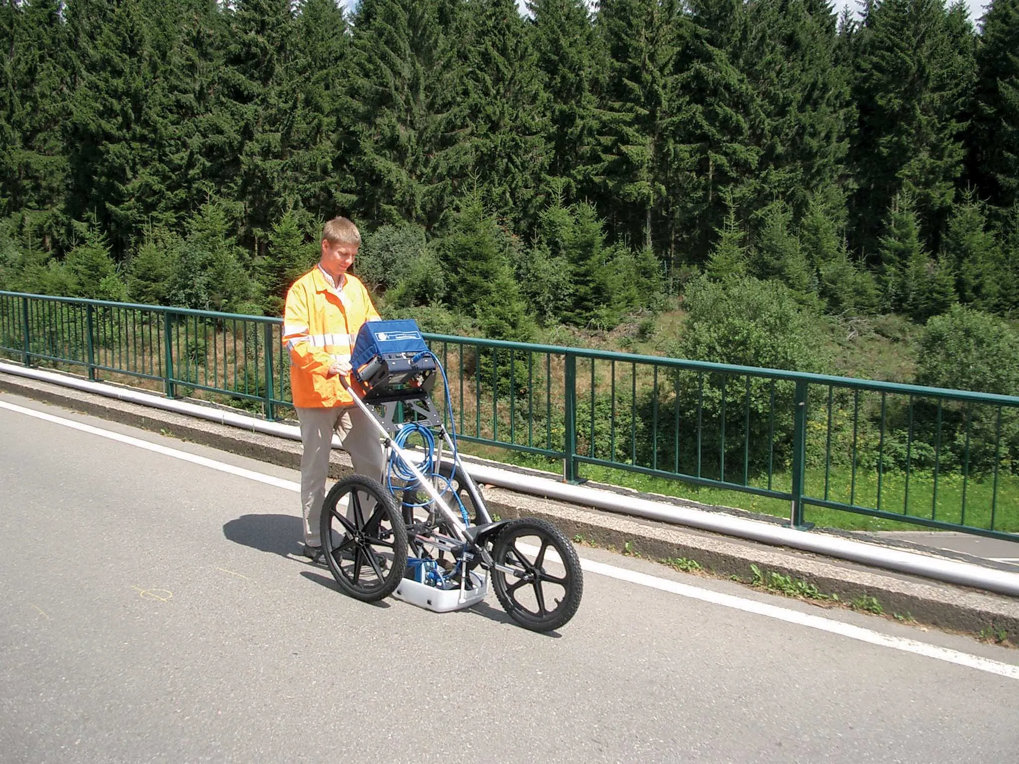
The BridgeScan monitoring system from GSSI comes with its own cart for versatility of use
8095 GSSI is introducing the sophistictaed BridgeScan condition assessment system. This package is used for concrete inspection and utility mapping of bridges.

Said to be both affordable and versatile, this ground penetrating radar (GPR) equipment can be used to assess concrete condition on bridge decks, as well as parking structures. Using this unit offers accurate assessments of concrete condition, which improves repair cost estimation and saves time and money.

With BridgeScan, identification of rebar location and depth is said to be easy and quick. It can handle bridge deck condition assessments, determining concrete cover depth on new structures, and concrete inspection, as well as measuring slab thickness, and void detection and location. Construction professionals, utility locators, and engineers can also use the unit as a basis for a utility locating GPR system to map and locate underground infrastructure – pinpointing the depth and position of metallic and non-metallic pipes in real time.

Unlike other units, the firm says that the BridgeScan system is aimed at bridge condition assessment. It can accurately represent bridge data by automatically accommodating for bridge skew angle. Using a non-destructive method of evaluating bridge deck thickness, the BridgeScan system is said to obtain reliable thickness measurements in minutes, eliminating the need to core.

The BridgeScan system includes the SIR 3000 control unit, a small, lightweight GPR system designed for single-user operation, which incorporates advanced signal processing and display capability for in-the-field 3D imaging. The same control unit can be used for multiple applications. Other BridgeScan components include a 1600MHz antenna, a three-wheeled survey cart with encoder wheel, and a 2m control cable. Also included is a transit case for the control unit, batteries and charger, as well as RADAN software and application-specific software for bridge deck condition assessments.

For more information on companies in this article

Related Content

  • Made to Measure laser mapping
    June 15, 2012
    Dutch surveying company Geomaat says it is taking millimetre accurate measurements in record time to aid a range of highway design, construction and maintenance projects. Using the mobile laser mapping system StreetMapper, and specially developed point cloud software, Geomaat says it can calculate highly accurate cutting, milling and asphalt figures, create as built models and undertake change detection.
  • Made to Measure laser mapping
    June 26, 2012
    Dutch surveying company Geomaat says it is taking millimetre accurate measurements in record time to aid a range of highway design, construction and maintenance projects. Using the mobile laser mapping system StreetMapper, and specially developed point cloud software, Geomaat says it can calculate highly accurate cutting, milling and asphalt figures, create as built models and undertake change detection.
  • Bentley Systems launches OpenRoads Designer CONNECT Edition
    April 13, 2017
    The beginning of this year saw Bentley Systems launch a major advanced comprehensive global tool for today’s increasingly widespread BIM environment. Christmas 2016 came early for Bentley's global clients. In fact, they had a hint of what was going to be under their tree come the celebrations in December. On November 1, at Bentley’s annual global client gathering and awards event Year in Infrastructure Conference in London, the solutions provider announced that OpenRoads Designer CONNECT Edition would be a
  • Location location
    February 28, 2012
    Improved underground utility location capabilities are claimed for the improved unit from Radiodetection, This new unit is a development of the RD8000 range of pipe and cable locators introduced by Radiodetection in 2008 and offers the addition of an innovative current direction (CD) feature. This is available on Radiodetection's most advanced locator the RD8000PDL and allows a user to trace and identify a target cable in highly congested areas or when running parallel to other lines.