GSSI offers bridge monitoring tool

GSSI is introducing the sophistictaed BridgeScan condition assessment system. This package is used for concrete inspection and utility mapping of bridges. Said to be both affordable and versatile, this ground penetrating radar (GPR) equipment can be used to assess concrete condition on bridge decks, as well as parking structures. Using this unit offers accurate assessments of concrete condition, which improves repair cost estimation and saves time and money. With BridgeScan, identification of rebar
May 19, 2015 Read time: 2 mins
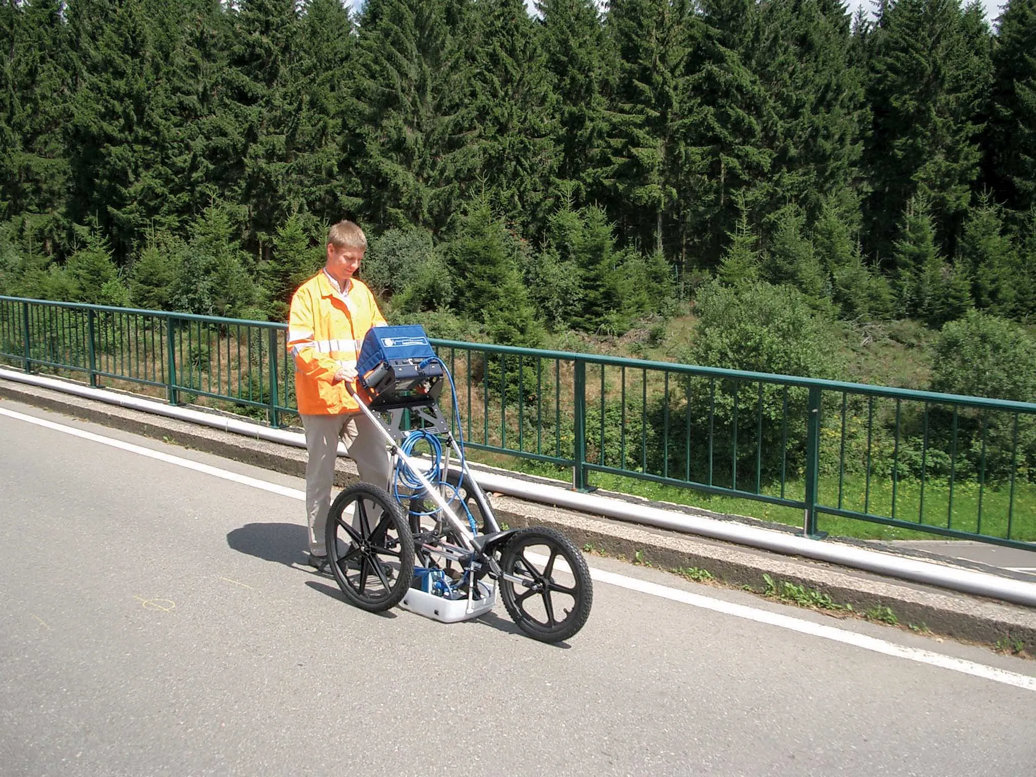
The BridgeScan monitoring system from GSSI comes with its own cart for versatility of use
8095 GSSI is introducing the sophistictaed BridgeScan condition assessment system. This package is used for concrete inspection and utility mapping of bridges.

Said to be both affordable and versatile, this ground penetrating radar (GPR) equipment can be used to assess concrete condition on bridge decks, as well as parking structures. Using this unit offers accurate assessments of concrete condition, which improves repair cost estimation and saves time and money.

With BridgeScan, identification of rebar location and depth is said to be easy and quick. It can handle bridge deck condition assessments, determining concrete cover depth on new structures, and concrete inspection, as well as measuring slab thickness, and void detection and location. Construction professionals, utility locators, and engineers can also use the unit as a basis for a utility locating GPR system to map and locate underground infrastructure – pinpointing the depth and position of metallic and non-metallic pipes in real time.

Unlike other units, the firm says that the BridgeScan system is aimed at bridge condition assessment. It can accurately represent bridge data by automatically accommodating for bridge skew angle. Using a non-destructive method of evaluating bridge deck thickness, the BridgeScan system is said to obtain reliable thickness measurements in minutes, eliminating the need to core.

The BridgeScan system includes the SIR 3000 control unit, a small, lightweight GPR system designed for single-user operation, which incorporates advanced signal processing and display capability for in-the-field 3D imaging. The same control unit can be used for multiple applications. Other BridgeScan components include a 1600MHz antenna, a three-wheeled survey cart with encoder wheel, and a 2m control cable. Also included is a transit case for the control unit, batteries and charger, as well as RADAN software and application-specific software for bridge deck condition assessments.

For more information on companies in this article

Related Content

  • Ontario opts for Power InRoads design tools
    June 12, 2012
    One of Canada's largest provinces, Ontario, has decided to go with the latest Power InRoads suite of design tools now being offered by Bentley Systems as a complete stand-alone version As well as the Inroads tools, that means Ontario's Ministry of Transportation will use drafting and document production by the MicroStation CAD tool, and mapping and GIS functionality from Bentley Map. It previously used InRoads for highways work but on an AutoCAD platform. The whole new package is also designed to work co
  • Topcon: A revolution in construction technology’s coming
    July 7, 2021
    The construction equipment industry is at a turning point. Topcon’s senior leaders believe that we are about to see a huge surge in the adoption of new construction technologies. The time is ripe as a new, younger and more tech-savvy generation comes to the fore. Governments could save billions, and where does the smartphone fit in?
  • Degaroute skipline markings
    May 6, 2016
    Of the 8,050km of tollway roads in the United States, the Illinois State Toll Highway Authority manages 460km of them As part of the maintenance programme for this network of five highways, the Illinois State Toll Highway Authority has partnered with Applied Research Associates to manage and monitor the performance of all their pavement marking programmes, providing recommendations for striping projects.