Drone system from HCSS

HCSS says it is offering powerful new features for its HCSS Aerial package, a drone-based data analytics platform. This includes improvements with calculations and measurements, annotation and designs, and navigation. New features are said to optimise tablet performance and improve user experience with the mobile device.
October 22, 2021 Read time: 2 mins
HCSS is now offering improved functionality for its drone package

“Customers have asked us to allow HCSS Aerial measurements and quantities data to be integrated with HCSS HeavyJob Project Management and Job Cost solution,” said JP Giometti, vice president, Global Strategy and Corporate Development, HCSS. “We are Beta testing this integration and gathering feedback from clients before introduction. By integrating with HeavyJob, clients will be able to keep their jobs and budget on track with less expensive yet more accurate drone mapping.”

Features in the new update include the ability to provide measurements and analytics from design items, saving time, whether users are running calculations to compare design to the as-built for quality assurance or checking bills from subcontractors. The package can also eliminate any errors that might occur from manual drawing areas or lines. It can import images into HCSS Aerial to create a new annotation. The platform pins the annotation automatically, depending on the GPS position. Users inspecting a site on a tablet can import the photographs on the go. It offers easier drawing of lines and polygons for measurements and analytics.

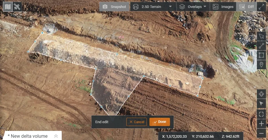
Users can now make edits and adjust points in lines and polygons without starting calculations. The package can upload design files and notes before the first flight or while the flight is still being processed. A “Go to Coordinates” navigation tool can change a map display to a specific point by entering coordinates.

Measurement details for tablets optimises the small screen and allows users to choose between side navigation and a top-mounted calculation detail box.

For more information on companies in this article

Related Content

  • Smarter paving option from Vögele
    December 12, 2018
    Vögele is extending its range of service and training options for users with the introduction of a new app and web facility. This is said to allow paving crews to get to grips with the ErgoPlus 3 operating concept quickly and easily with the aid of numerous animations. The tool allows users to learn how to position and adjust the screed, as well as retrieve paving programmes. Using the system allows operators to achieve optimum paving results and efficient job site processes, according to the firm. The sy
  • Not lost in translation – detecting BIM changes
    May 22, 2018
    A new package from 3D Repo offers effective real-time BIM change detection. This cloud-based change detection software can be used for 3D construction models to avert BIM issues from unregistered changes. This solution is said to provide a fast and reliable way to detect changes in underlying 3D models, using an encrypted web browser. The patent pending innovation operates on any 3D models, regardless of their file type, software used to produce them or file size. Called 3D Diff, the 3D Repo solution also a
  • US asphalt and quarry show highlights new technology
    May 8, 2015
    New technology was one key focus area for the World of Asphalt/AGG1 event run recently in the US city of Baltimore - Mike Woof writes Technology has been a major focus for the combined World of Asphalt and AGG1 2015 exhibition and conference held in Baltimore. The exhibition area attracted 450 exhibitors and covered a larger area than for previous events, while over 10,000 education season tickets were bought by those wanting to attend the presentation sessions. The event was held from March 17th- March
  • Swarco launches Zephyr software for traffic sign control
    November 15, 2017
    Swarco has launched Zephyr, a cloud-based software package to provide local authorities with total control over traffic sign assets and strategy. Swarco said that Zephyr allows authorities full flexibility over their assets, including variable message signs and trailer VMS, car parking signs, vehicle-activated signs and school warning signs. A web-based interface enables users to edit message and pictogram displays at the touch of a button, as well as upload new text and graphics as required, explained Andr