A major new highway project in Peru will improve connectivity for the Arequipa region - Mauro Nogarin writes
Peru’s Matarani-Bonbon road project is an important route and forms part of the Camana - Dv Quilca - Ilo - Tacna highway project. The road stretches through several provinces in the Arequipa region. The deadline for completing the work is 720 days after January 2015, and it is scheduled to be completed by December 2016. Progress has been good and as of July 2015, it was 80% completed.
The main
A major new highway project in Peru will improve connectivity for the Arequipa region - Mauro Nogarin writes
Peru’s Matarani-Bonbon road project is an important route and forms part of the Camana - Dv Quilca - Ilo - Tacna highway project. The road stretches through several provinces in the Arequipa region. The deadline for completing the work is 720 days after January 2015, and it is scheduled to be completed by December 2016. Progress has been good and as of July 2015, it was 80% completed.
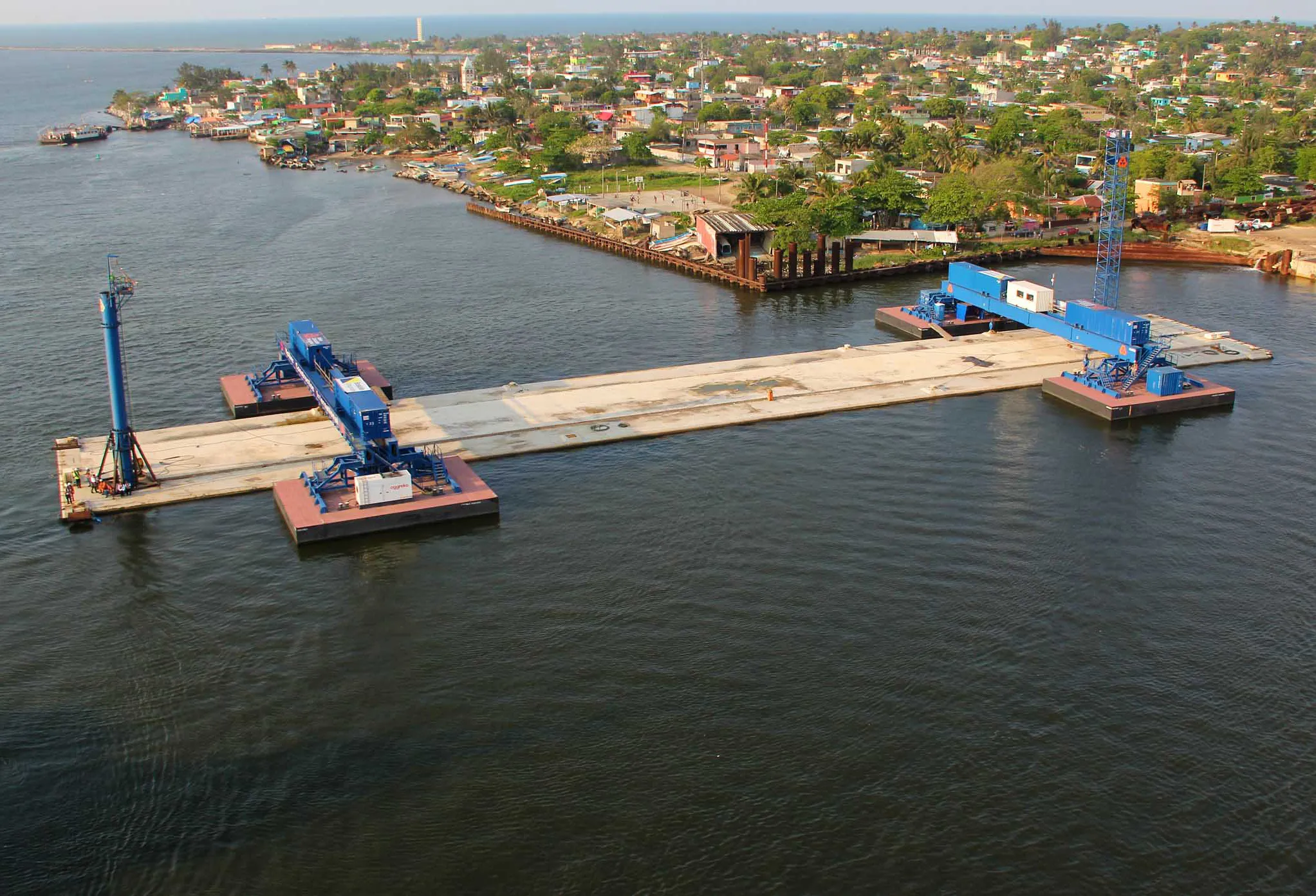
The main activities taking place in the region of Arequipa are mining, fishing and agriculture and it is ranked the second most industrialised and commercial city in Peru. The main commercial activities include manufactured products and production of textiles from the wool of llamas and alpacas. It also possesses a good railway system, and the port of Matarani. However the existing road links are not considered sufficient for its transport needs due to the heavy truck traffic to and from the area.
Tourism in this region is an important factor in consolidating the economy; as the third most visited city in the country after Cusco and Lima, it receives more than a million tourists/year. The new highway will improve access for tourists and will also boost safety, a key concern for the local authorities.
According to the topography and characteristics of the existing roads, the road is divided into different segments. Taking into account the high level of existing traffic, the construction of the first 15km of road was carried out to provide a secondary highway with separate roads, each with two lanes. The designers also opted to avoid crossing the congested urban area of Mollendo. This section includes three roundabouts which required a volume of 3 million m3 of fill material. With the construction work requiring around 3.5 million m3 of material to be excavated, this section will have two overpasses over the existing railway tracks.
Starting at Km 15, the second section of the road meets the current road that connects Mollendo with Punta de Bombon and this route is parallel to the sea. The section required the reshaping of the existing road and widening it to make improvements. This section has a roundabout located at Km 29 + 450, which provides access to the south side of Mejia. It also has an underpass at the entrance to the district of Mollendo located at Km 24 + 550. The construction of this section required approximately 220,000m³ of filler material and the excavation of about 55,000m³ of material.
The third section of the route runs from Km 36 and enters the Tambo Valley (one of the largest in the Arequipa region), where the main activity is agriculture and fish farming. From Km 38 + 200 it constitutes a new road, crossing farmland and irrigation canals for about 7km. This section will replace the existing road which runs between the towns of La Cuva and Punta de Bombon.
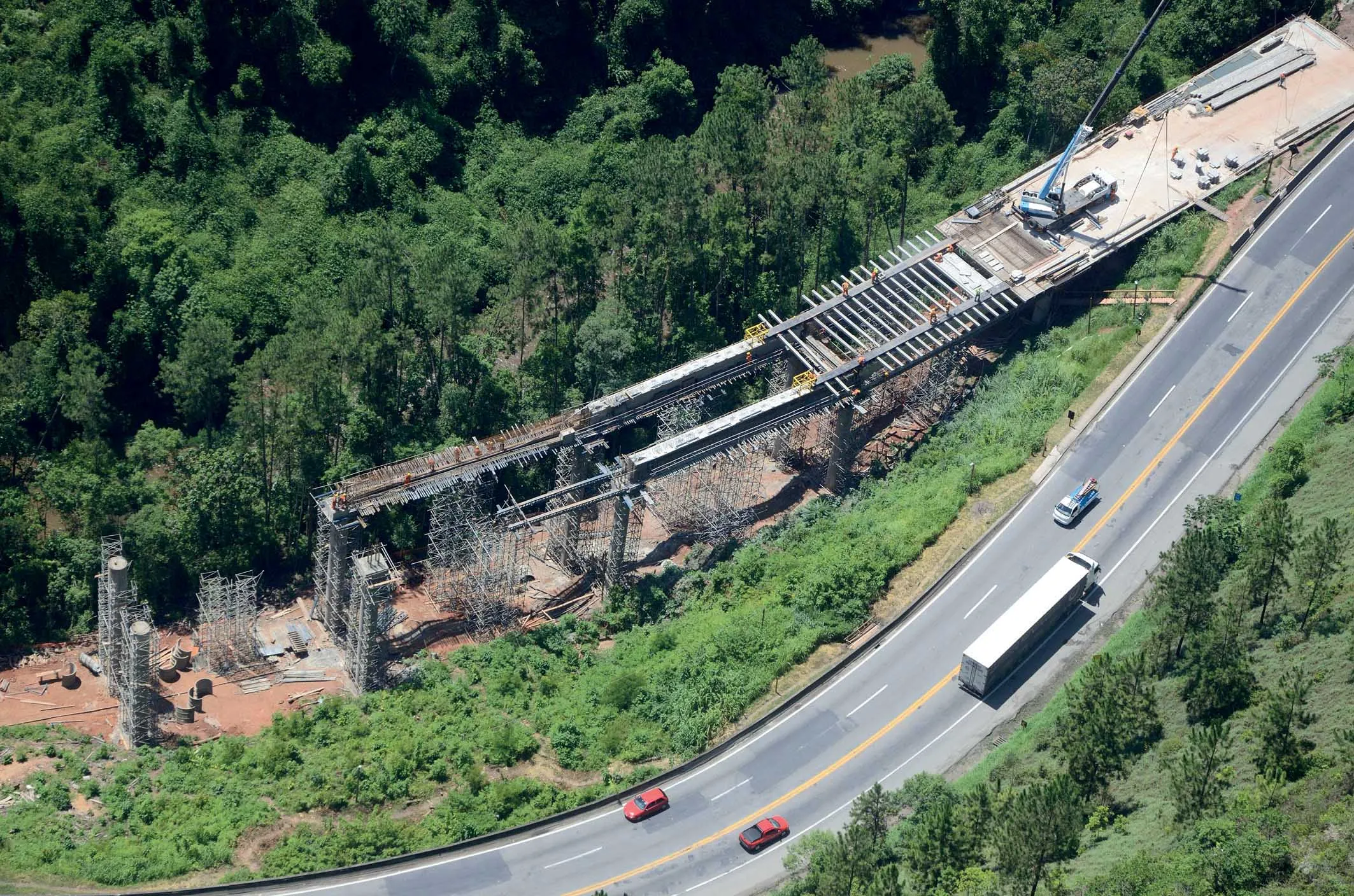
Villagers in the area have stopped using the old Freyre Bridge that links with the district of Punta de Bombonas as it is a narrow, single lane structure. Instead they now use the modern bridge called Puente Tambo, which has a span of approximately 190m and is located at Km 42+ 080 to Km 42 + 270. The remaining work on this section will require the building of an underpass and overpass to solve the junction with the current coastal road and provide access to the center of Punta de Bombon Alto at Km 44 + 780. This section is expected to require about 137,944m3 of fill, and an estimated 35,700m3 of excavated material.
As the construction work for this project was carried out it became apparent to the engineering team that the geological characteristics of the area would pose challenges. The data from the Geological Mining and Metallurgical Institute (INGEMMET) described specific geological formations for the areas of land through which the project runs. But surveys carried out during the project showed that the geology varied from the data provided by INGEMMET. For the stretch of highway from Km 0 + 000 to Km 15 + 600, the geology features marine terraces. For the coastal road stretch from Km 15 + 600 to Km 36 + 000 to Km 45 + 200 there are alluvial deposits and beach sand with fluvial deposits.
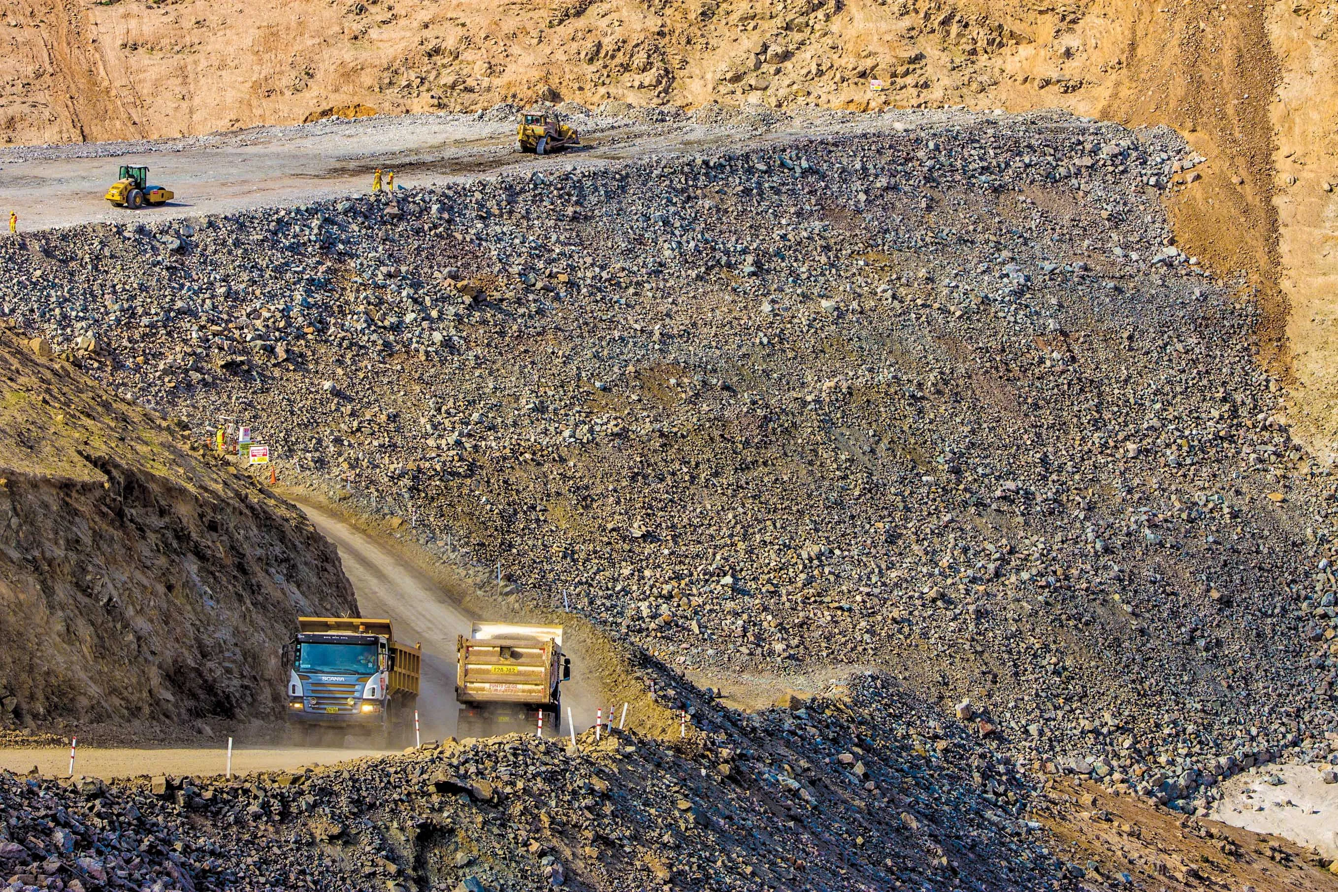
As a result of this segmentation, excavation work had to be carried out on different types of materials, which were classified as loose material, loose rock and hard rock. Due to the fact that the contract was set out in unit prices, this posed a challenge to the project team. During excavation work, material was reclassified using seismic refraction tests. This showed that there was an underestimation of hard rock by over 40%. Additional works had to be implemented with the construction of six roundabouts for traffic distribution and six intersections.
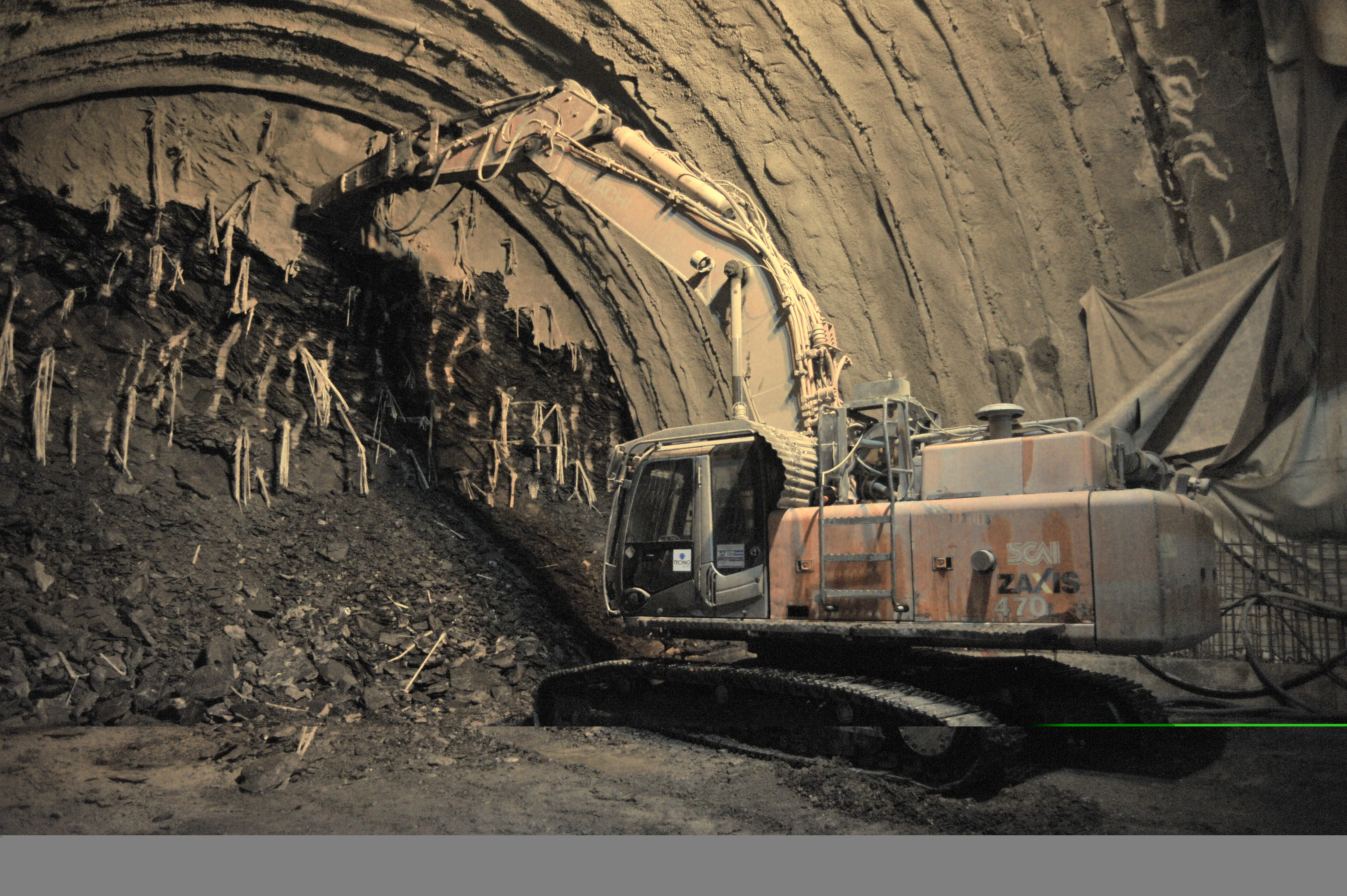
Underpasses using portico style tunnels were required to cross the railway tracks at Km 2 + 774, Km 13 + 510 and Km 14 + 288.
The Tambo Bridge located on the river of the same name is made up of four sections, with a width of 7m. The structure is made with post-tensioned beams and upper slab of 27,000m³ of concrete. The pavement structure consists of a flexible pavement, which required around 77,000m³ of asphalt.
The new route is designed to have a 20-year working life in all. The road features a structural component of asphalt pavement with a granular sub-base sift. The road features a base of quarried and screened aggregates, of variable thickness from 15-27.5cm. On top of this is a 15-22.5cm layer of aggregates, with asphalt on top. The hot mix asphalt features a uniform thickness of 10cm.
However for the next stage of the work, the project study recommends a further reinforcement of the 10cm asphalt. This will receive a further layer of asphalt with similar characteristics and a thickness of 4.5-6.5cm.
Peru’s Matarani-Bonbon road project is an important route and forms part of the Camana - Dv Quilca - Ilo - Tacna highway project. The road stretches through several provinces in the Arequipa region. The deadline for completing the work is 720 days after January 2015, and it is scheduled to be completed by December 2016. Progress has been good and as of July 2015, it was 80% completed.
The main activities taking place in the region of Arequipa are mining, fishing and agriculture and it is ranked the second most industrialised and commercial city in Peru. The main commercial activities include manufactured products and production of textiles from the wool of llamas and alpacas. It also possesses a good railway system, and the port of Matarani. However the existing road links are not considered sufficient for its transport needs due to the heavy truck traffic to and from the area.
Tourism in this region is an important factor in consolidating the economy; as the third most visited city in the country after Cusco and Lima, it receives more than a million tourists/year. The new highway will improve access for tourists and will also boost safety, a key concern for the local authorities.
According to the topography and characteristics of the existing roads, the road is divided into different segments. Taking into account the high level of existing traffic, the construction of the first 15km of road was carried out to provide a secondary highway with separate roads, each with two lanes. The designers also opted to avoid crossing the congested urban area of Mollendo. This section includes three roundabouts which required a volume of 3 million m3 of fill material. With the construction work requiring around 3.5 million m3 of material to be excavated, this section will have two overpasses over the existing railway tracks.
Starting at Km 15, the second section of the road meets the current road that connects Mollendo with Punta de Bombon and this route is parallel to the sea. The section required the reshaping of the existing road and widening it to make improvements. This section has a roundabout located at Km 29 + 450, which provides access to the south side of Mejia. It also has an underpass at the entrance to the district of Mollendo located at Km 24 + 550. The construction of this section required approximately 220,000m³ of filler material and the excavation of about 55,000m³ of material.
The third section of the route runs from Km 36 and enters the Tambo Valley (one of the largest in the Arequipa region), where the main activity is agriculture and fish farming. From Km 38 + 200 it constitutes a new road, crossing farmland and irrigation canals for about 7km. This section will replace the existing road which runs between the towns of La Cuva and Punta de Bombon.
Villagers in the area have stopped using the old Freyre Bridge that links with the district of Punta de Bombonas as it is a narrow, single lane structure. Instead they now use the modern bridge called Puente Tambo, which has a span of approximately 190m and is located at Km 42+ 080 to Km 42 + 270. The remaining work on this section will require the building of an underpass and overpass to solve the junction with the current coastal road and provide access to the center of Punta de Bombon Alto at Km 44 + 780. This section is expected to require about 137,944m3 of fill, and an estimated 35,700m3 of excavated material.
As the construction work for this project was carried out it became apparent to the engineering team that the geological characteristics of the area would pose challenges. The data from the Geological Mining and Metallurgical Institute (INGEMMET) described specific geological formations for the areas of land through which the project runs. But surveys carried out during the project showed that the geology varied from the data provided by INGEMMET. For the stretch of highway from Km 0 + 000 to Km 15 + 600, the geology features marine terraces. For the coastal road stretch from Km 15 + 600 to Km 36 + 000 to Km 45 + 200 there are alluvial deposits and beach sand with fluvial deposits.
As a result of this segmentation, excavation work had to be carried out on different types of materials, which were classified as loose material, loose rock and hard rock. Due to the fact that the contract was set out in unit prices, this posed a challenge to the project team. During excavation work, material was reclassified using seismic refraction tests. This showed that there was an underestimation of hard rock by over 40%. Additional works had to be implemented with the construction of six roundabouts for traffic distribution and six intersections.
Underpasses using portico style tunnels were required to cross the railway tracks at Km 2 + 774, Km 13 + 510 and Km 14 + 288.
The Tambo Bridge located on the river of the same name is made up of four sections, with a width of 7m. The structure is made with post-tensioned beams and upper slab of 27,000m³ of concrete. The pavement structure consists of a flexible pavement, which required around 77,000m³ of asphalt.
The new route is designed to have a 20-year working life in all. The road features a structural component of asphalt pavement with a granular sub-base sift. The road features a base of quarried and screened aggregates, of variable thickness from 15-27.5cm. On top of this is a 15-22.5cm layer of aggregates, with asphalt on top. The hot mix asphalt features a uniform thickness of 10cm.
However for the next stage of the work, the project study recommends a further reinforcement of the 10cm asphalt. This will receive a further layer of asphalt with similar characteristics and a thickness of 4.5-6.5cm.