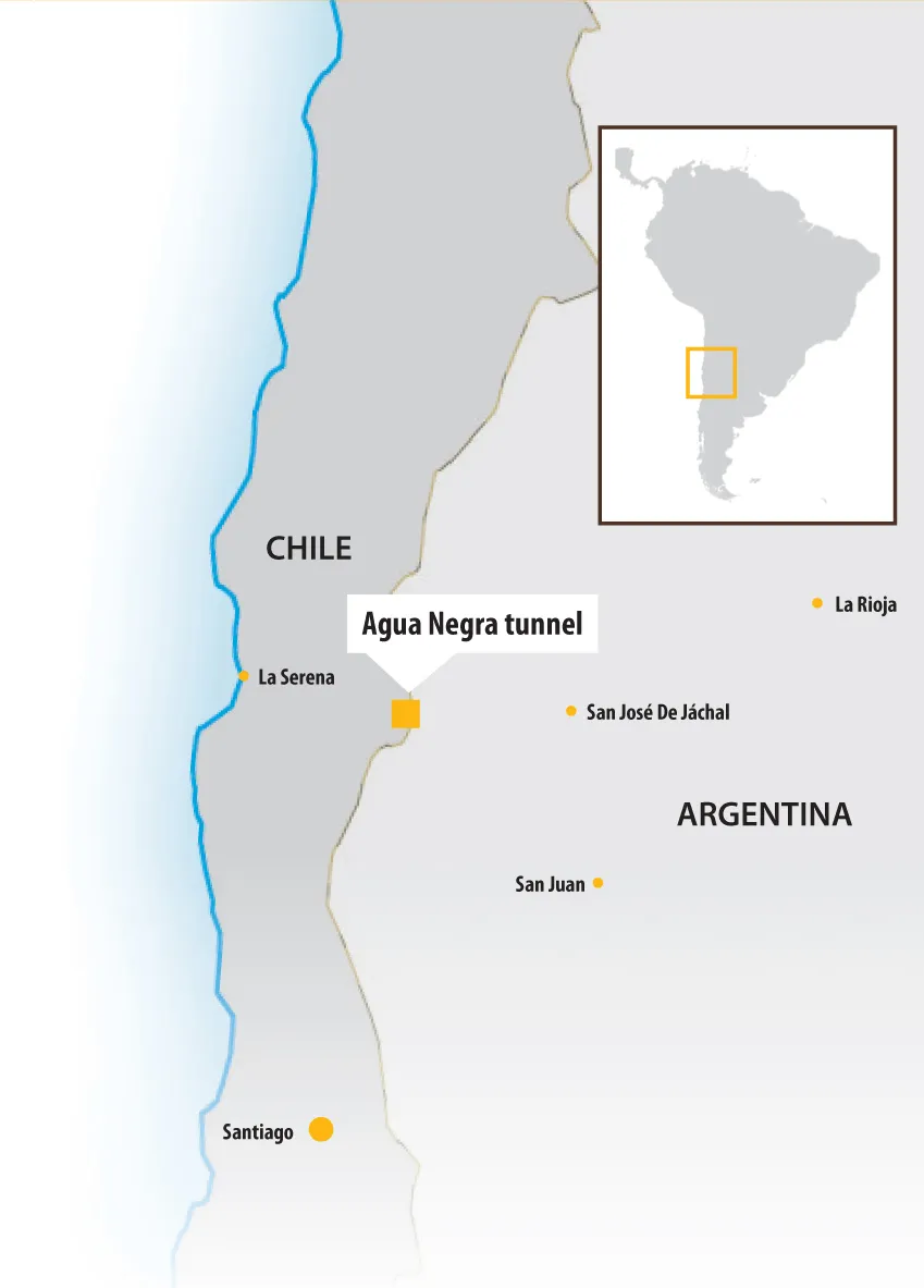
A new tunnel between Chile and Argentina will boost trade and transport between the two countries - Mauro Nogarin writes
The international Tunnel Paso Las Leñas will stretch 11.5km at 2,050m above sea level through the Andes. Once complete, it will greatly improve the connectivity and integration between the Chilean O'Higgins region with the Argentine Mendoza region. It will provide an additional road infrastructure to help the integration between Chile, Mercosur and Asia through the axis from Porto Alegre-Buenos Aires-San Luis-San Rafael to San Antonio Rancagua-Santiago-Valparaiso. Also included in this project is the construction and paving of an international road measuring 134km, from Sosneado, in Argentina, to the area of the Termas de Cauquenes, connecting from there with Route 5 and the Camino de la Fruta.
The works will represent an investment of US$1.67 billion, split between Chile and Argentina. This sum also includes the improvement and maintenance of roads, construction and equipping of the tunnel and the construction of buildings for border control.
Paso de las Leña tunnel
Total estimated length: 11.6km
Chile side: 2.6km (22.5%)
Argentine side: 9km (77.5%)
Tunnel entrance altitude in Chile: 2,020m
Tunnel entrance altitude in Argentina: 2,364m
Average grade: 3%
The expected benefit is to boost Argentina's integration with the other countries of the Mercosur group - Brazil, Paraguay, Uruguay and Venezuela. Associate countries are Bolivia, Chile, Peru, Colombia, Ecuador and Suriname. The project will also shorten the route between Santiago and Buenos Aires by 50km; reduce transportation costs; and improve the development of foreign trade in mining, farming, forestry and industrial products.
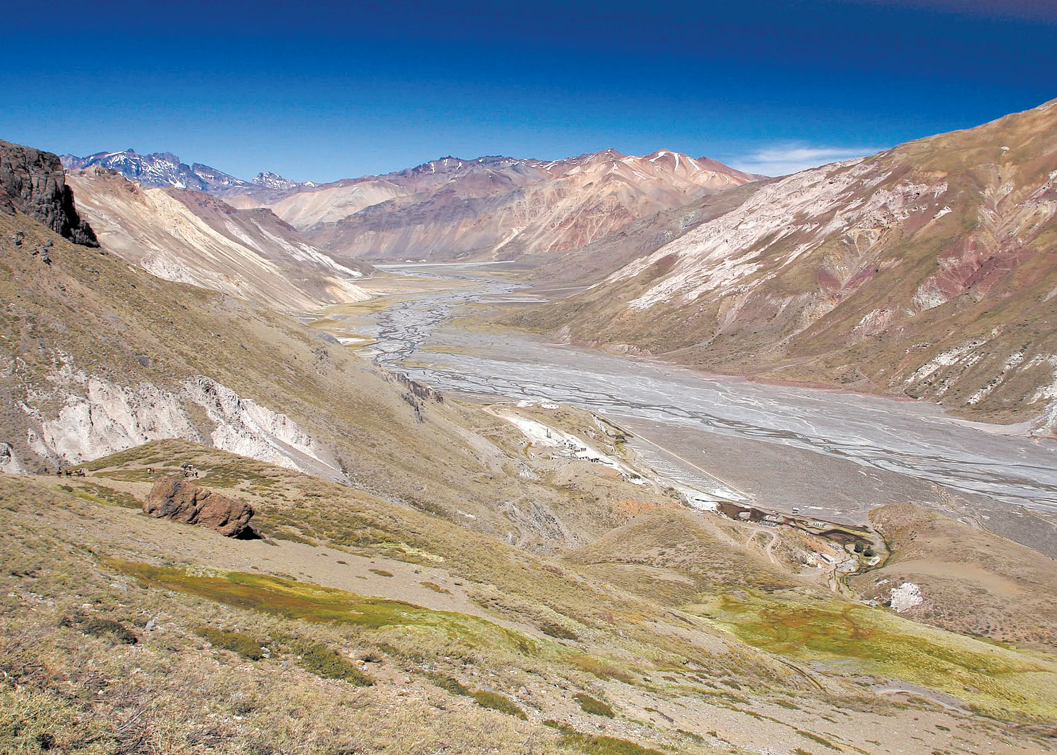
From a geomorphological point of view the area of the tunnel is in an area of transverse cords that descend from the mountains forming small river valleys draining from the Andes. However, the main challenge for this project is the climate, which produces avalanches during the winter and floods in spring. Communications are often severely disrupted for at least one month a year which could affect the project’s progress.
The tunnel construction project Las Lenas also includes improving access to the tunnel from both sides of the Andes. On the Chilean side, the Ministry of Public Works will build and improve a total of 57.7km of roads. In fact, in July 2016 the engineering study for the stretch of 11km began between the Cauquenes and Chacayes sector. The Cortaderal river valley has a length of 20.8km to the entrance to the tunnel portal and is characterised by major earthworks and road structures such as bridges and viaducts.
The construction of the double tunnels, each with two lanes, has a total length of 11.6km, with 2.6km on the Chilean side and 9km in Argentina. It is designed with an average gradient of 3% and will be at just over 2,040m above sea level in parallel to Rancagua, Chile, and San Rafael in Argentina.
Each tunnel is 7.3m wide, with a 1m pedestrian walkway on each side and a height of 5.1m. At the top of the tunnel it has a double chamber for exhaust air and at the bottom a double chamber for fresh air of 7.3m wide.
Currently the method of excavation NATM is being used and it was decided not to use a TBM due to the rigidity in the design of the geometry of the cross section and the radii of curvature of alignment.
Additional studies have focused on a ventilation system and fire emergencies, cost-benefit analysis of energy supply and seismic risk.