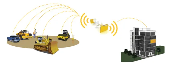
But using sophisticated machine control technology is helping deliver greater accuracy in the road construction market, meeting tougher client demands.
Using the latest digital measurement solutions in road construction can help deliver design data into working on the ground to meet tough requirements from clients. To meet the ever tougher need in construction, the surveying department at LEONHARD WEISS opted to use a digital solution from Leica Geosystems to control milling work on the renovation of the German A70 autobahn in Northern Bavaria, to speed up the work and ensure precision.
The state of Bavaria has provided planning data and target values to the construction company. The construction firm opted to use the new technology as it believes that making the construction process digital should help to boost efficiency and precision, allowing it to meet client requirements more easily.
For renovating a road, milling off the existing surface layer is an important step. An accurately milled substrate is crucial for delivering a quality asphalt base layer as detailed in the design guide, made more complex due to the precise cross slopes and gradients.
According to the contractor, using 3D profile milling can help deliver a base with the correct profile, which can then be built on. Meanwhile, the contractor wanted to use technology that would be ready to use quickly, so that the construction process would not be delayed.
When selecting a measure-ment system for the team, the firm said that ease-of-use and minimal installation requirements on the milling machine were also important factors.
The GNSS-supported milling solution from Leica Geosystems met all those requirements, so the contractor opted to use the Leica iCON site Milling Pilot.
As LEONHARD WEISS was already using the Leica iCON iCG70 and iCG60 construction rovers, the CC80 construction controller, and the iCON site-field software, introducing the Milling Pilot System was simpler. The iCON site software has been developed specifically for handling positioning and location duties in construction and runs on all Leica iCON-GNSS hardware. A brief on-site introduction to the package was then needed for the milling team to learn how use the system effectively.
The existing site was surveyed digitally by an engineering firm and the data was then transferred into the iCON software. Target values from the design guide were then loaded into the software, and the delta, the section that needed to be milled away, was calculated. The two-step preview of the target and cross slope values on the main set points along the road enabled consistent milling.
A visualisation function meant that the error-prone spray-on marking process was no longer necessary, saving time and cost compared to manual preparation. In road construction, costs can also be incurred when additional layers need to be applied if the milling is too deep, but this was also avoided by the increased precision of the system.
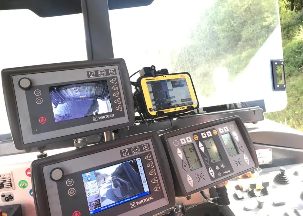
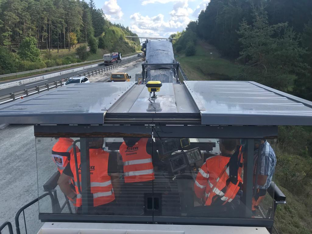
The iCON site Milling Pilot was simple to install, requiring an iCON-GNSS smart antenna, a CC80 controller and the relevant software. Another benefit of the system is that it is powered directly from the machine so there is be no need to charge batteries. Positioned on the top of the milling machine, the antenna was able to send GNSS correction data to the controller, which was displayed graphically for the construction team to view. The system’s preview tool is said to allow precise milling results without unevenness.
Initially, the LEONHARD WEISS team rented the system to see if it met the firm’s needs. Within a short space of time the milling team at LEONHARD WEISS was familiar with using the iCON site Milling Pilot. And after testing the package, the firm opted to buy a system of its own.