The firm claims that these improve simplicity and accuracy for asphalt paving jobsite documentation and process optimisation.
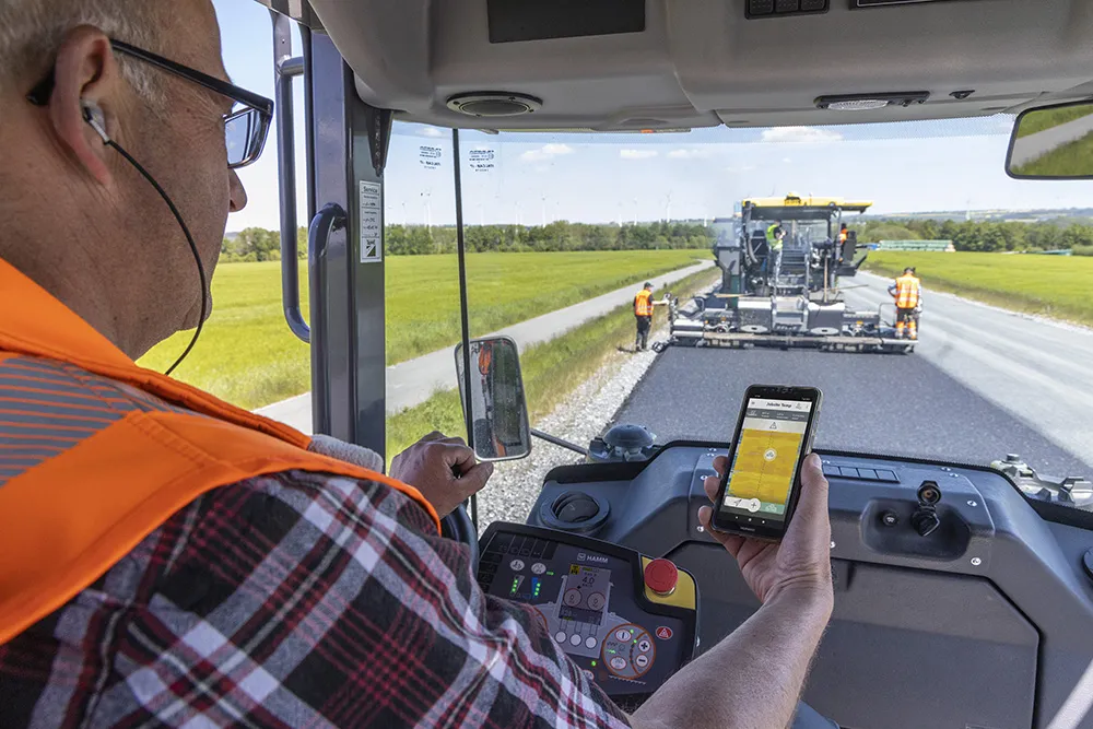
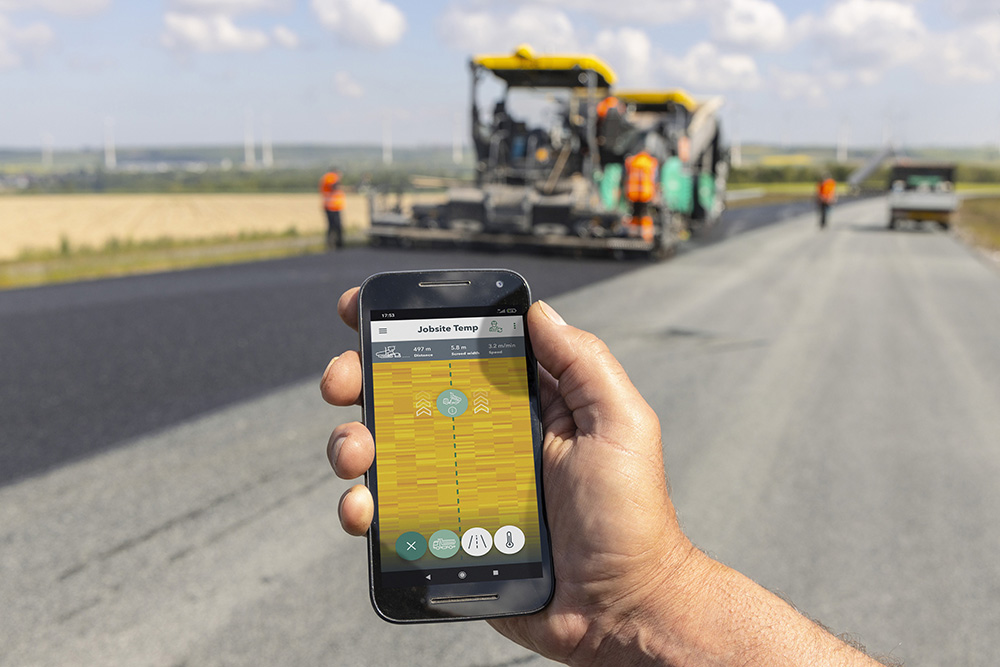
Paving temperatures can be monitored in real time on a smartphone, while the system automatically generates paving and logistics information.
Vögele has been offering a three-tier, modular digital road construction system, with different functional scopes. The three practical tools are designed for different construction projects and users and some of these tools can be combined or expanded. The RoadScan non-contacting measuring system allows users to monitor paving temperature across the whole paved area. The WITOS Paving Docu documentation tool records and analyses machine and process data, whilst the WITOS Paving Plus high-end solution allows all paving processes to be planned and optimised in real time. Vögele is expanding these three solutions by adding features that increase ease of use.
An important component is the new Jobsite Temp app. Users of WITOS Paving Docu and WITOS Paving Plus who also use the RoadScan temperature measuring system can connect to the paver using a QR code and activate the application. The Jobsite Temp app provides real time data access to relevant information for worksite personnel, such as paving supervisors and roller operators.
The foreman can use the system to view paving temperatures in real time as well as current pave speed, screed width and paver position. The system can show positions of trucks, including delivery note information and this makes it easier to work out where each should unload. Meanwhile, roller operators can view their own position and distance from the paver and define exclusion zones.
“The Jobsite Temp app gives paving crews a comprehensive real-time overview of all temperature data,” said Dr Stephan Weller, Software Products Manager at Vögele. The app and the paver are networked via WiFi, allowing information to be exchanged between the RoadScan temperature measuring system and the smartphone even where there is no mobile phone connection. The paver establishes a WiFi network with a radius of around 50-80m and acts as a server.
Vögele has also continued improving the temperature measuring system. RoadScan’s infrared camera measures paving temperatures up to 10m-wide across the mat, behind the screed. To avoid faults in the thermal image from moving objects, Vögele has developed automatic correction. The RoadScan system compares up to four images for a position and can detect moving obstacles such as compactors. These are removed from the thermal image, giving construction managers and paving supervisors an accurate overview of paving temperatures.
Vögele has also optimised odometer calibration as RoadScan’s GPS receiver and the odometer are calibrated automatically every 2m. “This prevents errors and saves additional effort,” said Dr Weller.
The WITOS Paving Docu documentation tool has new features that users can use to monitor paving data and progress more efficiently: paving crews have the option of entering target project values such as target tonnages, paving sections or areas directly in the Jobsite app and of tracking progress. They can also have displayed in the relevant truck history delivery notes from trucks which have already unloaded.
Vögele has expanded the WITOS Paving Plus process optimisation solution and made it easier for planners and construction managers to issue calls to tender. Once the relevant planning data has been entered in the control module, they can generate a template for a paving and logistics concept and produce a document that can be edited. This saves time and effort and gives the individual responsible the option of adding information or comments. “All the new features and developments linked to our digital road construction solutions ultimately have the same objective. We want to make life easier for planners, construction managers and paving crews and to give them the best possible support by providing reliable, straightforward and transparent information,” said Dr Weller.