Leica Geosystems offers smart compaction tool

Leica Geosystems is now offering a sophisticated machine control tool for use with compaction equipment. The firm’s advanced iCON roller package is said to offer contractors an effective solution that can deliver constant and effective compaction on any site. The new iCON roller has on-screen visualisation to show the user where completed passes have occurred and where more are needed for consistent results. Colour coding helps avoid costly reworking as pass count progress is constantly tracked. The unit
January 12, 2017 Read time: 2 mins
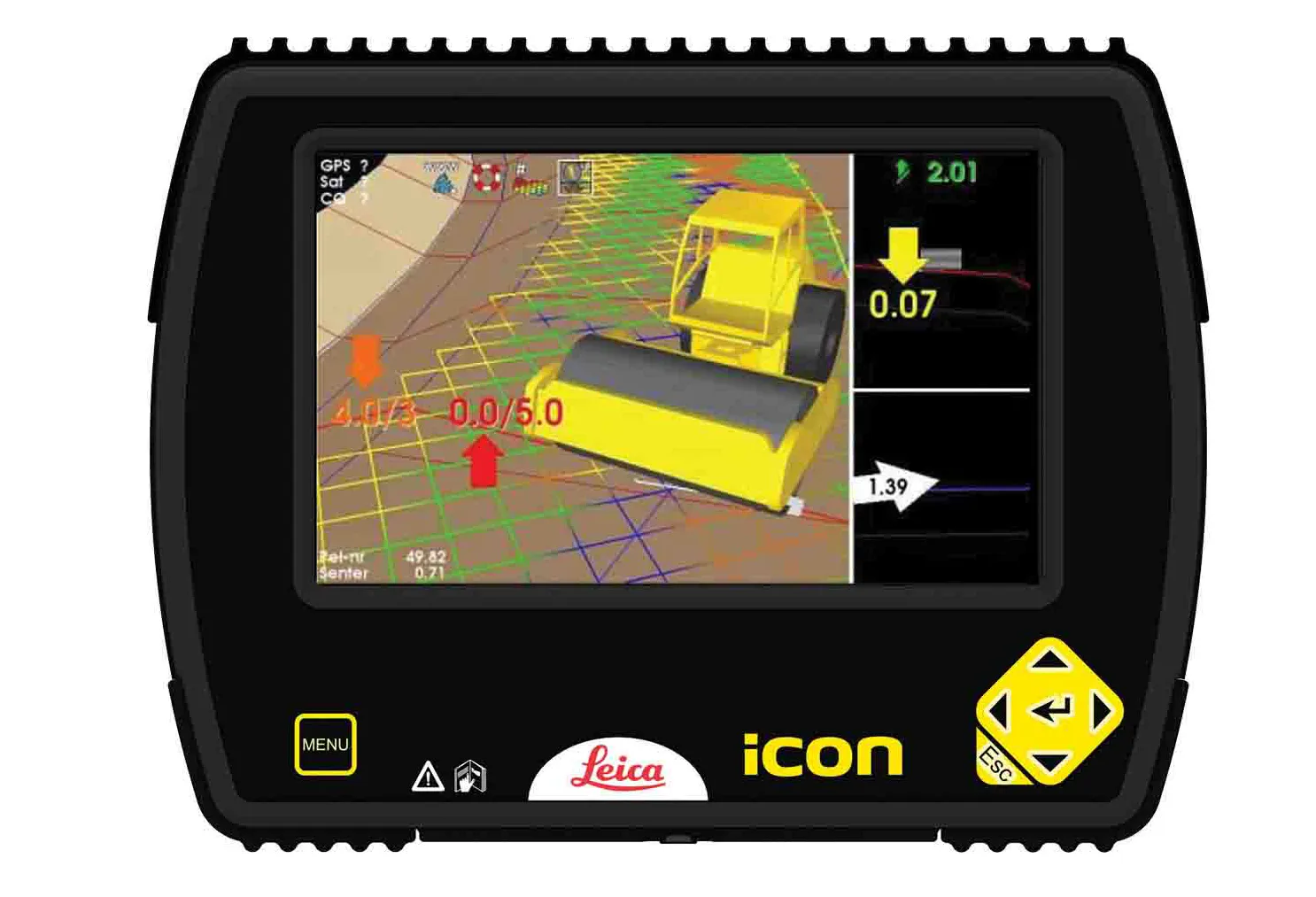
The new compaction tool from Leica Geosystems is said to boost accuracy
265 Leica Geosystems is now offering a sophisticated machine control tool for use with compaction equipment. The firm’s advanced iCON roller package is said to offer contractors an effective solution that can deliver constant and effective compaction on any site.

The new iCON roller has on-screen visualisation to show the user where completed passes have occurred and where more are needed for consistent results. Colour coding helps avoid costly reworking as pass count progress is constantly tracked. The unit is said to be simple to install and can be used on any soil and asphalt roller. It has a rugged panel that is fully protected for use on construction worksites, withstanding extreme temperatures and environmental conditions.

Using the firm’s high-accuracy GNSS solutions or total stations for work inside tunnels, precise positioning is achieved and continuously mapped. The job data is then stored in the panel’s on-board memory.  iCON telematics transfers this data via the cloud to the office for consistent job monitoring, resulting in improved quality control of the overall project. The new iCON roller also includes a reporting tool to generate useful job reports that document all compaction work.

For more information on companies in this article

Related Content

  • Data collection key to software developments
    February 13, 2012
    The collection and handling of data are key technology drivers in the software sector. New methods of data collection and manipulation are driving significant developments in software at present. The latest technology allows designers and engineers to collect, store and manipulate ever larger amounts of data. Growing use of mobile field equipment for both data collection and field management is driving interactive systems. And in an interview this month Autodesk senior vice-president for the construction an
  • New tablet solution for Leica Geosystems
    December 12, 2018
    Leica Geosystems is now using the rugged ZX70 Android tablet from Getac as the hardware for its new Leica Zeno GG04 plus Tablet Solution. The new partnership allows Leica Geosystems to bring geospatial data collection capabilities to customers in all terrains and weather conditions such as utilities, public services, transportation and construction. Leica Geosystems has developed a range of new software and hardware including its Zeno Mobile data collection app and Zeno GG04 plus smart antenna to capture a
  • Machine guidance and asset management aid fleet utilisation
    July 16, 2012
    Integrating Caterpillar's latest machine guidance and asset management tools offers efficiency gains for contractors in a competitive market. Mike Woof reports Caterpillar has been a leader in the development of GPS machine control systems through its partnership with Trimble. The manufacturer has rolled out a series of AccuGrade packages for various machines in its line-up, starting with the dozers and graders and then spreading to other machines such as scrapers, excavators and soil compactors. Caterpilla
  • Straight to the point for measurement
    February 6, 2018
    Leica Geosystems says it is introducing a major advance in site surveying. This offers a novel tilt compensation system, so that users are no longer required to hold the pole vertical. The new Leica GS18 T is claimed to be the world’s fastest GNSS RTK rover, while the firm is also offering the latest versions of Leica Captivate field software and Leica Infinity office software. With the addition of calibration-free GNSS and various upgrades to the Captivate field software and Infinity office software, use