Leica Geosystems offers smart compaction tool

Leica Geosystems is now offering a sophisticated machine control tool for use with compaction equipment. The firm’s advanced iCON roller package is said to offer contractors an effective solution that can deliver constant and effective compaction on any site. The new iCON roller has on-screen visualisation to show the user where completed passes have occurred and where more are needed for consistent results. Colour coding helps avoid costly reworking as pass count progress is constantly tracked. The unit
January 12, 2017 Read time: 2 mins
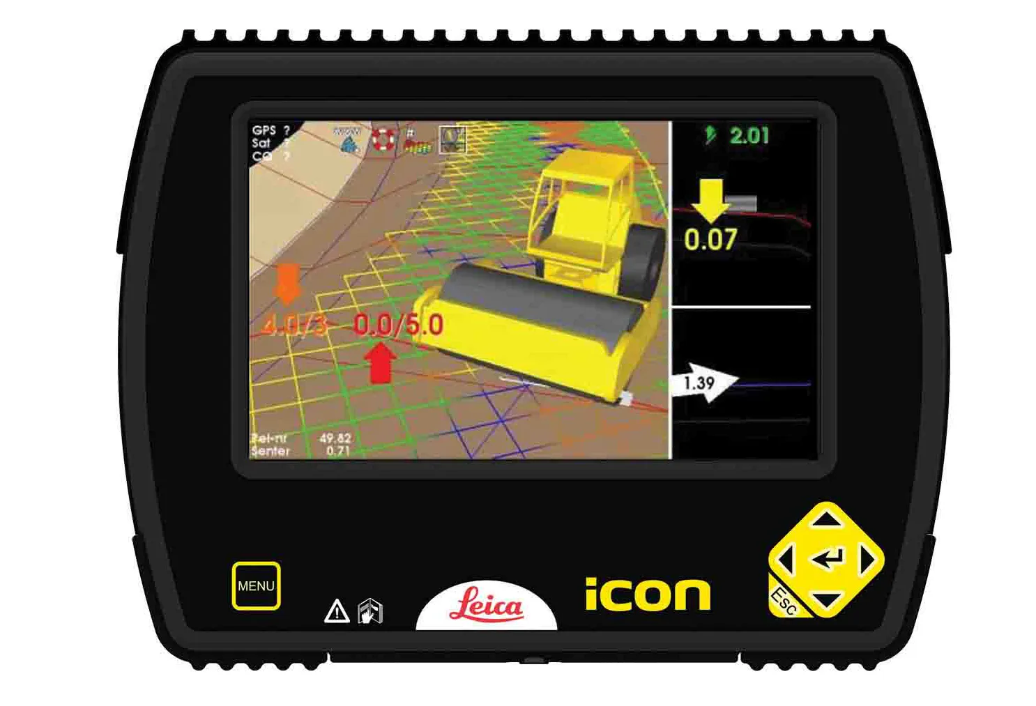
The new compaction tool from Leica Geosystems is said to boost accuracy
265 Leica Geosystems is now offering a sophisticated machine control tool for use with compaction equipment. The firm’s advanced iCON roller package is said to offer contractors an effective solution that can deliver constant and effective compaction on any site.

The new iCON roller has on-screen visualisation to show the user where completed passes have occurred and where more are needed for consistent results. Colour coding helps avoid costly reworking as pass count progress is constantly tracked. The unit is said to be simple to install and can be used on any soil and asphalt roller. It has a rugged panel that is fully protected for use on construction worksites, withstanding extreme temperatures and environmental conditions.

Using the firm’s high-accuracy GNSS solutions or total stations for work inside tunnels, precise positioning is achieved and continuously mapped. The job data is then stored in the panel’s on-board memory.  iCON telematics transfers this data via the cloud to the office for consistent job monitoring, resulting in improved quality control of the overall project. The new iCON roller also includes a reporting tool to generate useful job reports that document all compaction work.

For more information on companies in this article

Related Content

  • Data handling for efficient machine control
    October 16, 2012
    The rapid increase in information availability is transforming the construction sector. Conventional methods used for sourcing geographic data based on maps and localised sampling meant that there was often a lack of accurate information relating to ground conditions at specific areas where work was planned, often resulting in unwelcome surprises for construction companies along with additional costs for projects.
  • Novel survey solution from Hexagon
    January 6, 2023
    Leica Geosystems, part of Hexagon, says that its Leica iCON gps 160 package is a next-generation construction Smart Antenna with features that increase productivity for stakeout and measurement applications on the jobsite.
  • Leica Geosystems’ tools for site monitoring and handling GPR data
    October 11, 2017
    Leica Geosystems is offering new tools for construction firms for remote monitoring and for handling data from ground penetrating radar. With the GeoMoS Imaging package, users can stay up-to-date on remote monitoring; the live view allows observation and recording of areas of interest. A joystick provides remote access to the total station so that personnel can increase productivity and reduce time in the field.
  • Innovative compaction advances
    July 23, 2024

    Innovative asphalt compaction machines are now being introduced by several of the major manufacturers, with solutions offering improved working efficiency and performance.

    Three of the most innovative developments for asphalt rollers come from Dynapac, BOMAG and Hamm, although new asphalt compactors are also being introduced by other firms such as Ammann and Caterpillar.