Yotta is now offering the latest version of its Horizons visualised asset management platform. Version 2.6 of the package is said to provide a better user experience with improved visualisation.
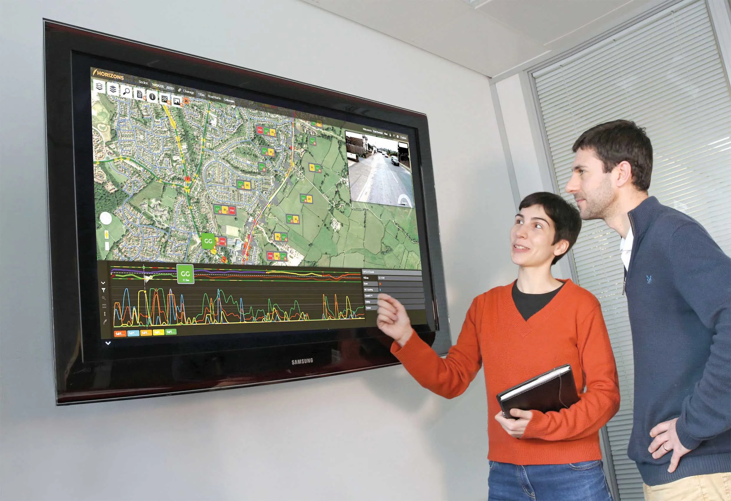
The latest version of the cloud-based solution also offers improved transparency with upgraded reporting providing clear and auditable work trails. Users of Horizons 2.6 can now directly link documents and images in Horizons, improving access to detailed information about a specific asset through the use of phot
RSS8110 Yotta is now offering the latest version of its Horizons visualised asset management platform. Version 2.6 of the package is said to provide a better user experience with improved visualisation.
The latest version of the cloud-based solution also offers improved transparency with upgraded reporting providing clear and auditable work trails. Users of Horizons 2.6 can now directly link documents and images in Horizons, improving access to detailed information about a specific asset through the use of photographs, drawings and plans. A new interface allows for integration of Horizons with other systems, such as works management software, to bring in live data for users. A cross-platform mobile app has also been developed in conjunction with the interface to provide the facility to upload and tag images.
The firm says it has made the interface more intuitive and easier to navigate with enhanced visualisation. It has also improved data access and sharing with the ability to create internal user groups. By moving away from a traditional software approach, the company claims it is giving users new levels of transparency on the analysis they undertake. This is said to result in clear, auditable evidence to support decision-making.
With new reporting functions and being easier to navigate and visualise, the changes provide access to new reporting elements such as predicted treatment lives. This helps users of Horizons better envisage and understand the outputs of analysis and also link more deeply and directly to UK Asset Management standards through the use of Gross and Depreciated Replacement Costs (GRC / DRC) directly in reports.
Horizons 2.6 also supports a wider range of document and image files than previous releases. Design drawings, photographs and field reports (PDF, .doc, JPEG and PNG) can now be linked to a specific asset and opened by other users of the Horizons platform. This can help improve working efficiencies by sharing information, in real time, with a much wider audience, potentially reducing the requirement for costly site visits.