Wireless mapping, data logging and asset management

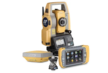
Topcon says that its advanced SiteLink technology provides a comprehensive information technology solution for equipment on construction sites. The SiteLink product is a wireless communications mapping, data logging, reporting and asset management package that can be used on off-highway equipment. According to Topcon the system can be used with any make, model or type of job site machine, regardless of manufacturer and age. The system can also pinpoint via GPS any make of equipment on a job site, serving as
February 24, 2012 Read time: 2 mins
342 Topcon says that its advanced SiteLink technology provides a comprehensive information technology solution for equipment on construction sites.

The SiteLink product is a wireless communications mapping, data logging, reporting and asset management package that can be used on off-highway equipment. According to Topcon the system can be used with any make, model or type of job site machine, regardless of manufacturer and age.

The system can also pinpoint via GPS any make of equipment on a job site, serving as a built-in theft protection tool.

SiteLink was developed jointly by Topcon and TSD Integrated Controls, a joint venture company of Topcon and 3157 Sauer Danfoss, and because of the communications technology integrated into the package, a user has real-time access to equipment based in remote locations at all times.

Achiel Sturm, TEP product marketing manager for construction products at Topcon Europe said: "The machines can talk to each other as well as to the computers in the office."

For more information on companies in this article

Related Content

  • Positioning tools continue to improve
    July 16, 2012
    Topcon says that its new IP-S2 package combines GNNS positioning capabilities with inertial sensors, while the firm also has a solution for customers wanting to mix and match receiver components. The IP-S2 is a vehicle-mounted, mobile 3D tool that offers precision mapping and surveying capabilities. The package collects data using 3D laser scanners, LIDAR, and/or cameras, and this is then integrated, time-stamped and geo-referenced. The customer can use this assembled data to combine LIDAR point cloud and d
  • Topcon unveils Hybrid Robotic System
    January 21, 2014
    Topcon Positioning Group has unveiled its Hybrid Robotic System, featuring the new DS series robotic total station and the recently announced MAGNET v2.0 software suite, a Topcon enterprise solution for the geomatics industry. Other Topcon components in the cutting-edge HRS include the economical HiPer SR GNSS receiver and Tesla large-screen tablet controller. The new system combines GNSS positioning and robotic measurements with an automated data workflow to provide added versatility and efficiency for
  • Manitowoc launches EnCORE Partner Programme for high quality rebuilds and its latest Falcon anti-collision system
    January 6, 2017
    A whole new raft of customer and product care systems took centre stage for Manitowoc at bauma as the crane manufacturer formally introduced its EnCORE Partner programme to the European, Middle Eastern and African (EMEA) markets and unveiled a new anti-collision system for the group’s Potain tower cranes.
  • Manitowoc launches EnCORE Partner Programme for high quality rebuilds and its latest Falcon anti-collision system
    April 18, 2013
    A whole new raft of customer and product care systems took centre stage for Manitowoc at bauma as the crane manufacturer formally introduced its EnCORE Partner programme to the European, Middle Eastern and African (EMEA) markets and unveiled a new anti-collision system for the group’s Potain tower cranes.