Versatile machine control package from Leica Geosystems

By Mike Woof April 25, 2024 Read time: 2 mins
Leica Geosystems is broadening its range of 3D solutions with its new iCON gps 120 antenna

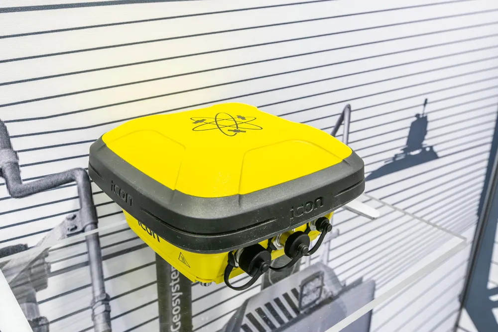
Leica Geosystems is widening its array of 3D machine control solutions with the introduction of its Leica iCON gps 120. This smart antenna offers customers a versatile machine control solution.

The nw Leica iCON 120 Machine Smart Antenna is integrated into the existing Leica MC1 solution platform and extends the machine control solution to more applications and machine types. Construction machines such as compaction rollers, which usually require only lower levels of accuracy without heading, can now be equipped with a tailor-made Leica MC1 machine control solution. This allows streamlined operations and consistent workflows between heavy construction equipment that vary in application requirements. Using the Leica MC1 machine control solution allows operators to carry out jobs more quickly and accurately, boosting fleet efficiency and reducing waste.

Construction customers can start with a single GNSS solution using a satellite-based augmentation system (SBAS) or HxGN SmartNet PPP service. If they need higher specifications, they can upgrade to an RTK solution with low or high accuracy by adding the communication unit Leica CR50. With a second iCON gps 120 Machine Smart Antenna, customers get a full high-accuracy dual GNSS solution with heading. A key feature of the design is that the antennas can be switched easily between Leica MC1 prepared machines due to the simple quick disconnect system.

“This solution is more versatile than our previous solution. You can take it from one machine to another and it’s perfect for rental machines. It’s an addition to our range, not a replacement for an existing unit,” according to Tommi Kauppinen, vice president, Heavy Construction, Machine Control Field Solutions at Leica Geosystems.
 

For more information on companies in this article

Related Content

  • Danish digging for Leica Geosystems’ 3D machine control
    October 26, 2017
    In Denmark’s northern Jutland, Leica Geosystems’ equipment is being used to help build a 40km motorway, one of the fastest-built such projects in the country’s history. The Danish Road Directorate is the client for the €5.4 million motorway between the two Danish cities of Herning, to the south with around 50,000 people, and Holstebro, a city of about 35,000 people, north of Herning. Preliminary ground investigations were made in 2013 and work started in 2015 with completion set for 2018.
  • Machine and machine control innovations in concrete paving
    June 28, 2013
    Machine innovations and machine control advances are the latest news in the concrete paving sector - Mike Woof reports. While machine control systems were pioneered in the concrete paving market, continuous refinement of the technologies is offering major improvements for customers. Customers have a choice now of more than one supplier while the packages are said to be more user-friendly than before. And in addition, the systems themselves can be more closely integrated into the machines due to advances mad
  • Topcon’s i33 versatile 3D indicate grade system
    April 2, 2014
    Topcon Positioning Group has unveiled a multi-platform 3D indicate grade system – i33. The new system features GPS technology and a graphical display and is said to provide a powerful indicate system at an economical price. The i33 is designed for quick installation and easy operation on many types of grading and earthmoving machinery. “It’s ideal for use on a dozer, scraper or virtually any type of machinery used for cut or fill operations,” said Kris Maas, manager of machine control product marketing f
  • It’s a level playing field with Leica’s iCON gps 70 Series
    April 27, 2018
    Efficiency is the name of the game from the iCON gps 70 Series, a GNSS rover from Leica Geosystems. With the iCON gps 70 T you can measure and stakeout points faster and without the need to keep the pole vertical and level the bubble. The combination of the latest GNSS technology and inertial measurement unit (IMU) equips the iCON gps 70 T with permanent tilt compensation and makes it resistant to any magnetic interference. Because the iCON gps 70 T is calibration-free, it can be ready instantly and any