Topcon’s advanced software for construction

Topcon Positioning is introducing the latest version of its MAGNET 5 software. This new version includes upgrades to the MAGNET Field, Office and Enterprise applications designed for advanced performance, third-party integration, and construction planning and oversight capability. The package offers new flexible display options and additional customisable data labels. Additionally, operators can view GNSS status when the controller is connected to a total station in Hybrid mode, and show offsets as a visua
December 12, 2018 Read time: 2 mins
The new MAGNET package from Topcon Positioning offers additional capabilities for use with machine control technologies

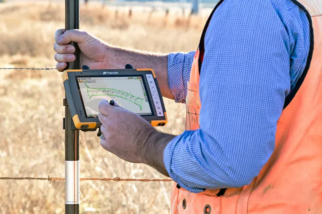
342 Topcon Positioning is introducing the latest version of its MAGNET 5 software. This new version includes upgrades to the MAGNET Field, Office and Enterprise applications designed for advanced performance, third-party integration, and construction planning and oversight capability.

The package offers new flexible display options and additional customisable data labels. Additionally, operators can view GNSS status when the controller is connected to a total station in Hybrid mode, and show offsets as a visual reference when staking roads and lines. Improvements to MAGNET Field also contain new vertical construction capabilities including reflectorless layout.

The MAGNET system also supports third-party construction and survey file types. It includes filtering and editing capabilities to bring Autodesk and Bentley design files to the office or directly to field software. MAGNET Enterprise updates feature new cloud connection to Autodesk BIM 360 and Bentley ProjectWise as well as unlimited project file storage.

Additions to MAGNET Office are designed to be centred on contractor needs and include new advanced corridor functionalities for machine control file preparation, Mass Haul application improvements, and an integration of BIM for infrastructure features directly into the suite. 

For more information on companies in this article

Related Content

  • Sophisticated deformation monitoring system from Topcon
    January 17, 2018
    Key upgrades are now available for the Delta Solutions deformation monitoring system from the Topcon Positioning Group. The improvements include software management upgrades and advanced modular configurations. The Delta Solutions package now benefits from new configuration choices employing either robotic total stations or GNSS with the ability to add leveling sensors.
  • Topcon’s multi-platform i33 3D indicate system
    January 6, 2017
    The i33 is Topcon’s cutting-edge economical and multi-platform 3D indicate grade system. The new system features GPS technology and a graphical display to provide a powerful indicate system at an economical price.
  • Advancing asphalt paving technology
    April 5, 2016
    Asphalt paver manufacturers are meeting demands for high performance machines that can deliver a quality mat - Mike Woof reports Major manufacturers are rolling out ranges of new asphalt pavers designed to meet the latest emissions regulations for Europe, as well as developing models to suit customers in developing nations. The firms have designed many of the latest machines to meet tough new emissions legislation, although versions will also be available for less regulated markets also. Ammann has up
  • Sokkia is offering new field service solutions for GNSS
    January 31, 2017
    Sokkia is introducing new field and office software solutions for its total stations, robotics and GNSS rover systems. These are the GeoPro Field and GeoPro Office packages. GeoPro Field provides a graphical user interface designed to collect field measurements for land surveying and construction activities. Sokkia GeoPro Office is the office-processing complement to the field software and can clean, process, and analyse field data into an easy-to-use form. The office software can also be expanded wi