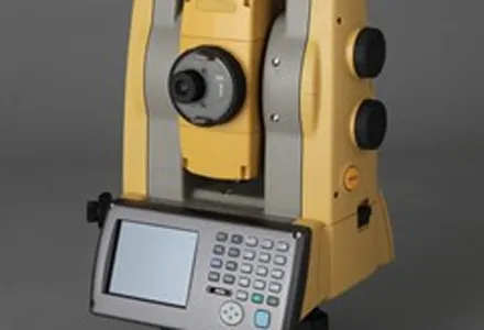
Topcon Europe Positioning (TEP) has launched a new, professional-grade robotic total station – the PS series – which the firm says is designed to surpass the power, accuracy and capabilities of its peers. The PS is said to utilise Topcon’s new PowerTrac technology to increase the prism tracking power. “Using new optics, laser system and advanced algorithms, PowerTrac provides the PS with the ability to keep tracking a moving prism even under the toughest environmental conditions,” said Leighton Davies, surv
RSS
“The PS has an extremely fast and powerful EDM (electronic distance measurement) and with the new MAGNET software onboard, each PS total station is ready of both one-man and two-man field operations,” added Davies.
The PS employs a phase shift EDM that, according to Topcon PS, has a smaller beam width than other reflectorless instruments in its class. The Topcon algorithm is said to reduce the noise associated with reflectorless measurements, providing an accurate result to most surfaces over longer distances up to a 1,000m non-prism range.
Topcon’s claimed smaller beam width is also said to enable measurements to be taken in tough situations, such as through a chain link fence to a building or other critical surface.
Waterproof and dustproof, the PS series is described by Topcon PS as having an advanced security and maintenance system (TSshield); an exclusive communications module (LongLink); and an integrated remote system (RC-5).
If the PS has been reported stolen, a signal can be sent to the instrument to disable it. To keep the instrument’s operating system up to date, a cloud-based server sends a message to the PS to advise the operator that a newer firmware version is available for download. With TSshield, Topcon PS say owners can even track the instrument location on a web-based map view.
Another of Topcon’s exclusive technologies – LongLink – is said to provide groundbreaking operational capabilities for a model of its kind. Davies said. “With a 600m wireless communication range, LongLink allows full operation of the PS from the prism pole, using the RC-5 remote system, field controller or Topcon Tesla tablet.”
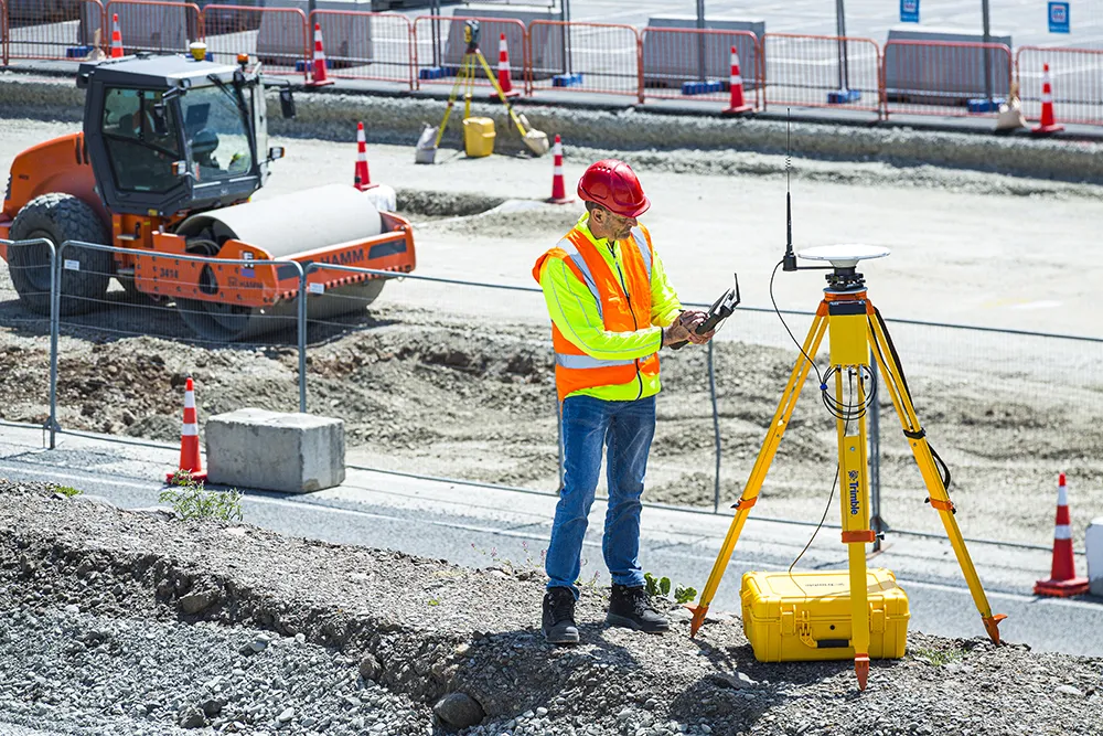
The PS is designed for use on a wide range of applications – building layout, earthwork volumes, land surveying, construction stakeout and even machine control LPS operation.
Additional features of the PS series include IP65 dust and waterproof rating; automatic angle measurement calibration; large graphic and colour touchscreen; backlit keyboard for use in bright or low light; USB flash drive port; and availability in 1, 3 and 5 arc second models.
“The PS has an extremely fast and powerful EDM (electronic distance measurement) and with the new MAGNET software onboard, each PS total station is ready of both one-man and two-man field operations,” added Davies.
The PS employs a phase shift EDM that, according to Topcon PS, has a smaller beam width than other reflectorless instruments in its class. The Topcon algorithm is said to reduce the noise associated with reflectorless measurements, providing an accurate result to most surfaces over longer distances up to a 1,000m non-prism range.
Topcon’s claimed smaller beam width is also said to enable measurements to be taken in tough situations, such as through a chain link fence to a building or other critical surface.
Waterproof and dustproof, the PS series is described by Topcon PS as having an advanced security and maintenance system (TSshield); an exclusive communications module (LongLink); and an integrated remote system (RC-5).
If the PS has been reported stolen, a signal can be sent to the instrument to disable it. To keep the instrument’s operating system up to date, a cloud-based server sends a message to the PS to advise the operator that a newer firmware version is available for download. With TSshield, Topcon PS say owners can even track the instrument location on a web-based map view.
Another of Topcon’s exclusive technologies – LongLink – is said to provide groundbreaking operational capabilities for a model of its kind. Davies said. “With a 600m wireless communication range, LongLink allows full operation of the PS from the prism pole, using the RC-5 remote system, field controller or Topcon Tesla tablet.”
The PS is designed for use on a wide range of applications – building layout, earthwork volumes, land surveying, construction stakeout and even machine control LPS operation.
Additional features of the PS series include IP65 dust and waterproof rating; automatic angle measurement calibration; large graphic and colour touchscreen; backlit keyboard for use in bright or low light; USB flash drive port; and availability in 1, 3 and 5 arc second models.