Topcon releases SurveyMaster Lite

Topcon Europe Positioning has released SurveyMaster Lite, a new CAD-based desktop application for surveying and job site information editing and plotting. Mark Contino, TPS (Topcon Positioning Systems, Livermore, USA) vice president of product marketing, said: "SurveyMaster Lite is a cost-efficient surveying office software package perfect for the cadastral surveying and construction stakeout professional."
February 13, 2012 Read time: 2 mins
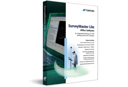
342 Topcon Europe Positioning has released SurveyMaster Lite, a new CAD-based desktop application for surveying and job site information editing and plotting.

Mark Contino, TPS (Topcon Positioning Systems, Livermore, USA) vice president of product marketing, said: "SurveyMaster Lite is a cost-efficient surveying office software package perfect for the cadastral surveying and construction stakeout professional." Modelled from Topcon's SurveyMaster software program, SurveyMaster Lite is loaded with survey specific functionality as well as surface modelling and contouring tools. It provides tools required to produce final plats and survey calculations for property surveys, topographic maps and ALTA surveys, and is designed so users can manage data from raw format all the way through to a finished plot. Survey calculations can be completed and uploaded to the field collector for stakeout and field verification.

Contino said: "SurveyMaster Lite is the perfect addition to complete any Topcon instrument system. It completes the cycle of a 'field-to-finish' solution. The program is on the USB drive so users can simply take the USB Drive with them and have the program on any PC.

"It was designed by surveyors that have the software experience needed to understand what is needed to manage site and surveying data efficiently."

For more information on companies in this article

Related Content

  • Topcon’s new haul management software
    January 4, 2016
    Topcon Positioning is updating its DynaRoad mass haul management software. The new DynaRoad v5.4.1 package helps streamline workflows through additional features for planning, scheduling and project control. In addition to an updated interface and new map views, DynaRoad now offers greater interoperability to the MAGNET Office software suite. The firm says that this update allows users to complete projects faster and streamline information to maximise profit and reduce risk. The DynaRoad software provide
  • Proper GPR Surveying Techniques
    May 10, 2019
    A sustainably good road surface often depends on how well understood is the ground underneath the road’s route. Brian Jones* offers some best practice and advice for getting the most from ground-penetrating radar investigations Ground-penetrating radar (GPR) is one of the most accurate non-destructive testing (NDT) methods available. To get the most from GPR surveying, it is absolutely essential to understand how GPR tools work and follow best practices when conducting surveys. Key areas to be aware o
  • GPS guidance delivers accurate machine control
    July 12, 2012
    GPS systems for machine control can make massive reductions in operating costs for contractors. Using GPS systems for machine control can make massive reductions in operating costs for contractors and the pace of technology improvements from manufacturers has been rapid. This market segment is dominated by Leica Geosystems, Trimble and Topcon, all of which introduced an array of new products earlier this year. Topcon's dozer control system first seen in public at the Intermat show in Paris, offers notable c
  • Not lost in translation – detecting BIM changes
    May 22, 2018
    A new package from 3D Repo offers effective real-time BIM change detection. This cloud-based change detection software can be used for 3D construction models to avert BIM issues from unregistered changes. This solution is said to provide a fast and reliable way to detect changes in underlying 3D models, using an encrypted web browser. The patent pending innovation operates on any 3D models, regardless of their file type, software used to produce them or file size. Called 3D Diff, the 3D Repo solution also a