
Topcon and Bentley training event

Topcon Positioning Group and Bentley Systems has run the first in its collaborative Constructioneering Academy initiatives The first session was held recently in Livermore, California. The two firms have joined efforts to provide opportunities designed to allow construction industry professionals to learn best practices in constructioneering, a process of managing and integrating survey, engineering, and construction data, to streamline construction workflows and improve project delivery. This approach
April 12, 2018 Read time: 2 mins
Topcon Positioning Group and Bentley Systems has run the first in its collaborative Constructioneering Academy initiatives


The first session was held recently in Livermore, California. The two firms have joined efforts to provide opportunities designed to allow construction industry professionals to learn best practices in constructioneering, a process of managing and integrating survey, engineering, and construction data, to streamline construction workflows and improve project delivery.

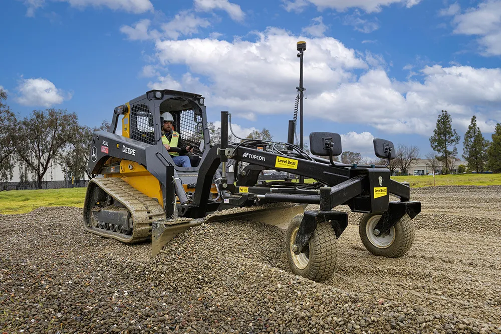
This approach allows data from design models to be transferred to machine control systems for more efficient working. Data can then be recovered from machines for analysis and also to the project model, providing accurate as-built information. The new joint initiative will allow construction firms to capitalise on this data sharing process, providing a BIM approach for more efficient project delivery.

“The courses are designed in a dialogue format to allow 342 Topcon and 6197 Bentley personnel to interact directly with attendees to cater the experience for their specific questions and demands,” said Ron Oberlander, senior director of Topcon Professional Services. “The future of construction automation continues to move forward with constructioneering digital workflows, which make the work of surveyors, engineers, and construction professionals automated, continuous, and continuously more valuable, throughout project life cycles and beyond completion.”

“Topcon and Bentley’s federated constructioneering technologies enable firms to gain unprecedented digital visibility and insights into their project outcomes, as compared to traditional construction workflows. Attendees of our academy will learn how their organisations can improve project delivery by leveraging technology, methods, and best practices to execute their projects more efficiently, monitor construction performance and progress, and reduce project costs,” said Vinayak Trivedi, Bentley Institute vice president.   

The Constructioneering Academy will continue with additional sessions throughout learning centres located worldwide, designed to reach industry professionals with hands-on training in real world scenarios and workflows.

For more information on companies in this article

Related Content

  • Safe construction amidst challenging times
    August 24, 2020
    Taking a steer on health and safety is crucial in these challenging times
  • Reality check: Topcon’s Aptix
    July 20, 2023
    The biggest challenge facing construction professionals and general contractors is disconnected data and/or siloed data sources. The recently launched Aptix integration platform has broken down these silos, explains Topcon’s Scott Langbein.
  • New project software developed by Bentley
    February 8, 2018
    Bentley Systems claims that its OpenRoads ConceptStation modelling package allows highway engineering professionals to quickly build conceptual road and bridge models. The software allows rapid conceptual and preliminary design, using information obtained through point clouds, reality meshes, GIS, and other sources. OpenRoads ConceptStation combines engineering drawing tools and project costs to improve decision-making in the design phase. Benefits include increasing design productivity, identifying
  • Positioning tools continue to improve
    July 16, 2012
    Topcon says that its new IP-S2 package combines GNNS positioning capabilities with inertial sensors, while the firm also has a solution for customers wanting to mix and match receiver components. The IP-S2 is a vehicle-mounted, mobile 3D tool that offers precision mapping and surveying capabilities. The package collects data using 3D laser scanners, LIDAR, and/or cameras, and this is then integrated, time-stamped and geo-referenced. The customer can use this assembled data to combine LIDAR point cloud and d