Straight to the point for measurement

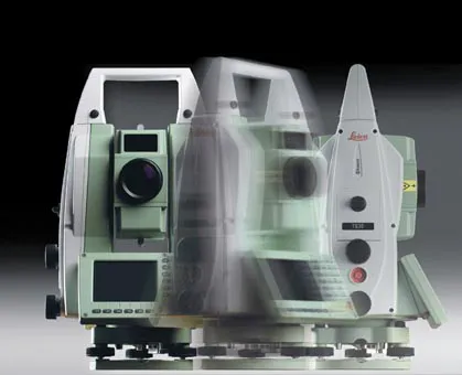
Leica Geosystems says it is introducing a major advance in site surveying. This offers a novel tilt compensation system, so that users are no longer required to hold the pole vertical. The new Leica GS18 T is claimed to be the world’s fastest GNSS RTK rover, while the firm is also offering the latest versions of Leica Captivate field software and Leica Infinity office software. With the addition of calibration-free GNSS and various upgrades to the Captivate field software and Infinity office software, use
February 6, 2018 Read time: 2 mins
More accurate measurements can be taken more quickly with the new package from Leica Geosystems
265 Leica Geosystems says it is introducing a major advance in site surveying. This offers a novel tilt compensation system, so that users are no longer required to hold the pole vertical. The new Leica GS18 T is claimed to be the world’s fastest GNSS RTK rover, while the firm is also offering the latest versions of Leica Captivate field software and Leica Infinity office software.


With the addition of calibration-free GNSS and various upgrades to the Captivate field software and Infinity office software, users are said to benefit from self-learning GNSS and engaging, intuitive software interfaces.  

Improved efficiency is claimed for the GS18 as a user no longer has to level the pole nor calibrate the system. The GS18 T is a calibration-free and tilt compensating GNSS RTK rover that is also said to be immune to magnetic disturbances. GNSS measurements can be taken from any position on site, saving users up to 20% of time in the field over conventional surveying practices according to the firm. As the only GNSS RTK rover to use precise enough inertial measuring units (IMUs) and not a compass, users can measure with a tilted pole close to buildings or metallic objects.

The GS18 T records how the pole was levelled during the measurement and stores the values, ensuring measurement traceability and quality reporting. Easy-to-use, the new GNSS RTK rover ensures users and managers increase productivity and reduce time on site.

Fully supporting the GS18 T, Leica Captivate v3.0 field software and Leica Infinity v2.4 office software now offer users a more immersive means of control on site and at the desk. Captivate allows configuration of the GS18 T for all measuring and staking applications and the visualisation of tilt compensated measurements. Measured data can be directly imported into Infinity or exported into a variety of formats suitable for CAD packages. Within Infinity, users can visualise the measured data, including the creation of reports providing traceability and quality assurance.

For more information on companies in this article

Related Content

  • Automated testing is safer, cheaper and more thorough
    December 12, 2018
    Automated testing is improving safety during paving and saving on testing costs. But it could also help reduce long-term maintenance costs too - Kristina Smith writes Testing pavements as they are laid can be a hazardous activity. The technician may be on their hands and knees, far behind the main gang, or reaching inside the hopper to measure the temperature of the hot mix or dodging rollers to take density readings.
  • Hemisphere GPS and Carlson Software's 'strategic' alliance
    March 2, 2012
    US firms Hemisphere GPS and Carlson Software have formed a 'strategic alliance'. The move, according to the companies, will provide a roadmap for new, integrated solutions for land survey, mapping, construction, mining and other key machine control markets.
  • Precision pinpointing
    March 1, 2012
    Leica Geosystems says that its TS30 package is a new high precision Total Station that meets highest standards in all surveying applications. Distances can now be measured with Leica Geosystems' proven PinPoint EDM Technology with an unprecedented precision of 0.6mm + 1ppm on prisms. On natural surfaces a high accuracy of 2mm + 2ppm up to 1,000m can be achieved.
  • Optimising operations with construction software gains
    May 20, 2015
    Innovations in construction software are helping boost project efficiency and optimising project operations – Clive Davidson writes Over the past decade, while construction engineers have been putting up buildings or infrastructure, software engineers have been developing a parallel universe where virtual buildings or infrastructure can be created in ever increasing detail. What started with 2D architectural drawings in computer-aided design (CAD) systems, has become a multi-dimensional world, with 3D ge