Spot on with Trimble’s X7 3D scanner

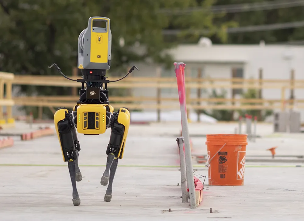
The X7 solution was jointly developed by Trimble and Boston Dynamics.
By Mike Woof November 25, 2021 Read time: 2 mins
Autonomous surveying and scanning is possible using the new package from Trimble

Remote surveying and scanning can be achieved using the autonomous robotic system available from Trimble. The package combines the Spot robot autonomous rover unit with the Trimble X7 3D laser scanner and Trimble FieldLink software.

This solution has been jointly developed between Trimble and Boston Dynamics and allows autonomous operation on construction sites. The system takes advantage of the robot's ability to navigate challenging, dynamic and potentially unsafe environments. Trimble's 3D data capture technology can deliver a continuous flow of information between the field and the office for documentation of jobsite progress.

The innovative package allows users to make important decisions, rather than waiting for the information to be relayed to project staff. The integration is focused on the automated capture of field construction data through the use of Trimble 3D capture technology and the Spot robot. The autonomous workflow for the X7 laser scanner uses fully integrated Spot robot controls in FieldLink software to create a predefined path of waypoints for Spot to follow and collect laser scans.

Laser scans collected using the X7 scanner and the Spot robot can be tied to a jobsite project coordinate system, as well as individual scan stations. The data is collected, and then made into a composite point cloud in real-time on the Trimble tablet controller before leaving the site. While performing autonomous operations, Spot's docking station enables in-field charging of batteries on both the robot and the X7 3D laser scanner, and also provides the continuous transfer of data through a Gigabit Ethernet connection to the office.

For more information on companies in this article

Related Content

  • Road recycling
    September 27, 2023
    Easier to operate, thanks to the increasing use of GPS, and greener to run because of biofuels are two of the more innovative technologies being integrated into machine design by major road recycling equipment manufacturers.
  • An improved paving control system is available from MOBA
    January 6, 2017
    MOBA is aiming to improve paving quality and cut contractor’s costs with its sophisticated heat measuring package for asphalt pavers, as well as its new sonic ski system. Called the PAVE-IR, this heat measuring system provides accurate temperature scanning and monitoring of mat temperature during asphalt paving. This can be documented for an entire project and allow contractors to optimise processes and verify the quality of paving work. Marketing manager Christine Seidel said, “The early generation system
  • An improved paving control system is available from MOBA
    February 8, 2013
    MOBA is aiming to improve paving quality and cut contractor’s costs with its sophisticated heat measuring package for asphalt pavers, as well as its new sonic ski system. Called the PAVE-IR, this heat measuring system provides accurate temperature scanning and monitoring of mat temperature during asphalt paving. This can be documented for an entire project and allow contractors to optimise processes and verify the quality of paving work. Marketing manager Christine Seidel said, “The early generation system
  • Going Digital helped the Government of Malaysia leverage digital twins to deliver trusted information for better project and asset management.
    March 30, 2020
    In 2014, the government of Malaysia announced a plan to fully develop and upgrade the two-lane trunk road across Malaysia’s largest state, Sarawak, to accelerate socioeconomic growth in East Malaysia.