Spot on with Trimble’s X7 3D scanner

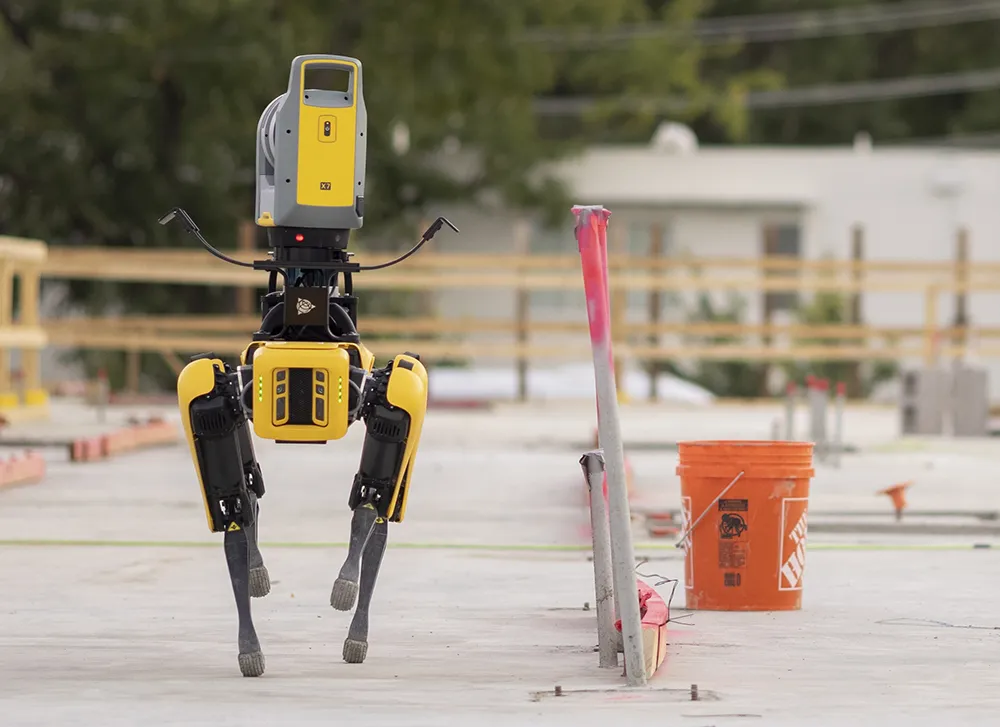
The X7 solution was jointly developed by Trimble and Boston Dynamics.
By Mike Woof November 25, 2021 Read time: 2 mins
Autonomous surveying and scanning is possible using the new package from Trimble

Remote surveying and scanning can be achieved using the autonomous robotic system available from Trimble. The package combines the Spot robot autonomous rover unit with the Trimble X7 3D laser scanner and Trimble FieldLink software.

This solution has been jointly developed between Trimble and Boston Dynamics and allows autonomous operation on construction sites. The system takes advantage of the robot's ability to navigate challenging, dynamic and potentially unsafe environments. Trimble's 3D data capture technology can deliver a continuous flow of information between the field and the office for documentation of jobsite progress.

The innovative package allows users to make important decisions, rather than waiting for the information to be relayed to project staff. The integration is focused on the automated capture of field construction data through the use of Trimble 3D capture technology and the Spot robot. The autonomous workflow for the X7 laser scanner uses fully integrated Spot robot controls in FieldLink software to create a predefined path of waypoints for Spot to follow and collect laser scans.

Laser scans collected using the X7 scanner and the Spot robot can be tied to a jobsite project coordinate system, as well as individual scan stations. The data is collected, and then made into a composite point cloud in real-time on the Trimble tablet controller before leaving the site. While performing autonomous operations, Spot's docking station enables in-field charging of batteries on both the robot and the X7 3D laser scanner, and also provides the continuous transfer of data through a Gigabit Ethernet connection to the office.

For more information on companies in this article

Related Content

  • Advances in asphalt paving equipment coming to market
    June 27, 2018
    Some of the key manufacturers are improving asphalt paving technology with key developments to machines as well as the electronics and telematics systems fitted – Mike Woof writes. Several of the major asphalt paver manufacturers have unveiled new machines and systems that can optimise operations. Improved operating features for the BOMAG BF 800 C-2 paver are said to help increase its output and efficiency when working on-site. An important development is the new traffic light system, which helps improve co
  • Software innovations aid road design
    February 24, 2012
    As an aid to design, construction software continues to be a foundation stone in new project development. Autodesk is working with the Incheon Free Economic Zone (IFEZ) and the Incheon Urban Development Corporation (IUDC) to cooperate in the creation of Asia's first Digital City for Incheon.
  • Topcon to smoothen roads with SmoothRide system
    February 28, 2018
    Topcon Positioning has developed a sophisticated package that can help deliver better road surface quality. The firm’s latest SmoothRide data collection package is said to make the mapping of road conditions easier and more efficient. The new RD-M1 Collect 2.0 package has an improved interface and a new graphical interface status bar that indicates the optimum speed for collecting road information based on the project requirements.
  • PTV’s novel traffic analysis system
    April 25, 2013
    German traffic analysis consultant and software maker PTV, which produces the well-known Visum and Vissim strategic traffic analysis and micro-simulation tools, has launched a new assessment tool aimed at studying traffic impact of new developments. PTV Vistro is claimed to be the first all-in­ one-solution for transport analysis and signal optimisation, an easy-to-use software that can be used to conduct traffic studies which are often a mandatory part of development applications and planning approvals.