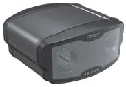
Sophisticated scanning tool from Leica Geosystems

A new laser scanning tool from Leica Geosystems offers accurate and fast 3D imaging laser scanning capabilities. The Leica BLK360 is said to be compact and easy to use, offering powerful spherical image capture duties. The firm says that the unit allows professionals to capture 360° imagery within minutes.
November 8, 2017 Read time: 1 min
A new laser scanning tool from 265 Leica Geosystems offers accurate and fast 3D imaging laser scanning capabilities. The Leica BLK360 is said to be compact and easy to use, offering powerful spherical image capture duties. The firm says that the unit allows professionals to capture 360° imagery within minutes.


Users place the lightweight BLK360 on a level surface or tripod and, with the push of a single button, it captures the HDR spherical imagery and takes a 360,000 point/second laser scan. Getting measurements right first time, the BLK360 features +-4mm accuracy at 10m and an overall 0.6 - 60m range. Within three minutes, the spherical image and laser scan is completed and ready to view in the 685 Autodesk ReCap Pro for mobile app, which runs on an iPad Pro. From there, users can take measurements, add markup and annotations or share onsite data in the office.

For more information on companies in this article

Related Content

  • Number plate recognition tools
    February 28, 2012
    CitySync is offering an array of new tools for the traffic sector. The JellyBean is a mobile automatic number plate recognition (ANPR) camera aimed at use by enforcement agencies and is designed specifically to be mounted on police vehicles. This advanced dual ANPR camera incorporates mono and colour overview cameras, uses sophisticated infra-red LED technology and features a compact and durable casing.
  • Sophisticated technology allows milling accuracy
    January 14, 2021
    Given the increase in vehicle numbers and that modern vehicles are heavier, it is more important for modern highways to be constructed to higher standards than previously.
  • Efficient concrete inspection from GSSI
    June 17, 2016
    A new portable tool from GSSI offers fast and accurate analysis of concrete structures. The firm’s latest handheld ground penetrating radar (GPR) can be used for concrete inspection Industry. The StructureScan Mini series is a handheld, all-in-one GPR system for locating rebar, conduits, post-tension cables and voids. The unit can also be used to determine concrete slab thickness in real time. The firm offers the product in two models, the standard StructureScan Mini and the high resolution StructureSca
  • Sophisticated new loaders
    March 10, 2021
    Sophisticated new wheeled loaders are now coming to market from key suppliers