Sophisticated georeferencing technology from Applanix

Applanix is now offering the Trimble AP+ Air OEM solution for Direct Georeferencing of airborne sensor data.
November 24, 2020 Read time: 2 mins
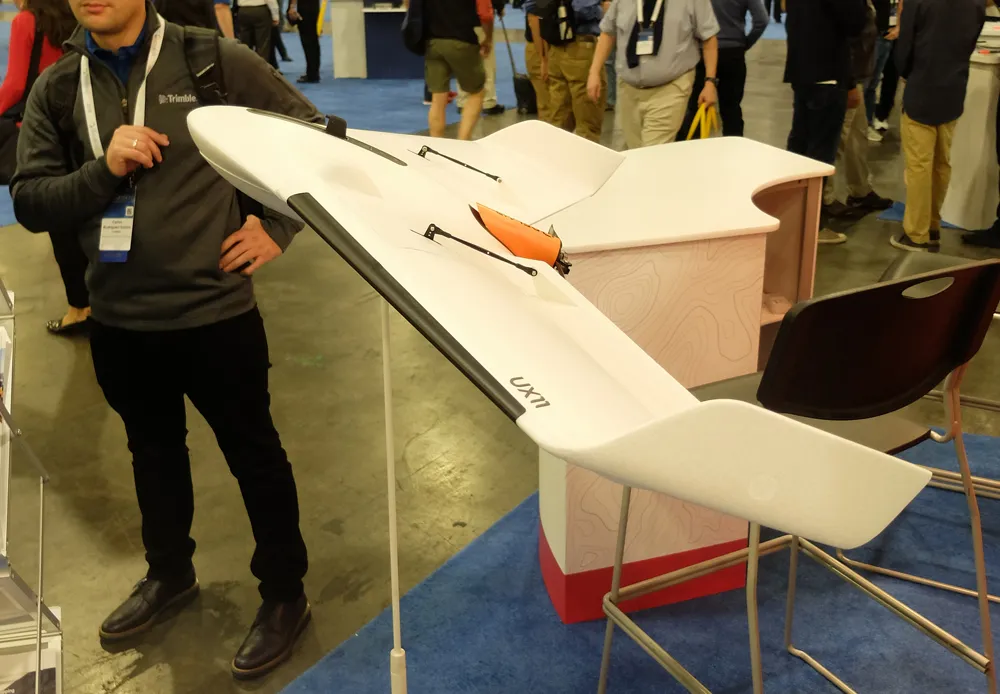
Applanix is now offering new georeferencing technology that can be used for data recovered from UAVs

The tool allows users to generate maps and 3D models without the use of ground control points. The Trimble AP+ Air can be used for manned platforms as well as on unmanned aerial vehicles (UAVs). It can be used with almost all airborne remote sensors, including photogrammetric cameras, LiDAR, hyper and multi-spectral cameras, and synthetic aperture radar.

Using advanced compact, low-power hardware, the Trimble AP+ Air features dual embedded survey-grade GNSS chipsets, an onboard inertial measurement unit (IMU), an external IMU, and the all-new Applanix IN-Fusion+ GNSS-aided inertial firmware. It is configurable to support the Direct Georeferencing accuracy demands of low-flying UAVs to high-altitude manned platforms.

The firm is part of the Trimble Group and has taken advanced features of Applanix Direct Georeferencing and Trimble GNSS technology and packaged these into a compact and versatile solution, according to Applanix. The company adds that systems integrators can embed a hardware solution that can be configured to meet different Direct Georeferencing needs of a specific sensor type.

The Trimble AP+ Air is supported by the Applanix POSPac MMS post-processing software, which features CenterPoint RTX post-processing for centimetre-level positioning without base stations.

For LiDAR integrators, the Trimble AP+ Air is compatible with the POSPac MMS LiDAR QC Tools for computing boresight as well as adjusting the relative accuracy of the POSPac trajectory being used to generate the point cloud. For integration with cameras, the solution is supported by the POSPac MMS Photogrammetry Tools for computing boresight and performing camera IO quality control.

For more information on companies in this article

Related Content

  • GPS technology developments
    June 13, 2012
    The use of GPS-inclusive technology is proving invaluable to contractors responsible for major transport-related construction projects across the globe. Guy Woodford looked at some of the latest and imminent site solutions featuring GPS Staff at Trimble Heavy Construction based in Sunnyvale, California recently finished developing three new solutions for connecting the construction site. The Trimble Connected Office, the Trimble Connected Controller and the Trimble Connected Machine, are all now available t
  • Sophisticated slipformer control from Wirtgen
    August 10, 2018
    Wirtgen is now offering a new version of its concrete slipformer control package. This new tool offers additional capabilities and improved performance over the earlier version. The company claims that its upgraded Wirtgen AutoPilot 2.0 package can deliver a higher paving accuracy along with lower costs. Newly-developed, this package is said to produce a wide array of offset and inset profiles, while also delivering these more economically and precisely than with the previous version. The 3D system can eit
  • Bentley is building its software solutions portfolio
    May 14, 2015
    Bentley Systems continues to develop its portfolio of software solutions - Mike Woof writes One of the leaders in the field of construction software, Bentley Systems is developing its array of solutions for industry users. The company is growing both by acquisition and organically, using its financial strength to buy up smaller niche firms as well as developing the capabilities of its in-house software further. The company has recently made three key acquisitions, for EADOC, Acute3D and C3global. The
  • Laser scanning focuses on asset management
    January 9, 2015
    Laser scanners and improved data collection and analysis software are making light of asset management surveying. David Arminas reports The age of the laser scanner is upon us, taking over from traditional manual methods of surveying, data collection and processing. These new technical developments are making it much easier to process and use the data captured and are providing highways engineers with powerful tools to record, map and visualise their assets. This is good news for highways authorities