Sophisticated geopositioning tool from Topcon

Topcon says that its new T-18 handheld controller offers accuracy for geopositioning, construction, mapping and vertical construction applications. The controller includes a sunlight-readable display with a 1GHz processor, 1GB of internal storage, and up to 10 hours of battery life. “For MAGNET Field data collection, the T-18 controller offers a durable ergonomic solution with faster processing, a larger screen, better connectivity and longer battery life than previously available comparable systems,” said
October 9, 2018 Read time: 2 mins
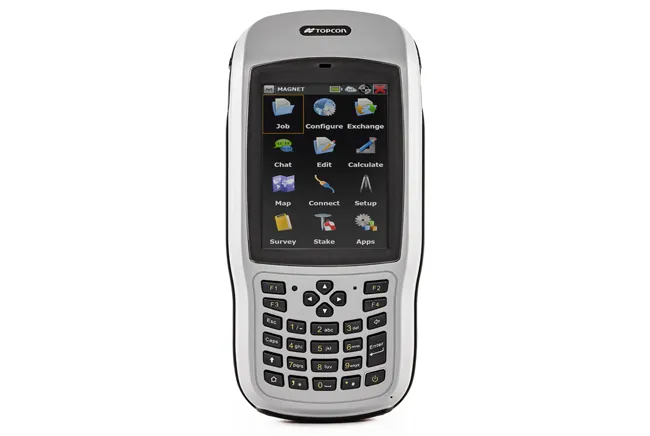
Topcon’s new T-18 unit offers advanced geopositioning capabilities
342 Topcon says that its new T-18 handheld controller offers accuracy for geopositioning, construction, mapping and vertical construction applications.  The controller includes a sunlight-readable display with a 1GHz processor, 1GB of internal storage, and up to 10 hours of battery life. “For MAGNET Field data collection, the T-18 controller offers a durable ergonomic solution with faster processing, a larger screen, better connectivity and longer battery life than previously available comparable systems,” said Ray Kerwin, director of global surveying products.


The T-18 features a 3.5G cellular modem for connectivity with Topcon MAGNET solutions for sending and receiving data to the cloud company account.  The firm says that the cellular option makes it easier to communicate with field crews when projects need to be changed or if important data is required back in the office. The modem can be used for RTK correction services. Additional key features include standard Bluetooth and Wi-Fi connectivity, as well as an IP65 rating for dust and water protection in demanding job site conditions.

For more information on companies in this article

Related Content

  • Latest GIS and software tools improve operations
    February 24, 2012
    Innovative GIS and software solutions are coming to market from the three key market players - Mike Woof reports Competition is strong in the field for GIS and surveying systems as well as the associated software. The three major players in the sector, Leica Geosystems, Topcon and Trimble, all invest heavily in research and development and continue to roll out new solutions for construction customers that will boost the efficiency of surveying as well as overall project implementation.
  • Laser scanning focuses on asset management
    January 9, 2015
    Laser scanners and improved data collection and analysis software are making light of asset management surveying. David Arminas reports The age of the laser scanner is upon us, taking over from traditional manual methods of surveying, data collection and processing. These new technical developments are making it much easier to process and use the data captured and are providing highways engineers with powerful tools to record, map and visualise their assets. This is good news for highways authorities
  • Data accuracy
    February 13, 2012
    Sokkia is introducing the versatile GRX1 system, which includes a fully scalable GNSS receiver, new SHC250 data collector and improved software. The GRX1 GNSS receiver features an integrated antenna, digital UHF radio, GSM module, Bluetooth module and detachable battery. This comes in a compact, rugged, magnesium-alloy body and has fully upgradeable features that allow users to start with an entry model for L1 GPS. This can be upgraded to L1 GPS+GLONASS, to L1/L2 GPS, up to 72-channel L1/L2 GPS+GLONASS rece
  • Efficient surveying
    February 10, 2012
    According to Spectra Precision, its latest outdoor data collectors can optimise surveying operations. The sophisticated Ranger 3 data collector series and the Nomad 900 series are designed to operate with Spectra Precision Survey Pro field software and offer advanced surveying capabilities. Spectra Precision now offers three Ranger 3 models, the 3L, 3XC and 3RC. These data collectors come standard with an 800MHz processor, 256MB of memory, a full VGA display, integrated Bluetooth, GPS, compass and 802.11 Wi