Sophisticated geopositioning tool from Topcon

Topcon says that its new T-18 handheld controller offers accuracy for geopositioning, construction, mapping and vertical construction applications. The controller includes a sunlight-readable display with a 1GHz processor, 1GB of internal storage, and up to 10 hours of battery life. “For MAGNET Field data collection, the T-18 controller offers a durable ergonomic solution with faster processing, a larger screen, better connectivity and longer battery life than previously available comparable systems,” said
October 9, 2018 Read time: 2 mins
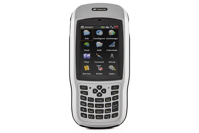
Topcon’s new T-18 unit offers advanced geopositioning capabilities
342 Topcon says that its new T-18 handheld controller offers accuracy for geopositioning, construction, mapping and vertical construction applications.  The controller includes a sunlight-readable display with a 1GHz processor, 1GB of internal storage, and up to 10 hours of battery life. “For MAGNET Field data collection, the T-18 controller offers a durable ergonomic solution with faster processing, a larger screen, better connectivity and longer battery life than previously available comparable systems,” said Ray Kerwin, director of global surveying products.


The T-18 features a 3.5G cellular modem for connectivity with Topcon MAGNET solutions for sending and receiving data to the cloud company account.  The firm says that the cellular option makes it easier to communicate with field crews when projects need to be changed or if important data is required back in the office. The modem can be used for RTK correction services. Additional key features include standard Bluetooth and Wi-Fi connectivity, as well as an IP65 rating for dust and water protection in demanding job site conditions.

For more information on companies in this article

Related Content

  • Trimble’s innovative technology at Conexpo 2014
    January 6, 2017
    The Trimble Quantm alignment planning system allows road designers to reduce planning time and deliver projects with minimal environmental and social impact at a lower construction and operating cost. The system, on show at Conexpo 2014, analyses millions of alignment alternatives and returns a range of options to the planning team for consideration. When new data becomes available the Quantm system can quickly recalculate more alignment options.
  • Trimble’s innovative technology at Conexpo 2014
    January 17, 2014
    The Trimble Quantm alignment planning system allows road designers to reduce planning time and deliver projects with minimal environmental and social impact at a lower construction and operating cost. The system, on show at Conexpo 2014, analyses millions of alignment alternatives and returns a range of options to the planning team for consideration. When new data becomes available the Quantm system can quickly recalculate more alignment options.
  • Variable message signs deliver real time travel information
    April 10, 2012
    Variable Message Sign systems are helping ease traffic congestion and keeping drivers better informed on key highways across Europe and the rest of the world. Guy Woodford looks at some of their recent applications By coupling its Intelligent Travel Time System (ITTS) with Bluetooth technology, Alcatel-Lucent is measuring traffic flow in real time and conveying it seamlessly to local authorities in the French city of Vélizy-Villacoublay. The city, a major business enterprise hub 14km south-west of central
  • Advanced, low emission, fuel efficient earthmoving
    February 23, 2012
    Manufacturers are rolling out sophisticated machines for the European, North American and Japanese markets - Mike Woof reports. This year has been a pivotal period for the development of advanced, low emission earthmoving machines. During 2011 an array of manufacturers have introduced new models designed to comply with the latest Stage IIIB/Tier 4 Interim emissions regulations introduced for